Interstate 91States traversed: Vermont, Massachusetts,
and Connecticut |
|
Interstate 91 follows the Connecticut River Valley from northeastern Vermont to New Haven, Connecticut. It spans the entire north-south distance of western New England, just like US Route 5, which follows alongside it for its entire length. The northern end is a Canadian border crossing near Newport, Vermont, in Vermont's northeastern corner. From there, it heads south, bound for St. Johnsbury, where Interstate 91 begins to hug the western bank of the Connecticut River--and thus the eastern border of Vermont. Interstate 91 continues following the western side of the river into Massachusetts, where it serves Springfield and the surrounding area. Interstate 91 continues south to form the backbone of Connecticut, which is to say that it cuts a north-south path down the middle of the state. It's the main north-south highway in Hartford. Interstate 91's southernmost extent reaches New Haven, where it ends at an interchange with Interstate 95.

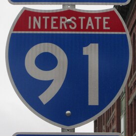
My photo of an Interstate 91 marker comes from a sign assembly in St. Johnsbury, Vermont. The sign assembly depicted faces north along US Route 5. US Route 2 and US Route 5 share a concurrency for the length of a single block in St. Johnsbury; this photo faces north along that concurrency, showing southbound traffic that the turn to continue west on US Route 2 is coming up at the next junction. US Route 5 continues south to cross over to the other side of Interstate 91 shortly after exiting downtown St. Johnsbury to the south, meeting a full interchange; thus, this guide marker toward Interstate 91 points directly ahead. I took this picture on a rainy day in October 2015, touring the northeastern states. Since this photo was taken in the worst weather conditions of any weather conditions surrounding me when I took a photo for my national collection, I might try and take a better picture of Interstate 91 later.
Back to the nationwide main page.
Back to the home page.
Back to the nationwide main page.
Back to the home page.
