Iowa Route 2 is one of Iowa's longest state highways, running across the southern part of Iowa. The highway actually spans the width of Iowa's southernmost (complete) row of counties. The western end of Iowa Route 2 crosses the Missouri River into Nebraska City, Nebraska, where it becomes Nebraska Route 2. The eastern end doesn't quite make it to the Mississippi River, but it did so in the past, formerly reaching Fort Madison's bridge over the river to Illinois Route 9. Nowadays, Iowa Route 2 is cut off at 20th Street and Avenue L in Fort Madison, Iowa; this intersection is the point where Business US Route 61 turns from 20th Street's northern leg to Avenue L's western leg. A mile-long piece of Iowa Route 2 was deleted in Fort Madison when locals' disdain for truck traffic through town won out over political interest in maintaining the continuous east-west thoroughfare. Plus, wrapping around the north side of town on US Route 61 and dropping south to the bridge doesn't create too horribly cumbersome of a detour. Nearly every county seat in Iowa's southernmost complete row of counties is connected by Iowa Route 2.
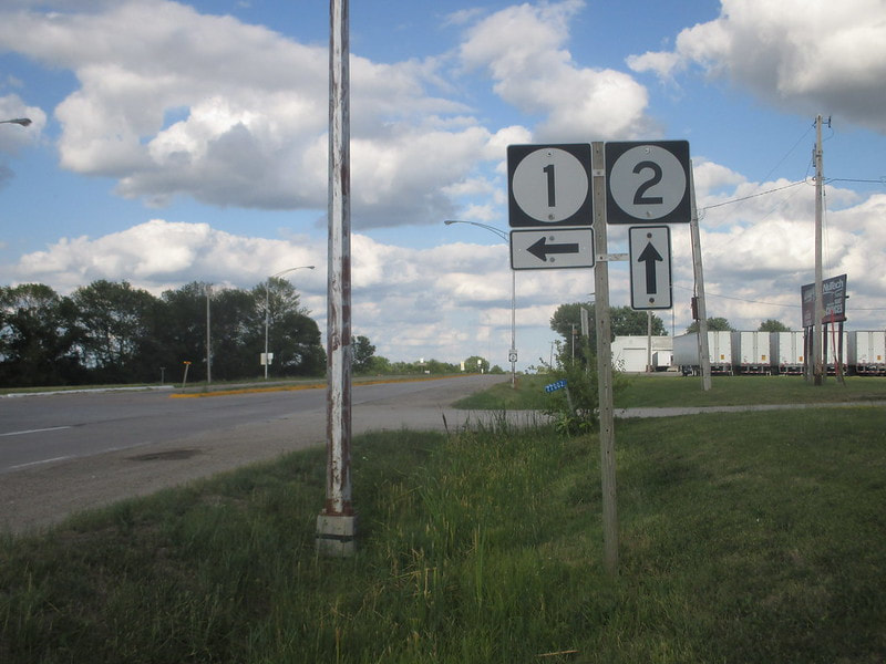
If you have seen the Iowa Route 1 page, you've seen this photo before. My photo for Iowa Route 2 is the source for both of my shield images corresponding to Iowa Route 1 and Iowa Route 2. The sign assembly depicted sits along Iowa Route 2 at its junction with Iowa Route 1 south of Keosauqua. This junction is the southern end of Iowa Route 1. The signage shows eastbound traffic on Iowa Route 2 where to turn if they want to access Iowa Route 1. This photo was taken on June 30, 2017 as part of my trip across eastern Iowa.
Back to the Iowa main page.
Back to the home page.
Back to the Iowa main page.
Back to the home page.
