Interstate 77 runs from Cleveland, Ohio, south to Columbia, South Carolina, by way of West Virginia, the western arm of Virginia, and Charlotte, North Carolina. The entire route follows the current and former routing of US Route 21. The northern end is alongside downtown Cleveland, at Interstate 90. The corridor carves its way south through Ohio, in a way that puts one-quarter of Ohio's width to the east, and puts three-quarters of Ohio's width to the west of it. Interstate 77 goes south through Akron, crossing into West Virginia at Marietta, Ohio, and near Parkersburg, West Virginia. The highway becomes the West Virginia Turnpike at Charleston, where Interstate 64 joins from the west. Interstate 64 splits to the east at Beckley, West Virginia, but the tolled West Virginia Turnpike continues to carry Interstate 77 south. Interstate 77 heads south out of West Virginia into Virginia, ending the tolled section of the highway; this occurs near Princeton and Bluefield. Interstate 77 heads south across Virginia's western arm, passing through Wytheville, and the highway then enters North Carolina. In North Carolina, Interstate 77 passes through Statesville and Charlotte. As it exits Charlotte, it enters its final state of South Carolina. While within the borders of South Carolina, Interstate 77 follows the northern half of a north-south centerline drawn through the state. The southern end occurs at Interstate 26 on the south side of Columbia, the state capital of South Carolina. Much of the traffic reaching the southern end of Interstate 77 probably joins Interstate 26 southeastward toward Charleston, South Carolina.
The featured photo for Interstate 77 appears immediately below, but Interstate 77 had an older featured photo on this page. That older photo appears at the bottom of this page.
The featured photo for Interstate 77 appears immediately below, but Interstate 77 had an older featured photo on this page. That older photo appears at the bottom of this page.
My photo for Interstate 77 shows a junction marker posted for westbound travelers on US Route 378 in Columbia, South Carolina. Junction markers are supposed to use route shields that are 36 inches by 36 inches, but this one doesn't. The upside to this is that I only seek out photos of route markers that are the regular 24-inch size. Therefore, I can use this photo and extract my cropped shield image from this right here! This photo was taken in June, 2024, as I traveled to Myrtle Beach, Congaree National Park, New River Gorge NP, and Cuyahoga Valley NP. I set out to drive Interstate 77 from end to end soon after taking this photo!
Another photo used to serve as the featured photo for Interstate 77, until June, 2024. That photo is still available for viewing below.
Another photo used to serve as the featured photo for Interstate 77, until June, 2024. That photo is still available for viewing below.
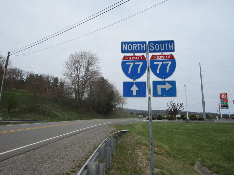
The older photo of Interstate 77 signage comes from Bland, Virginia, at the northernmost interchange housed along Interstate 77's stint in western Virginia. This interchange connects to a surface road carrying US Route 52 and Virginia State Route 42. That surface road runs east into the background of this photo, which shows signage pointing west toward eastbound travelers. The signage notifies those eastbound travelers of the upcoming southbound onramp to Interstate 77. This photo was taken as part of the Virginia trip of April, 2021.
Back to the nationwide main page.
Back to the home page.
Back to the nationwide main page.
Back to the home page.


