Ohio State Route 67 joins western and northern Ohio, running from Wapakoneta to Republic. The route begins in Wapakoneta, heading north from an interchange at US Route 33. It starts out going north on the southern beginnings of two other routes, Ohio Route 198 and Ohio Route 501, but Ohio Route 67 soon splits from these two routes to start out toward the east. Ohio Route 67's first half encompasses an easterly route from Wapakoneta to Kenton. Around Kenton, Ohio Route 67 bends toward the northeast, staying as a diagonal route for the duration of its second half. The northeastward Ohio Route 67 serves Marseilles, Upper Sandusky, and Sycamore before ending in the town of Republic, Ohio at Ohio Route 19. The ending comes as Ohio Route 18 bends from easterly to northeasterly, taking over the northeasterly alignment that carried Ohio Route 67.
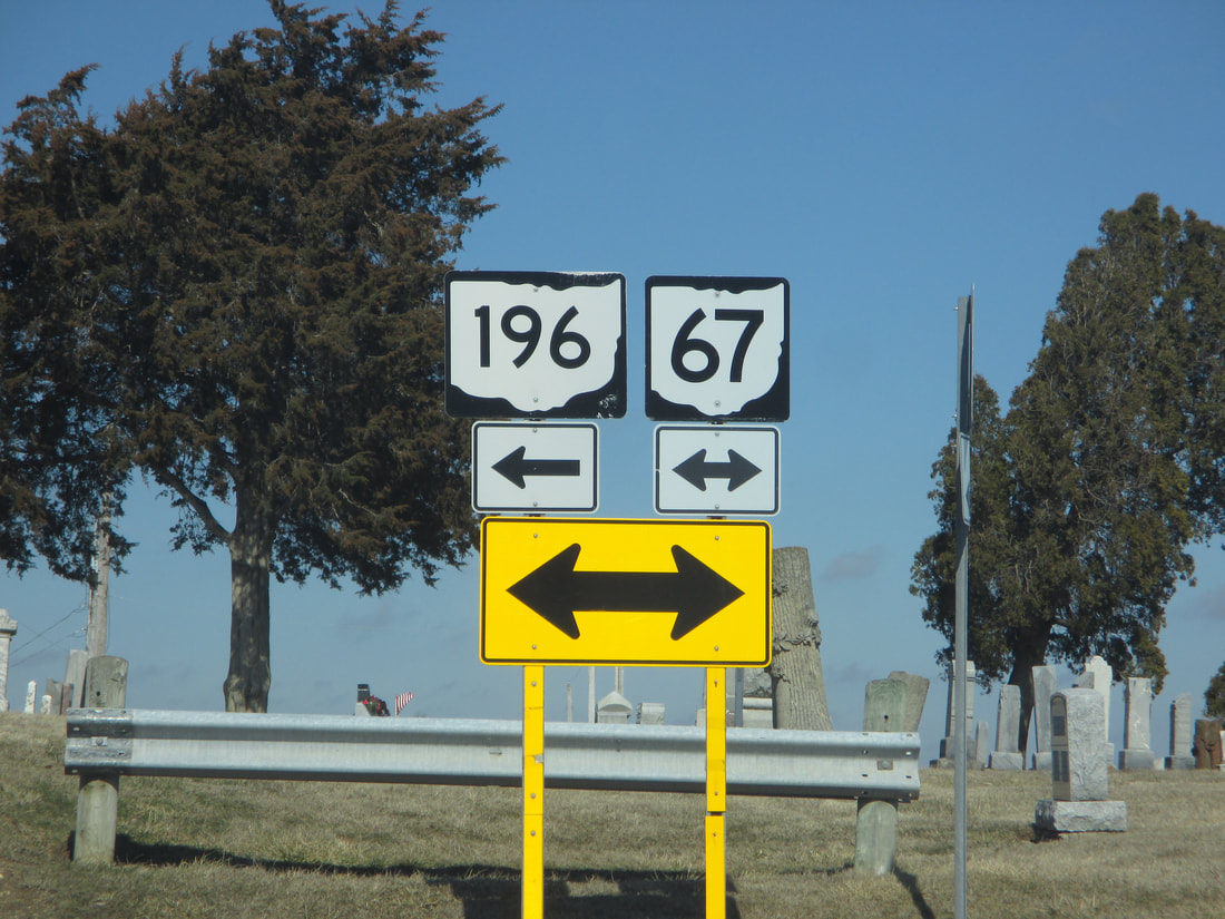
My photo of Ohio State Route 67 comes from its interactions with Ohio Route 196, near Waynesfield. Just east of Waynesfield, Ohio Route 196 comes from the south to turn westerly along Ohio Route 67. The sign looks north at a scene viewed by those reaching that junction coming from the south along Ohio Route 196. The signage points those northbound travelers to the left if they wish to stay on Ohio Route 196. The photo seen here was taken in Leap Day 2016, heading back toward home from Columbus.
Back to Ohio Routes 1 through 99.
Back to the Ohio main page.
Back to the home page.
Back to Ohio Routes 1 through 99.
Back to the Ohio main page.
Back to the home page.

