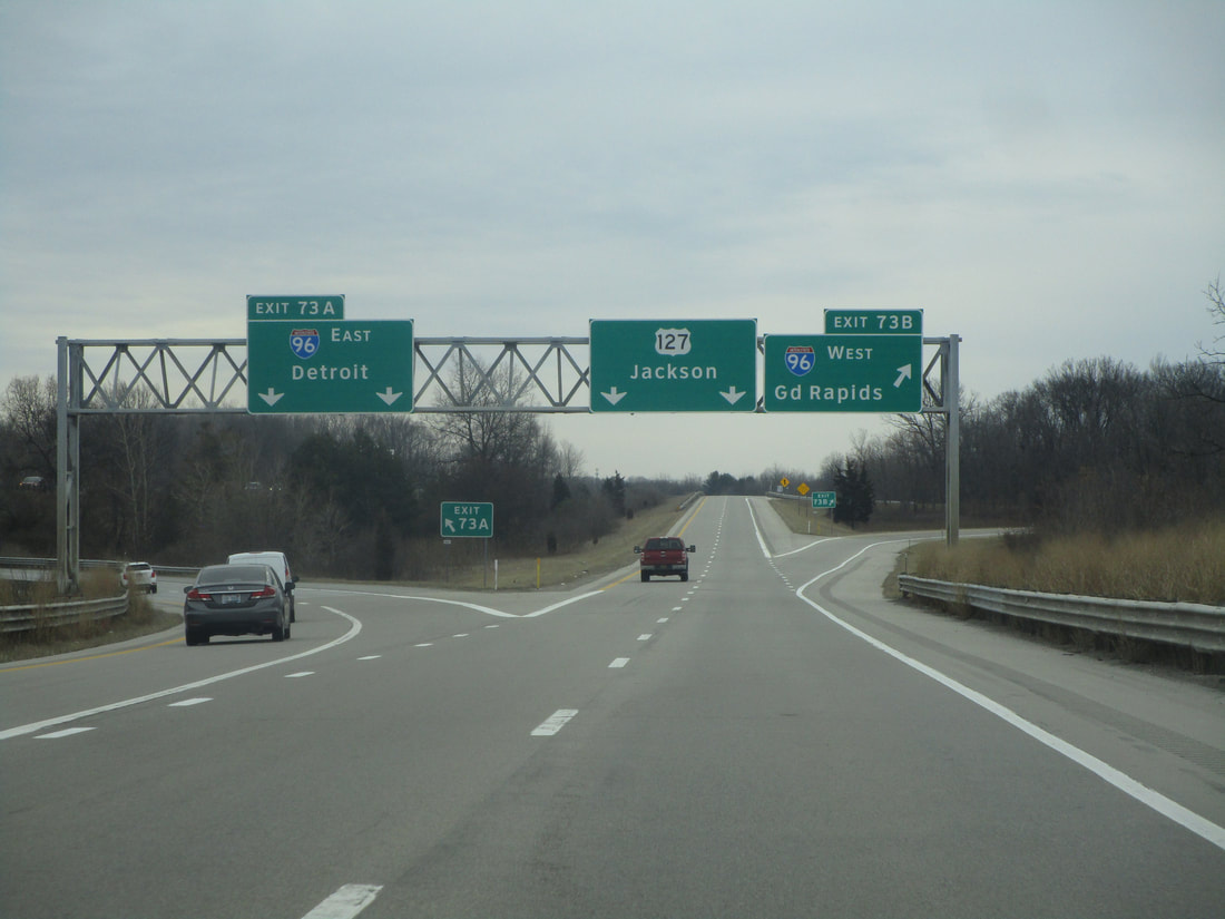
Interstate 496 is the freeway cutting through the center of Lansing, Michigan, and it serves as an alternate to Interstate 96. While Interstate 96 circles around the southern and western sides of Lansing, Interstate 496 brings those from Interstate 96 right into downtown Lansing. The western end of Interstate 496 at an interchange on the west side of Lansing, where Interstate 69 and Interstate 96 are concurrently on a north-south alignment. Interstate 496 will bring traffic westward into Lansing, whether it's traffic coming from the southwest on Interstate 69, or if it's traffic coming from the west on Interstate 96. Interstate 496's eastward progressing brings it right through downtown Lansing. After downtown, Interstate 496 joins the US Route 127 freeway south out of town. This southward bend brings Interstate 496 back to Interstate 96, its parent route. The culmination of Interstate 496 occurs at this interchange between Interstate 96 and US Route 127, on the southeastern outskirts of Lansing. A full exit list lies below, with photos of each exit where possible, but first I wanted to share the origin of my I-496 shield image:
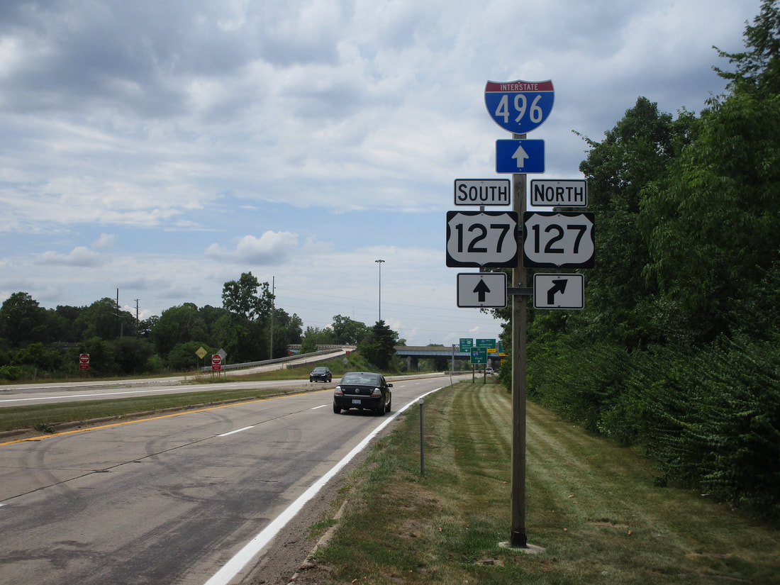
My photo of a cutout shield for Interstate 496 comes from Trowbridge Road in East Lansing. The interchange where Interstate 496 joins US Route 127 south is a complex interchange that also provides access to and from surface roads. One of those surface roads is Trowbridge Road, which stems east from the interchange. Those meeting the end of Trowbridge Road, heading westerly, are fed into an interchange with full access to Interstate 496 west, US Route 127 north, and US Route 127 south. In recent years, the adoption of unisigns for Michigan's Interstate junctions has made cutout shields difficult to find across the state. Usually, I'm relegated to finding these cutout shields on "To" guide markers, distant from the Interstate itself. The cutout shield in this photo is right at Interstate 496, though, and it welcomes the westbound surface traffic into the interchange. This photo was taken in August 2020, taking a slightly indirect route home from Traverse City.
Exits are listed from west to east along Interstate 496, as that's the order in which the mileage markers appear. All of Interstate 496 is in the Lansing area, so I won't bother listing Lansing as the city home to each exit, to avoid bombarding you with redundancy.
The westernmost interchange connecting to Interstate 496 is a sprawling, fully directional interchange with the concurrency of Interstates 96 and 69. This is the point of mile marker zero, but the exit isn't labeled with an exit number.
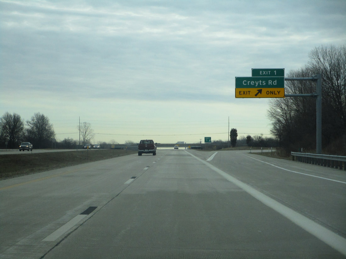
Exit 1 is for Creyts Road; the eastbound exit is a lone exit, whereas westbound travelers find two separate exits to Creyts Road:
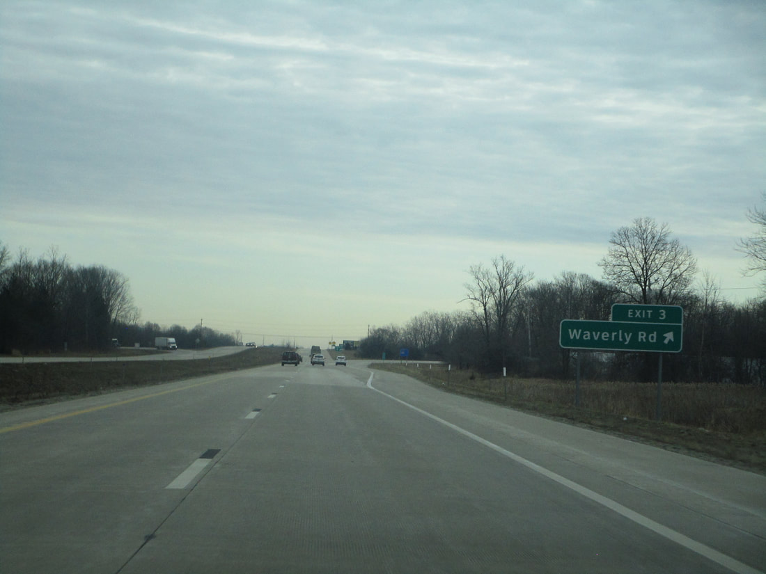
Exit 3 is to Waverly Road:
Exit 4, only accessible to westbound travelers, is a ramp connecting to the southwesterly road called Lansing Road...
Exit 5 leads to Michigan Highway 99, which runs along Martin Luther King, Jr. Blvd. in Lansing. Signs will also point out that this is the most direct route to the Capitol Loop:
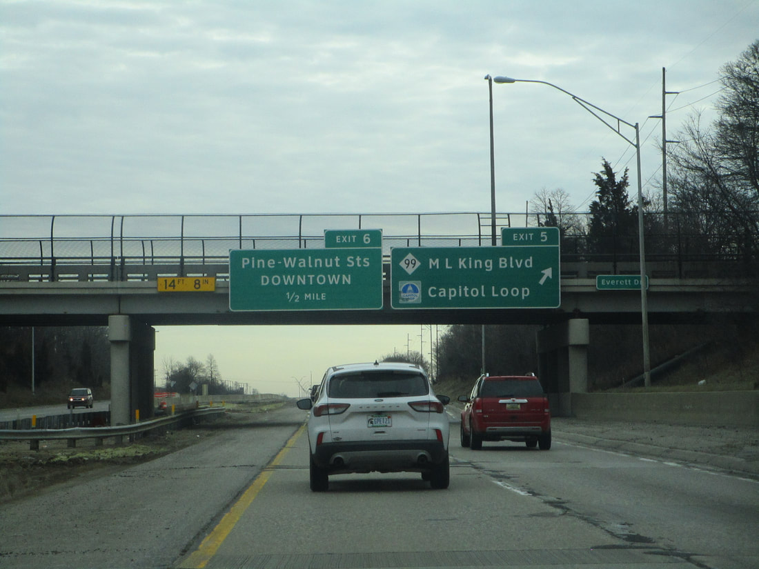
Exit 6, only for travelers coming from the east, leads to Walnut Street and Pine Street...
Exit 7 leads to Cedar Street, Birch Street, and Pennsylvania Avenue, but this is split into two exits for the westbound travelers. For westbound travelers, Exit 7A leads to Grand Avenue, and Exit 7B is the one leading to Cedar, Birch, and Pennsylvania...
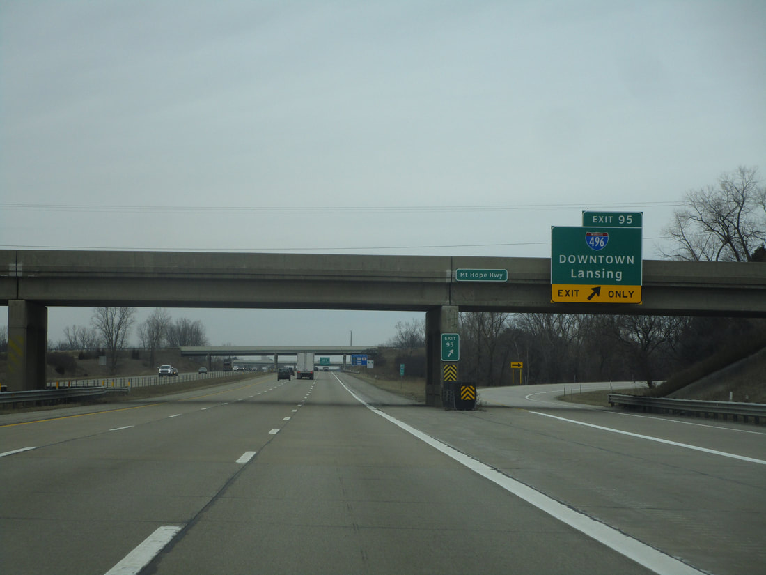
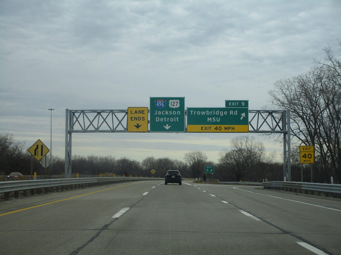
Exit 8 leads to US Route 127 northbound, at the interchange where Interstate 496 joins US Route 127 south:
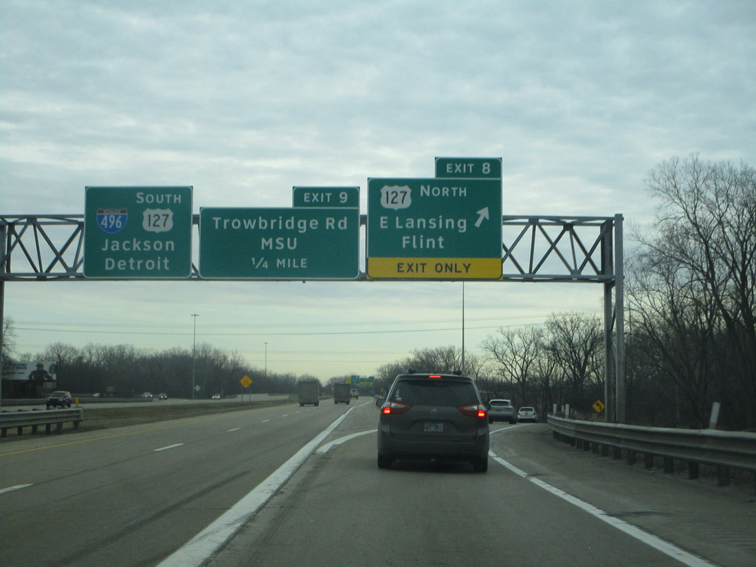
Exit 9 leads to Trowbridge Road and Michigan State University:
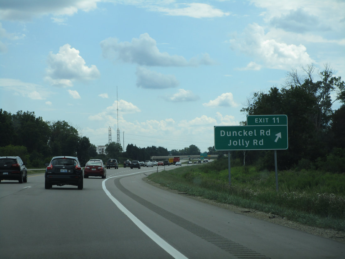
Exit 11 connects to Dunckel Road and Jolly Road:
The last pair of exits off of Interstate 496 lead to Interstate 96, at Interstate 496's southeastern end. US Route 127 continues south as a freeway, in just the same way it entered the Lansing area from the north.