US Route 41 in Michigan serves the purpose of winding its way across the Upper Peninsula, from Menominee to Marquette to the northern tip of the Keweenaw Peninsula. Its path across the Upper Peninsula is overall north-south, but its journey is less than direct. US Route 41's entry into Michigan is a bridge over the Menominee River connecting Marinette, Wisconsin, and Menominee, Michigan, two towns along the western shore of Lake Michigan. From here, US Route 41 goes north, then east, then north, then west, then north. The first leg of US Route 41, ordered from south to north, stems north out of Menominee, running through Stephenson to Powers. US Route 41 turns east at Powers to reach Escanaba. Note that Michigan Highway 35 connects Menominee and Escanaba, just as US Route 41 does; however, Michigan Highway 35 is more direct, forming the hypotenuse of a right triangle where US Route 41 comprises the northward and eastward legs. From Escanaba, US Route 41 heads northerly and northwesterly to Marquette, a city on the shores of Lake Superior. In the Marquette area, US Route 41 joins Michigan Highway 28 west for a long concurrency; this long westward stint is for the purpose of positioning US Route 41 so it can turn northerly onto the Keweenaw Peninsula. Near Covington, US Route 41 meets the northern end of US Route 141, and it turns northerly through L'Anse and Baraga to the Keweenaw. At Houghton, US Route 41 joins Michigan Highway 26 north across the lift bridge into Hancock. US Route 41 continues to the end of the Keweenaw, passing through Calumet to end near Copper Harbor. The entrance to Fort Wilkins State Park is the site of US Route 41's northern endpoint; as noted by a sign posted at this termination point, US Route 41 traverses 1,990 miles from Miami, Florida to reach this culmination of the route.
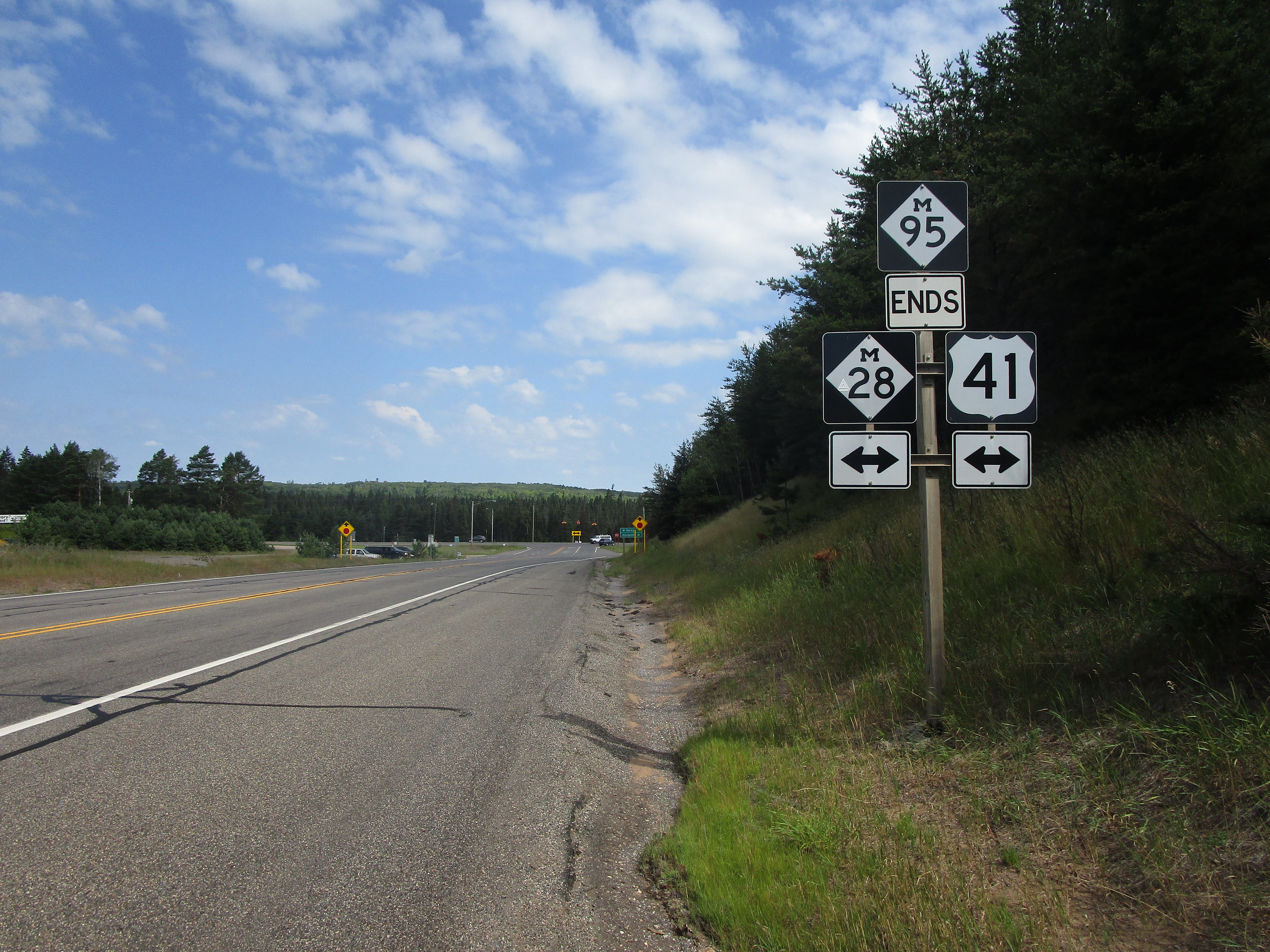
My photo of US Route 41 signage in Michigan comes from the northern end of Michigan Highway 95, along US Route 41's westward stint west of Marquette. Specifically, this intersection occurs west of Ishpeming, but east of the tiny town of Champion. The sign assembly depicted seeks to inform northbound travelers on Michigan Highway 95. Michigan Highway 95 ends here, and turning either way at the stop sign will put these travelers on the concurrency shared between Michigan Highway 28 and US Route 41. This photo was taken at the end of July 2022, during a trip to the Keweenaw Peninsula, Drummond Island, and Alpena.
Back to the Michigan main page.
Back to the home page.
Back to the Michigan main page.
Back to the home page.

