Iowa Route 57 is an east-west route from Cedar Falls west to near Iowa Falls. Much of it follows an old alignment of US Route 20, which got moved southerly to a newer expressway. The highway is about 44 miles long. The western end is at US Route 65 just north of Iowa Falls. The eastern end is at an interchange in Cedar Falls, just outside of Waterloo, where US Route 218 bends and spawns the northern end of Iowa Route 58. US Route 218 turns from the northern leg of the interchange to the eastern leg, and Iowa Route 58 gets its northern start along the south leg of the interchange; in addition, Iowa Route 27 moves from north to south across the interchange as well. Ackley, Aplington, and Parkersburg are a few of the towns served buy Iowa Route 57.
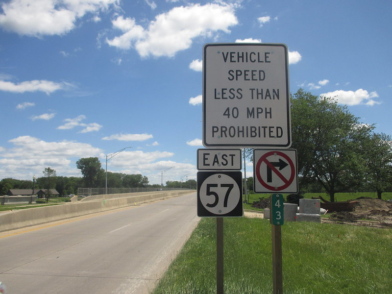
My photo for Iowa Route 57 is the last eastbound reassurance marker that an eastbound traveler could observe along Iowa Route 57, before reaching the eastern terminus at US Route 218 and Iowa Route 58. Drivers seeing this sign assembly have just proceeded through the intersection with Main Street in Cedar Falls, to a point where Iowa Route 57 becomes a freeway approach to the interchange marking the eastern end of the route. The transition to a freeway-like road is the reason why you see the sign prohibiting vehicle speeds below 40 MPH. Though I drove Iowa Route 57 from end to end in May 2022, this photo actually comes from July 1, 2017, on a trip when I crossed eastern Iowa from south to north.
Back to the Iowa main page.
Back to the home page.
Back to the Iowa main page.
Back to the home page.

