US Route 20 spans the width of Iowa, situated about a third of the way down the state, from north to south. This puts US Route 20 at a latitude where it's skewering through the fourth row of counties from the state's northern end (out of 9). The east-west highway enters Iowa from Nebraska by crossing the Missouri River into Sioux City, Iowa. It crosses the river along with Interstate 129 and US Route 75. While Interstate 129 abruptly ends a fraction of the mile into the state at Interstate 29, US Route 20 continues wrapping around the southeast side of Sioux City, splitting from US Route 75 soon after. US Route 20 continues as a 4-lane expressway across the entire remainder of Iowa, with the occasional upgrade to a fully-fledged freeway. US Route 20 is instrumental for accessing Fort Dodge, Waterloo, and Dubuque, among other smaller locales. It passes just to the south of Iowa Falls, which is accessed by a short jaunt north on US Route 65. Waterloo is where US Route 20 meets Iowa Route 58 and Iowa Route 27. Iowa Route 27 joins US Route 20 around the south side of Waterloo, coming from Iowa Route 58's north leg. Iowa Route 27 then splits from US Route 20 to continue south along Interstate 380. US Route 20's last and easternmost Iowa destination is Dubuque, on the Mississippi River. It leaves the state of Iowa for the very northwest corner of Illinois.
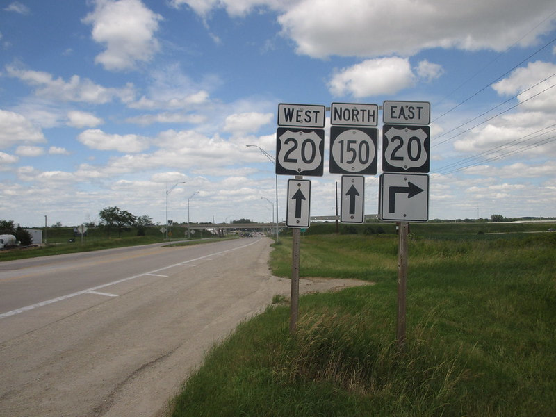
My photo of US Route 20 in Iowa comes from its interchange with Iowa Route 150 in Independence, Iowa. This sign assembly in the photo faces south to northbound traffic on Iowa Route 150. It announces that the turn for the onramp to eastbound US Route 20 is just ahead, on the right. This photo was taken on July 1, 2017, as I was closing out my trip across eastern Iowa.
Back to the Iowa main page.
Back to the home page.
Back to the Iowa main page.
Back to the home page.

