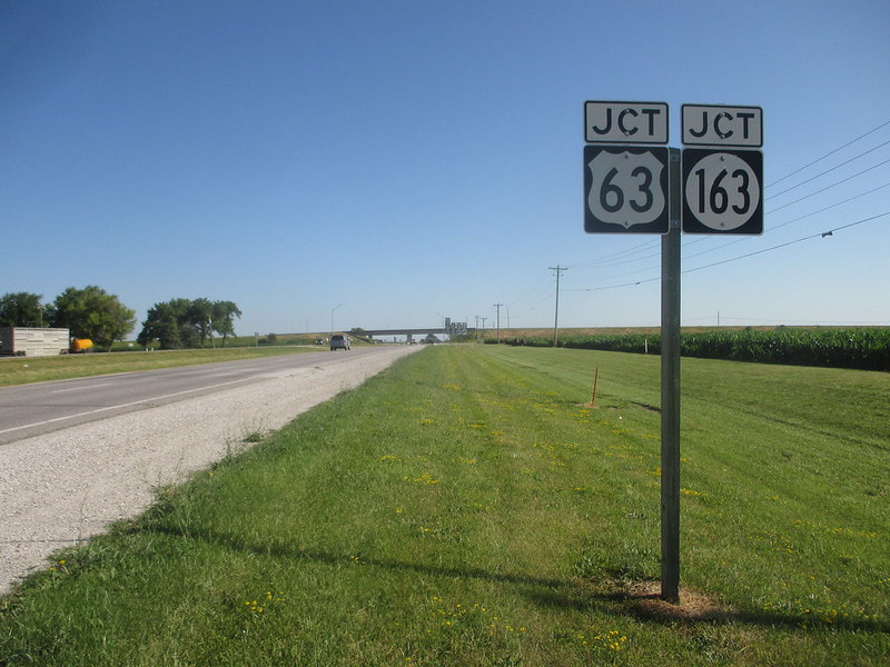
In Iowa, US Route 63 runs north-south, forming a line that separates eastern Iowa from central Iowa. The point where it meets each of the northern and southern borders of Iowa lies one-quarter of the way west from the eastern end of the border. Most of US Route 63 in Iowa is a typical, two-lane rural highway, but two separate expressway sections exist. The first expressway segment runs from New Hampton south to the northern outskirts of Waterloo; the other expressway piece is the portion of US Route 63 that follows the Iowa Route 163 expressway, from Oskaloosa to Ottumwa. US Route 63 enters Iowa at Chester, Iowa, having just dropped southward from Rochester, Minnesota. In Iowa, US Route 63 serves New Hampton, Waterloo, Toledo, Tama, Montezuma, and New Sharon before joining Iowa Route 163 in Oskaloosa. US Route 63 and Iowa Route 163 run southeasterly together past Eddyville until Ottumwa. At Ottumwa, US Route 63 splits from Iowa Route 163 to use a bridge to the west shared with US Route 34. US Route 63 then leaves Ottumwa on a two-lane surface highway leading south. Finally, US Route 63 departs Iowa between Bloomfield, Iowa and Lancaster, Missouri.
My photo of a US Route 63 marker in Iowa comes from Ottumwa, Iowa, along the roadway carrying Iowa Route 149 north out of town. Since US Route 63 and Iowa Route 163 run together around the north side of town, the two routes appear together on this northbound junction marker. The signage faces south on the north side of Ottumwa, alerting northbound travelers on Iowa Route 149 of the upcoming interchange. July 1, 2017, was the date when I took this photo traveling across eastern Iowa.
Back to the Iowa main page.
Back to the home page.
Back to the Iowa main page.
Back to the home page.

