Interstate 75 is the premier north-south highway corridor across Michigan, and it's the only connection between the Lower Peninsula and the Upper Peninsula. Interstate 75 originates all the way in Miami, Florida, but long after it has set out toward the north, it enters the southeastern corner of Michigan's Lower Peninsula, from Toledo, Ohio. From there, Interstate 75 angles northeast to downtown Detroit, where it bounces northwesterly to Flint. For a more direct north-south route between Flint and Toledo, use the US Route 23 freeway, which serves as a nice alternate to Interstate 75. Beyond Flint, Interstate 75 heads northerly and northwesterly past Saginaw to the northern tip of the Lower Peninsula. Interstate 75 is the sole route designation that uses the Mackinac Bridge, and the Mackinac Bridge is the sole roadway connection between the Lower Peninsula and the Upper Peninsula. From Mackinaw City on the northern tip of the Lower Peninsula, the Mackinac Bridge crosses the straits of Mackinac, the body of water connecting Lake Michigan to Lake Huron. The bridge puts Interstate 75 in St. Ignace, on the Upper Peninsula. Interstate 75 runs north-northeasterly across the eastern portion of the Upper Peninsula, until Sault Ste. Marie. Sault Ste. Marie, Michigan, is where Interstate 75 ends, crossing the waterway separating Canada from the United States. That waterway is the St. Mary's River, carrying water that flows out of Lake Superior toward Lake Huron. The bridge to Sault Ste. Marie, Ontario marks the northern end of Interstate 75.
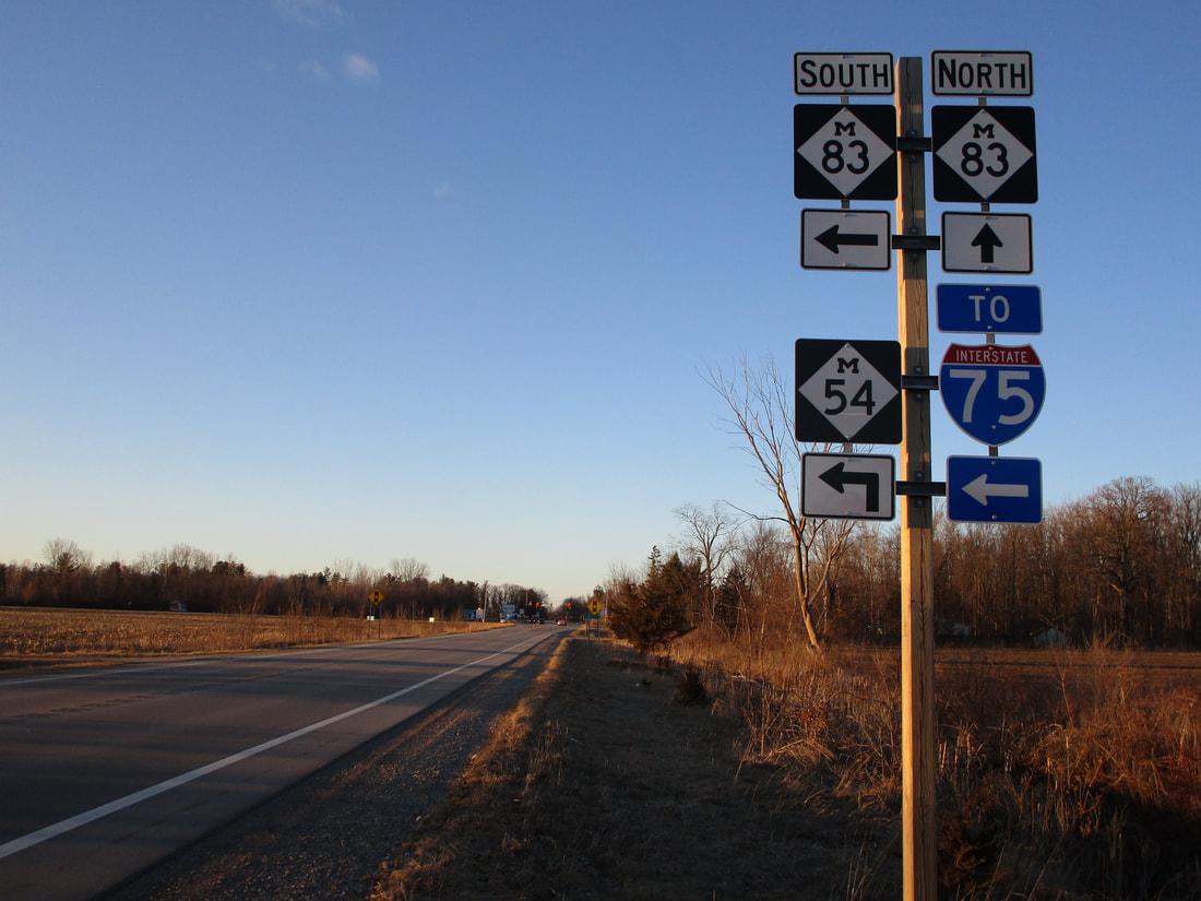
My photo with a cutout Interstate 75 shield comes from Birch Run, where Michigan Highways 54 and 83 converge. Travelers going northbound on Michigan Highway 54 use this signage to understand that Michigan Highway 54 is about to turn left toward Interstate 75. In recent years, the adoption of unisigns for Michigan's Interstate junctions has made cutout shields difficult to find across the state. Usually, I'm relegated to finding these cutout shields on "To" guide markers, distant from the Interstate itself. The cutout shield in this photo is no exception!
Michigan Interstate guides will come with complete exit lists and a photo for every exit, at some point in the future when I've driven the full lengths of all of them. This page showing the cutout shield will stay here for now, until that happens.
Back to the Michigan main page.
Back to the home page.

