Interstate 880 is a new designation for a piece of highway north of Council Bluffs, between Interstate 29 and Interstate 80. The highway was known as part of Interstate 680 until a few years ago. I'm not entirely sure why, but the decision was made to change this section of east-west highway to a separate one. Interstate 880 is useful because of Interstate 80's southward dive that occurs as it's moving west from Des Moines to Council Bluffs. That gives Interstate 880 two purposes. First, those who wish to bypass Omaha to the north can use Interstate 880 and Interstate 680, explaining why both of these routes once had the same number. Second, those who wish to move between the north leg of Interstate 29 and the east leg of Interstate 80 don't have to dive south and come back north. For example, travelers from Sioux City seeking to reach Des Moines can take Interstate 29 south to Interstates 880 and 80 east; this way, they don't need to dive south to Council Bluffs just to come back north. Interstate 880 has a few scenic turnouts along its route, as it traverses the rugged area known as the Loess Hills. It's sixteen miles long, and only has a couple intermediate exits between its endpoints.
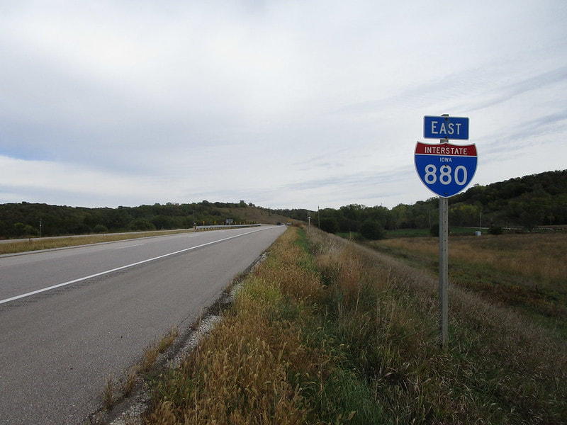
A full exit list with photos is included below. First of all, though, here is the photo showing where I got my shield image for Interstate 880. This isn't something I normally do, but I took a picture of a reassurance marker right along the freeway. This usually isn't a safe option, but Interstate 880 has low traffic and very few exits. The few exits along Interstate 880 are marked by unisigns, and I want cutout shields for my collection. That led me to take this photo in October 2021, which shows the first eastbound trailblazer east of Interstate 29.
A full exit list with photos is included below. First of all, though, here is the photo showing where I got my shield image for Interstate 880. This isn't something I normally do, but I took a picture of a reassurance marker right along the freeway. This usually isn't a safe option, but Interstate 880 has low traffic and very few exits. The few exits along Interstate 880 are marked by unisigns, and I want cutout shields for my collection. That led me to take this photo in October 2021, which shows the first eastbound trailblazer east of Interstate 29.
Full exit list of Interstate 880 in Iowa:
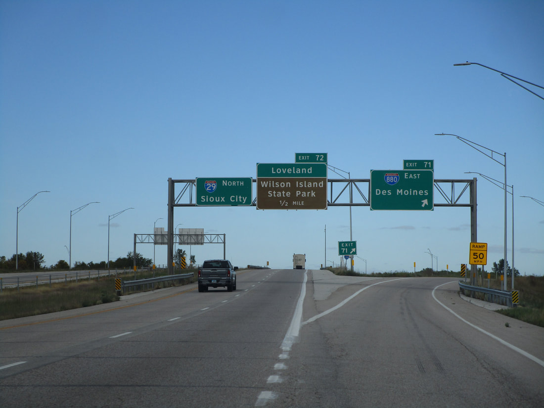
Interstate 880 begins at Interstate 29 near Loveland, Iowa. This photo was taken looking north along Interstate 29:
Interstate 880 begins at Interstate 29 near Loveland, Iowa. This photo was taken looking north along Interstate 29:
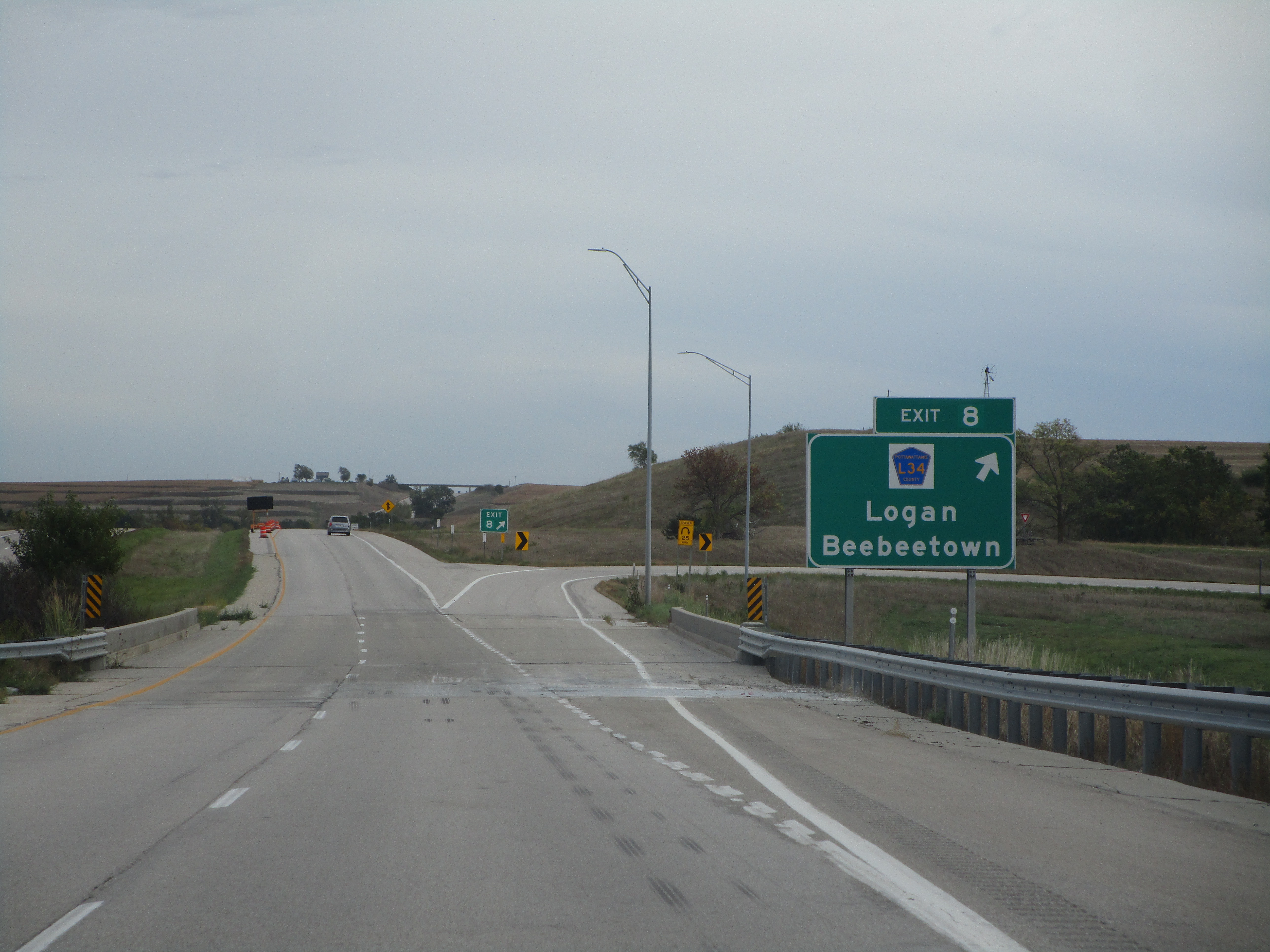
Exit 21 is for County Highway L34, signed as a connection to Logan and Beebeetown. Note that we are only eight miles into Interstate 880's eastward progression; that's because Interstate 880 still uses the mile markers it had when it was part of Interstate 680 (the mile markers and exit numbers remain this way today, to the best of my knowledge):
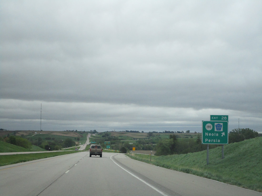
Exit 28 is for Iowa Highway 191 and County Highway GL8. Neola and Persia are shown as control cities:
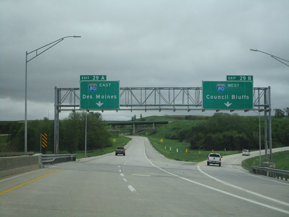
One mile beyond Exit 28, Interstate 880 ends at Interstate 80; the two ramps are signed as Exit 29A for eastbound and Exit 29B for westbound: