^Looking north toward downtown on the Dan Ryan Expressway, January 2022.
Interstate 94 spends its time in Illinois detouring around the south side of Lake Michigan between Milwaukee and Detroit, and connecting to downtown Chicago along that detour. This means that Interstate 94's trajectory through northeastern Illinois is mainly north-south, descending south from the Wisconsin border near Kenosha and cutting east into Indiana along Interstate 80 nearly ten miles south of Lake Michigan's shoreline. As Interstate 94 enters Illinois from Wisconsin, it's a tolled highway called the Tri-State Tollway through Lake County, and upon crossing into Cook County, it forms Interstate 294 which then carries the designation of "Tri-State Tollway." Interstate 94 splits from the Tollway and heads east to become several different freeways, starting with the Edens Expressway. The Edens Expressway ends at the Kennedy which carries Interstate 90, and Interstate 94 joins the Kennedy and Interstate 90 into downtown Chicago. Interstates 90 and 94 continue south out of downtown on the Dan Ryan Expressway, then Interstate 94 does its own thing on the Bishop Ford Freeway, heading southeast out of Chicago to join Interstate 80 into Indiana.
Exits on Interstate 94 in Illinois are anomalously listed in increasing order from north to south, to stick to the numbering convention for even-numbered east-west Interstate highways. Why?
You see, Interstate 94 is overall an east-west highway from Montana to Michigan, only cutting north-south temporarily around Lake Michigan. Exits and mile markers are labeled in increasing order from west to east on even-numbered highways like Interstate 94, so that numbering convention wasn't going to change for temporary jogs to the south or north. Since, Interstate 94 is overall trying to go west-to-east as it moves from north to south through Illinois, the east-west numbering convention holds on the large scale, but on a small scale, it just looks like a north-to-south progression in Illinois.
Interstate 94 enters Illinois from the Wisconsin border, promptly becoming a tollway, and it's carrying US Route 41 for the time being. The state border crossing also marks the official southern end of Interstate 41:
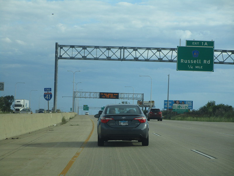
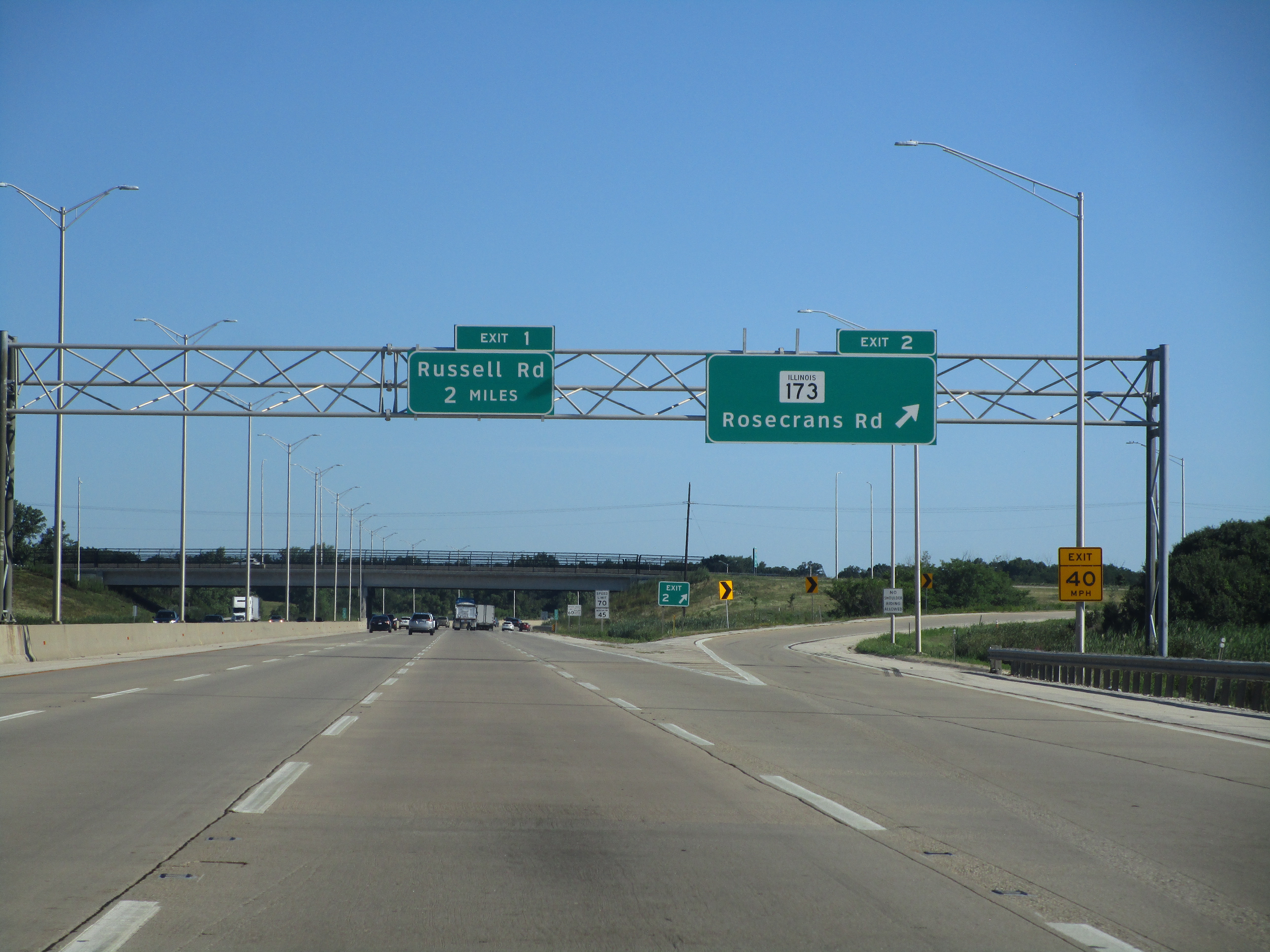
Exit 1 is a diamond interchange to Russell Road, a Lake County route that runs along the state line:
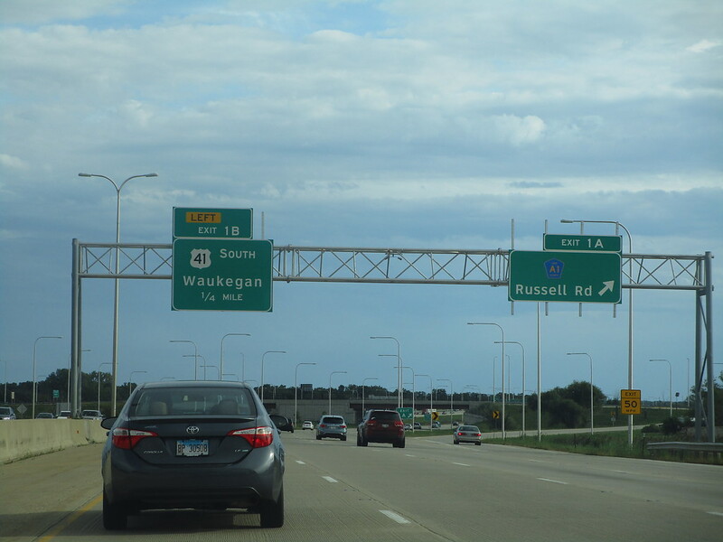
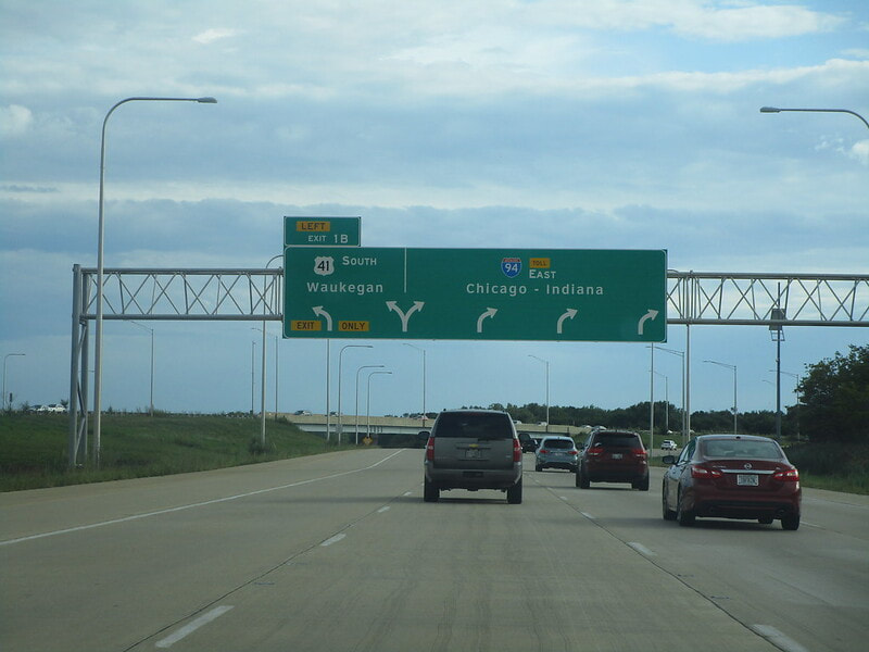
Exit 1B is a partial access interchange allowing US Route 41 to split from Interstate 94 and become its own highway (access only provided to/from the north on Interstate 94):
Exit 2 is for Illinois 173, also known as Rosecrans Road, with access only provided to/from the south (Use US Route 41 at exit 1B if you want access to/from the north):
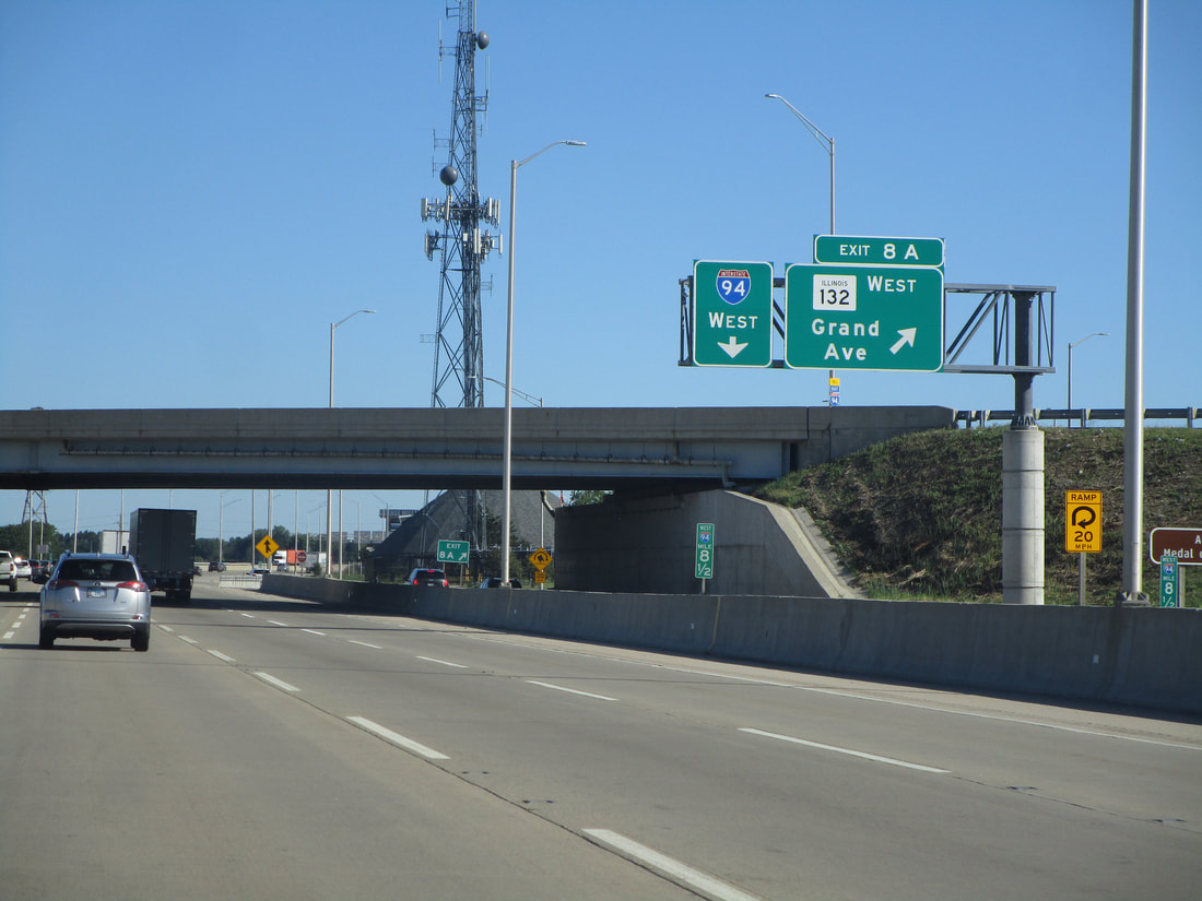
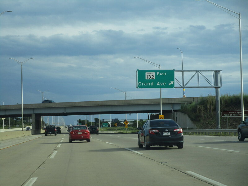
Exit 8A is the first half of a cloverleaf interchange, leading to Illinois 132 and Grand Avenue west:
|
|
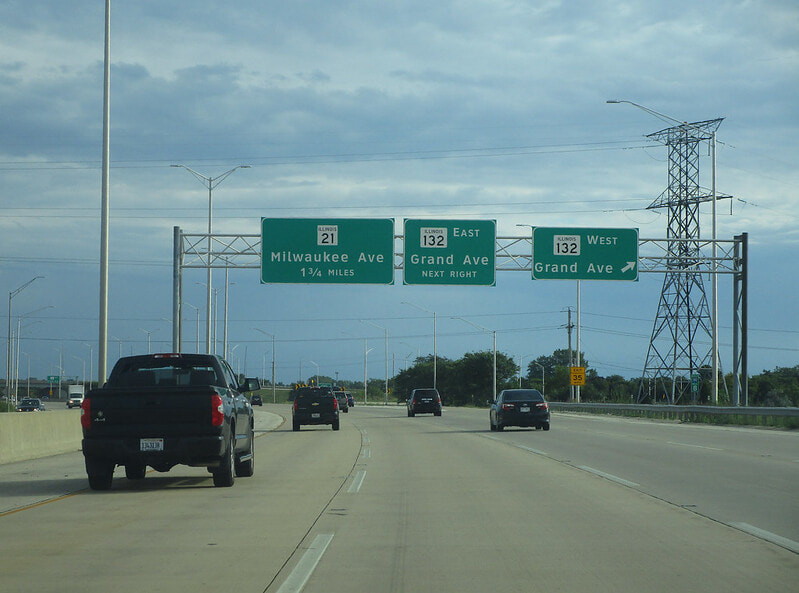
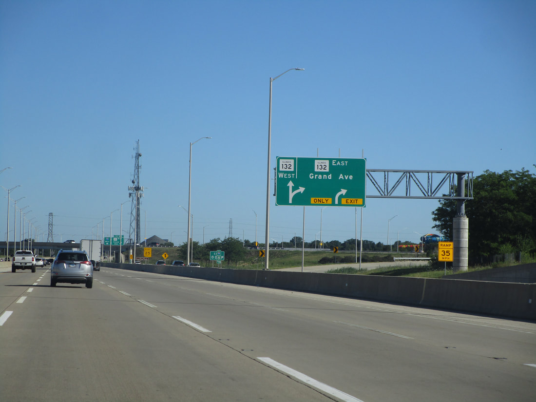
Exit 8A is the latter half of the cloverleaf interchange, leading to Illinois 132 and Grand Avenue east:
|
|
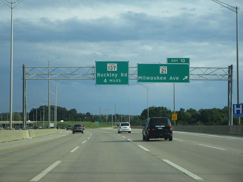
Exit 10 is for Illinois 21, known as Milwaukee Avenue, but with access only provide to/from the north on Interstate 94:
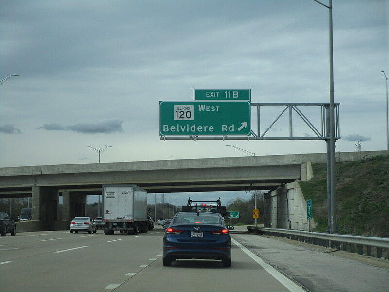
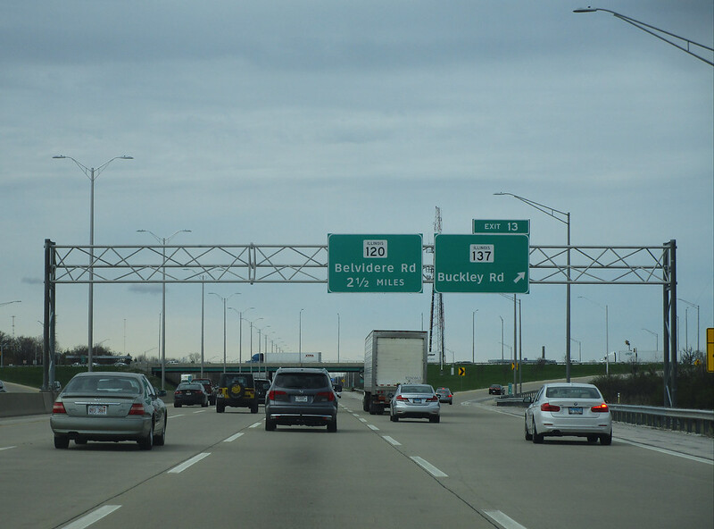
Exit 11A is for Illinois 120 westbound, known as Belvidere Road, but access is only provided to/from the south:
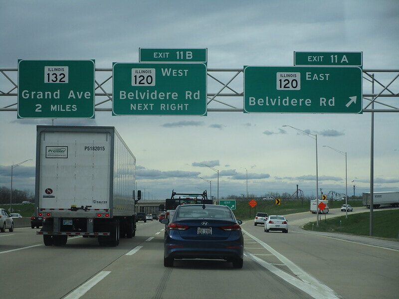
Exit 11B is for Illinois 120 eastbound, known as Belvidere Road, but access is only provided to/from the south:
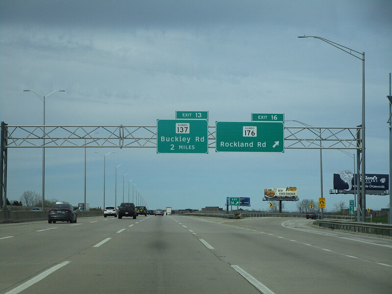
Exit 13 is a full diamond interchange to Illinois 137, known as Buckley Road in this region:
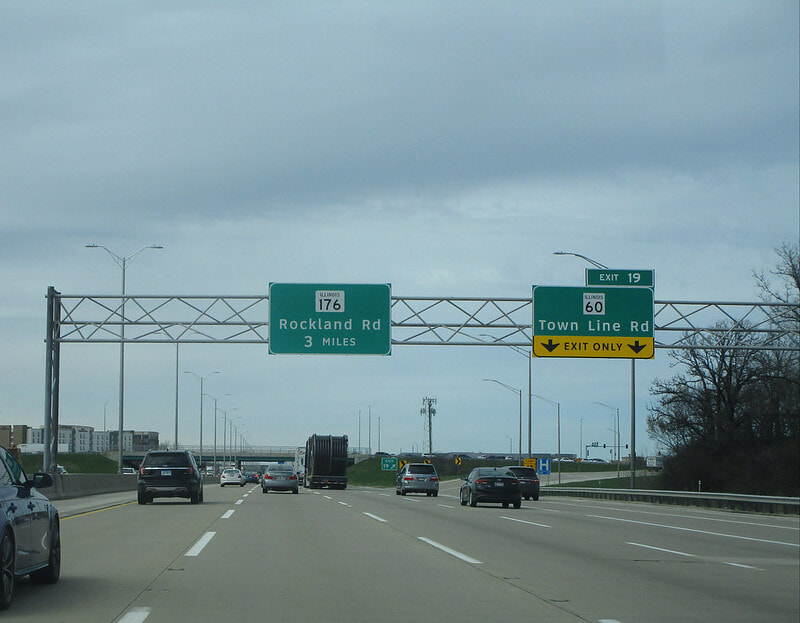
Exit 16 is for Illinois 176, known as Rockland Road, but only with access to/from the south:
Exit 19 is for Illinois 60, called Townline Road, and it's a full-access diamond interchange:
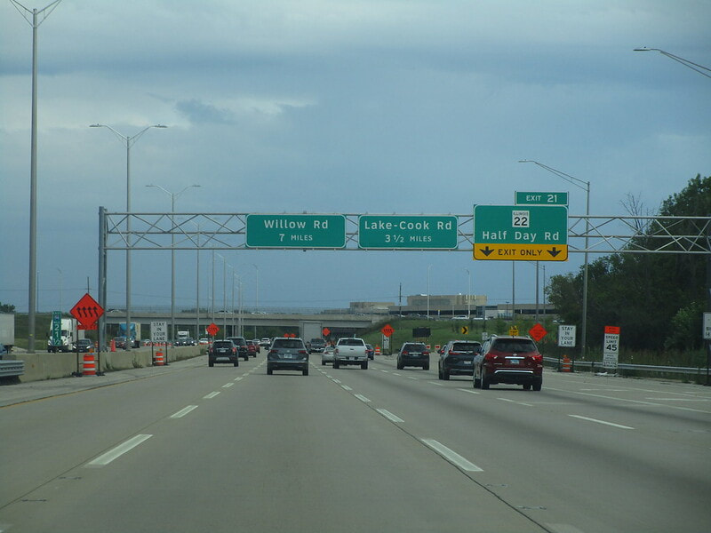
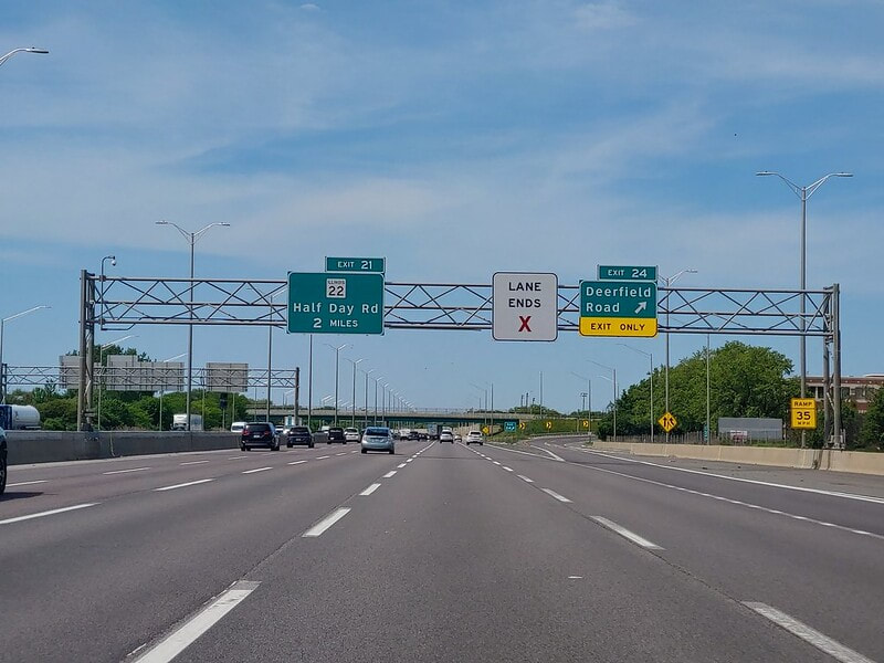
Exit 21 is a full diamond interchange to Illinois 22, known curiously as Half Day Road:
Exit 24 is to Deerfield Road, but only with access to/from the south on Interstate 94:
Exit 25A is to Lake Cook Road, but only with access to/from the north (and to/from the south on Interstate 294)...
Exit 25B leads to the northern beginning of Interstate 294, signed as the way to Indiana from here...
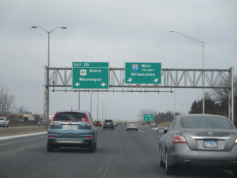
Exit 27 is to Illinois 43 and Waukegan Road, on the last tolled portion of Interstate 94 known as the Edens Spur, cutting east to the Edens Expressway; access to Illinois 43 is only provided to/from the west...
Around mile marker 29, Interstate 94 merges with US Route 41 south at a partial-access interchange, forming the Edens Expressway and marking the final time Interstate 94 exists as a tolled highway:
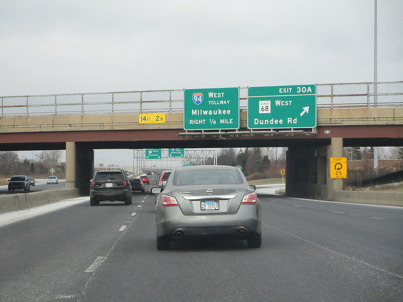
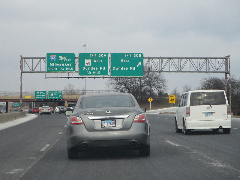
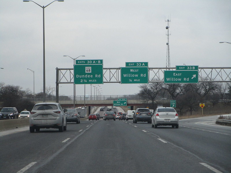
Exit 30A only has access to/from the south, but it leads to Illinois 68's westbound start along Dundee Road:
Exit 30B is for Dundee Road eastward, with access only provided to/from the south:
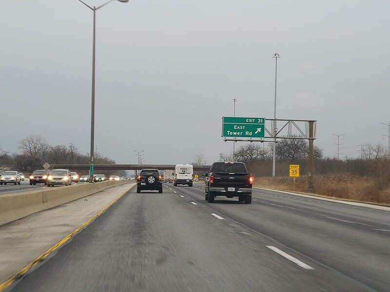
Exit 31 is to Tower Road eastbound, with access only provide to/from the north:
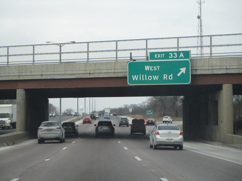
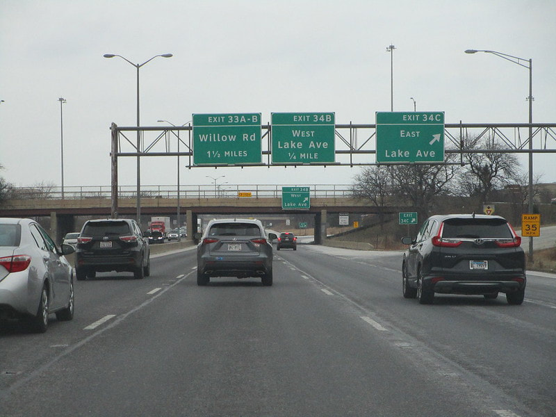
Exit 33A is for Willow Road west, with access only provided to/from the south:
Exit 33B is for Willow Road east, with access only provided to/from the south:
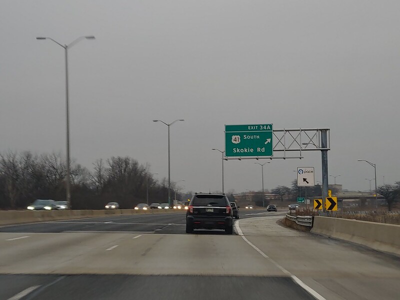
Exit 34A allows US Route 41 to depart from Interstate 94 and start using Skokie Road south instead, at a partial interchange (use Exits 34B and 34C for access to/from the north):
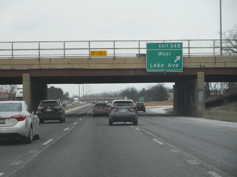
Exit 34B is for Lake Avenue westbound, but access is only provided to/from the south (use Exit 34A for access to/from the north):
Exit 34C is for Lake Avenue eastbound, but access is only provided to/from the south (use Exit 34A for access to/from the north):
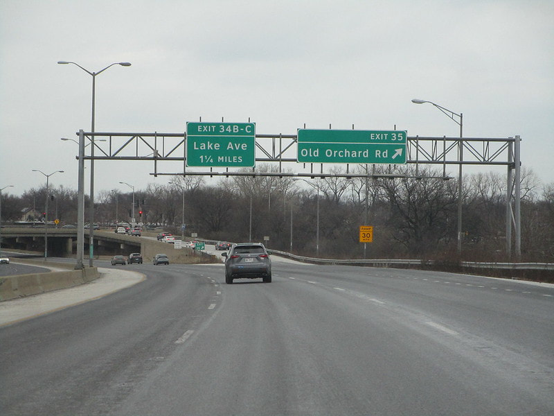
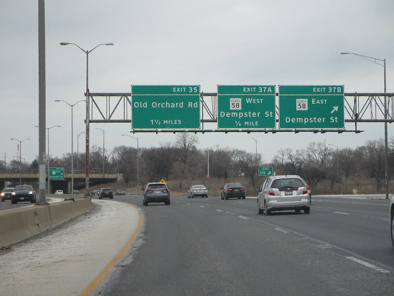
Exit 35 is a half-folded diamond interchange to Old Orchard Road:
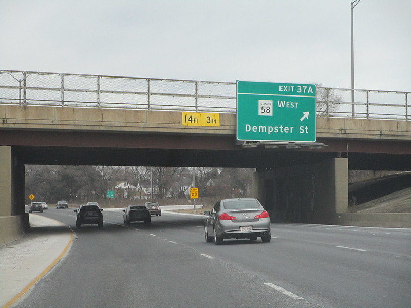
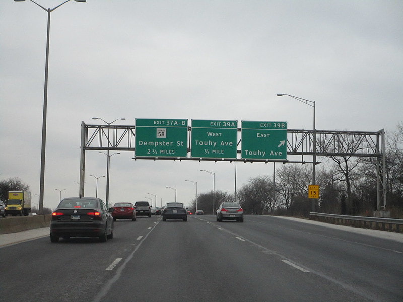
Exit 37A is the first of two ramps at the cloverleaf to Illinois Route 58, also known as Dempster Street; this first ramp leads to the westbound lanes:
Exit 37B is at the cloverleaf to Illinois Route 58, also known as Dempster Street; this ramp is the latter of the two, leading to the eastbound lanes:
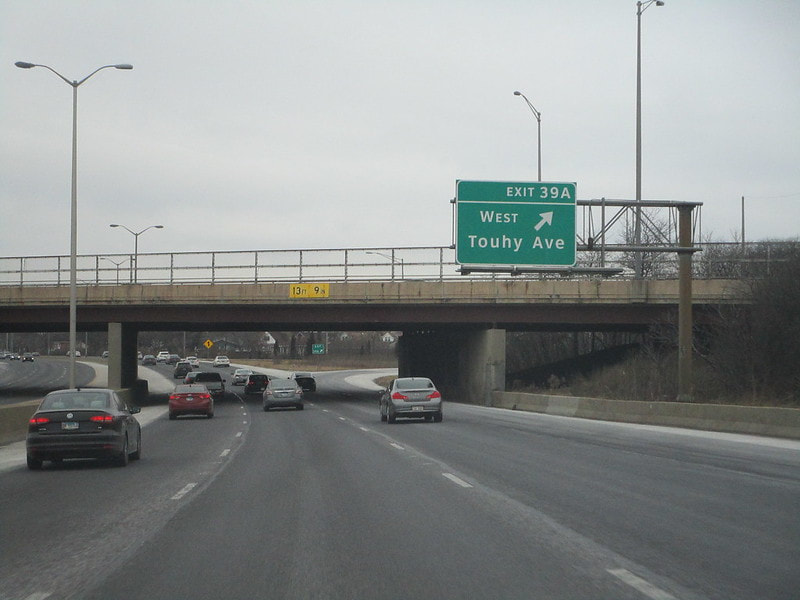
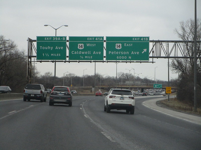
Exit 39A is for Touhy Avenue westbound, at a cloverleaf interchange:
Exit 39B is the letter of the two ramps at the Touhy Avenue cloverleaf, leading to the eastbound side of Touhy (pronounced "TOO-ee"):
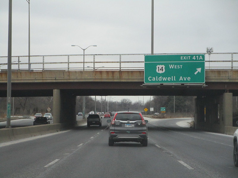
Exit 41A is for US Route 14 westbound along Caldwell Avenue, but access isn't provided between US Route 14's west leg and Interstate 94's northern leg:
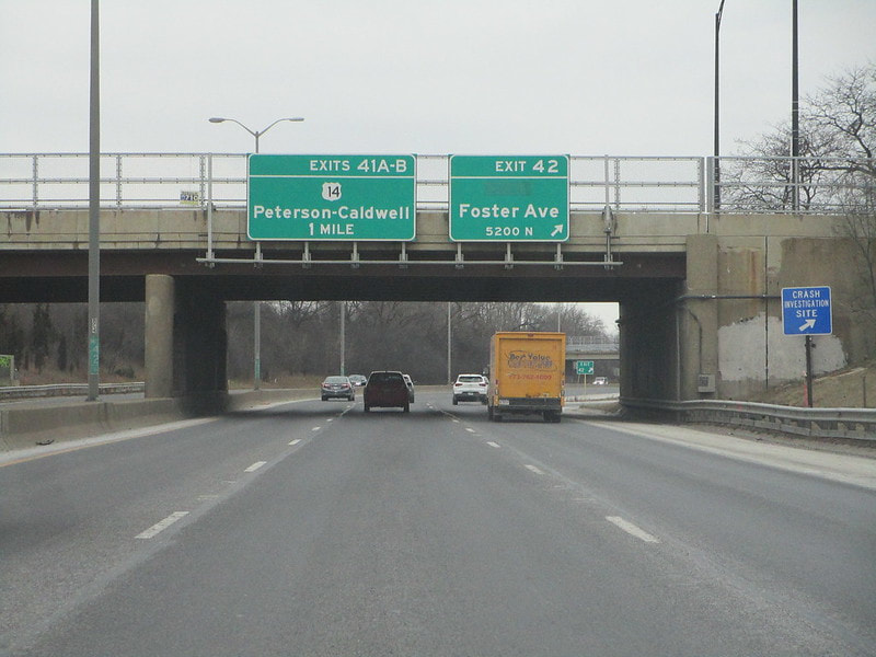
Exit 41B is for US Route 14 eastbound along Peterson Avenue, with full access to/from the eastern leg of US Route 14 mentioned here:
Exit 41C is a southbound offramp to Illinois 50 and Cicero Avenue southbound, providing the missing ramp to Foster Avenue at the exit 42 interchange coming up next...
Exit 42 is for Foster Avenue on Chicago's north side, with full access except for the southbound offramp taking place earlier at Exit 41C:
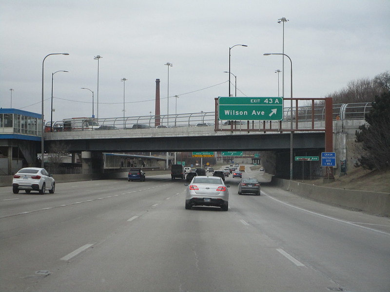
Exit 43A is for Wilson Avenue:
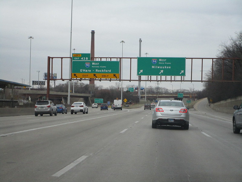
Exit 43B is where westbound Interstate 94 splits from Interstate 90 to go its own way on the Edens Expressway instead of the Kennedy Expressway; for eastbound, Interstate 94 joins the Kennedy Expressway and Interstate 90 as the Edens comes to an end:
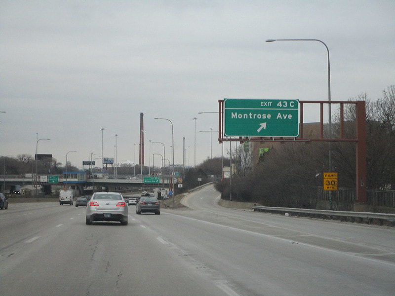
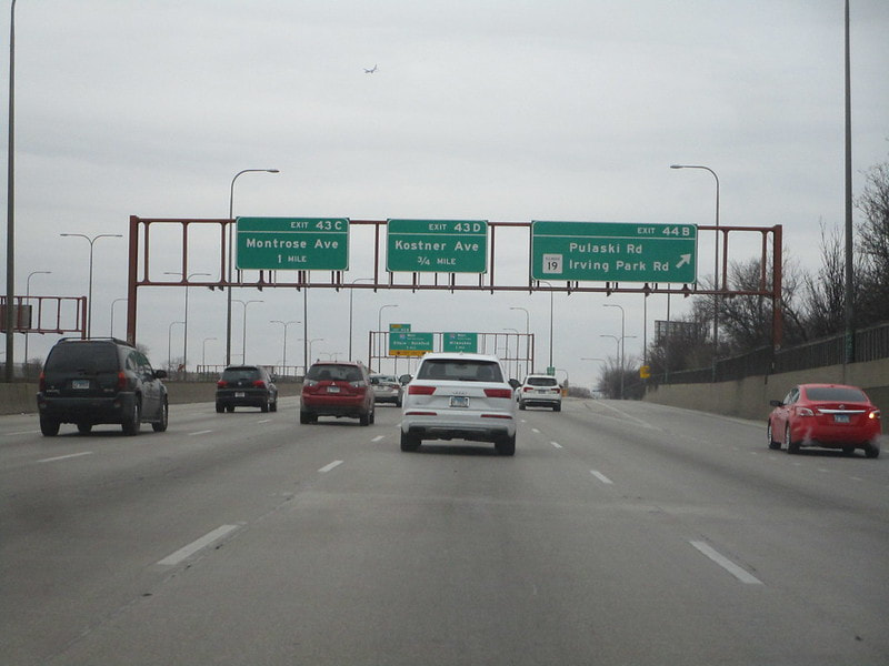
Exit 43C is only accessible to/from the east, but it accesses Montrose Avenue:
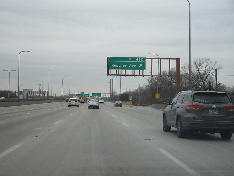
Exit 43D is a random westbound offramp for Kostner Avenue:
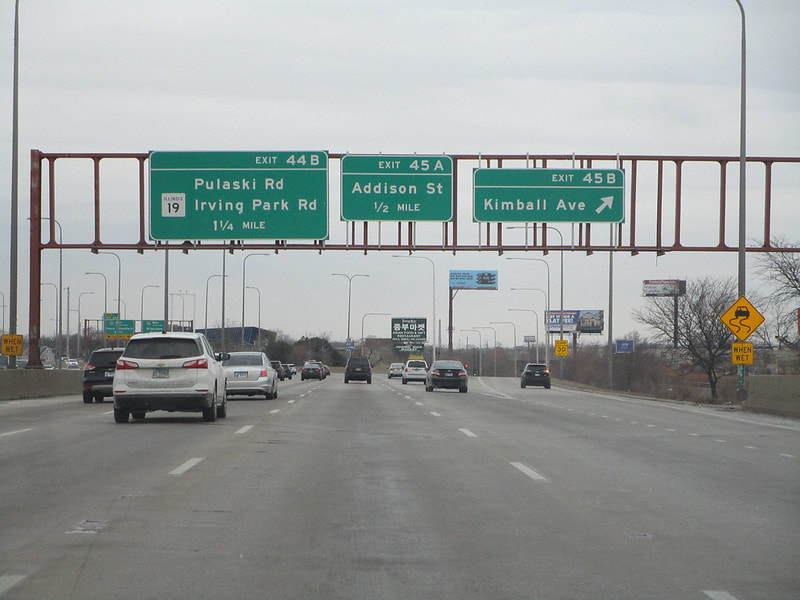
Exit 44A is for Keeler Avenue and Irving Park Road, which carries Illinois 19; the interchange has full access except for a westbound offramp, provided at Exit 44B...
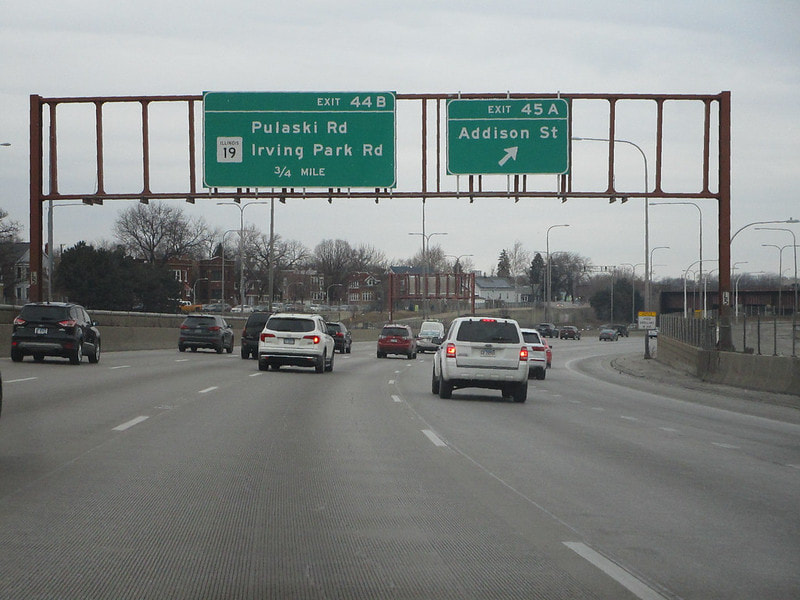
Exit 44B only provides access to/from the east, but it reaches Pulaski Road and Irving Park Road, which carries Illinois 19:
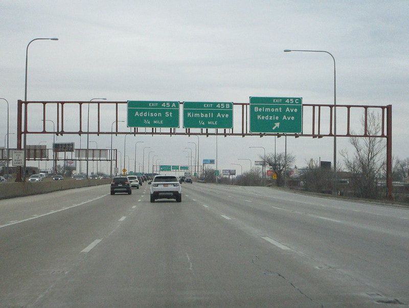
Exit 45A is a full interchange to Addison St.:
Exit 45B is a full interchange to Kimball Avenue:
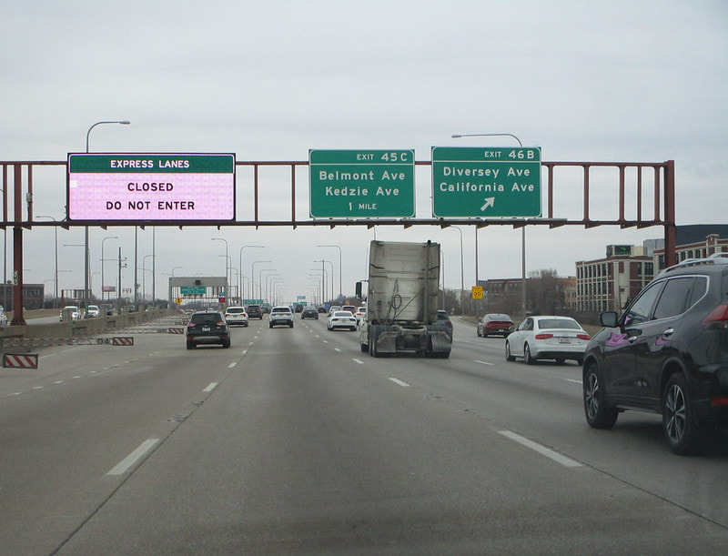
Exit 45C is to Belmont Avenue and Kedzie Avenue, with access only provided to/from the east:
Exit 46A is for California Avenue, but with access only to/from the west...
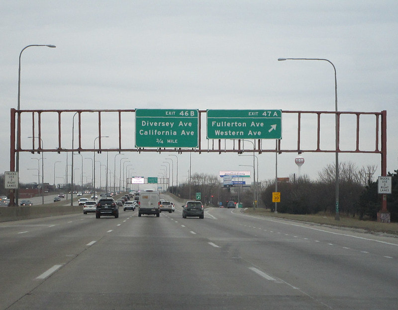
Exit 46B is for Diversey Avenue, linking to California Avenue, but with access only to/from the east:
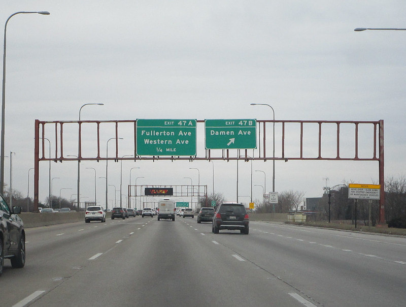
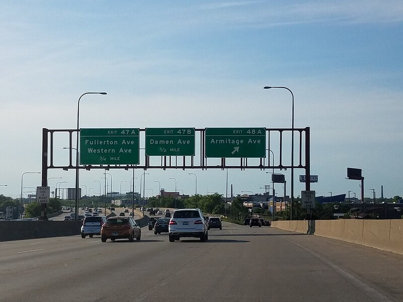
Exit 47A is for Fullerton Avenue, with full access provided:
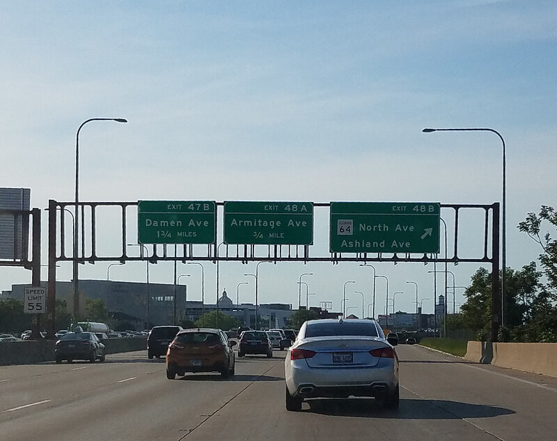
Exit 47B is for Damen Avenue, with access only provided to/from the east:
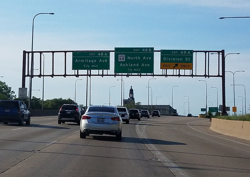
Exit 48A is for Armitage Avenue, with full access; from here, Interstates 90 and 94 take a decidedly southerly turn:
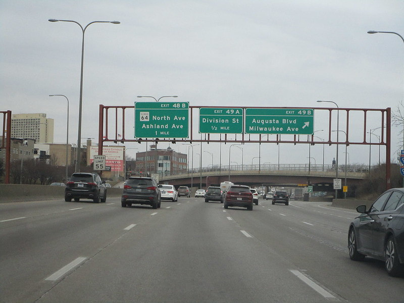
Exit 48B is a full-access interchange to North Avenue, which carries Illinois 64:
Exit 49A leads to Division Street, and it's a full-access interchange:
Exit 49B is for Milwaukee Avenue and Augusta Boulevard, but access is only provided to/from the south:
Exit 50A is for Racine Avenue and Ogden Avenue, with access provided only to/from the north:
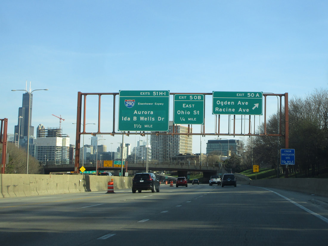
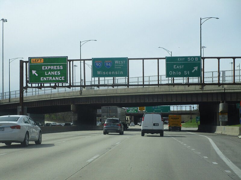
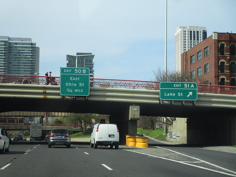
Exit 50B is for the Ohio Street feeder ramp, which feeds directly into the River North neighborhood, just north of downtown Chicago:
After emerging from the Hubbard Street Tunnel, dubbed "Hubbard's Cave", Interstates 90 and 94 have a right-oriented offramp every block for five blocks in a row. These are accompanied by frequent onramps that enter the carriageway from the left, alongside downtown Chicago. Exit 51A is only to/from the south, but it leads to Lake Street:
Exit 51B provides full access to/from Randolph Street:
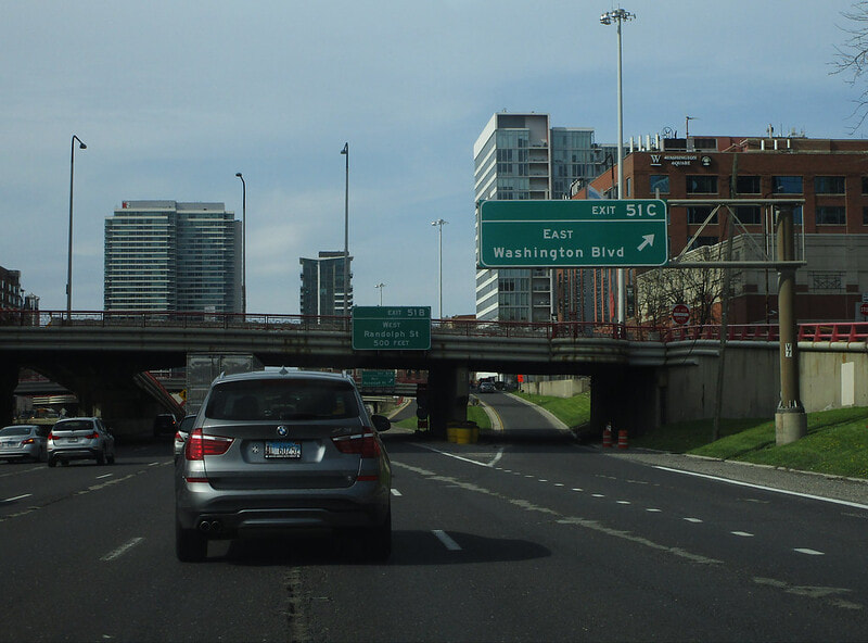
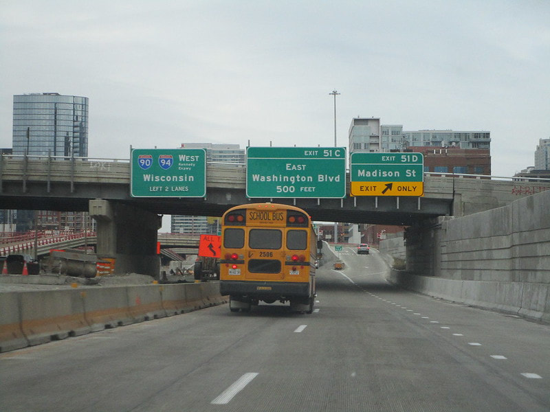
Exit 51C provides full access to/from Washington Boulevard:
Exit 51D provides full access to/from Madison Street:
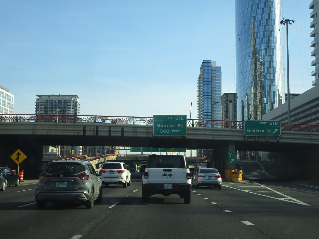
Exit 51E leads to Monroe Street, but only to/from the north:
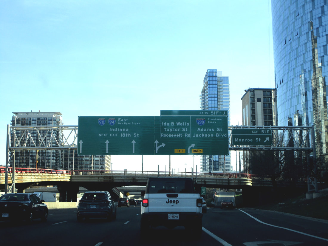
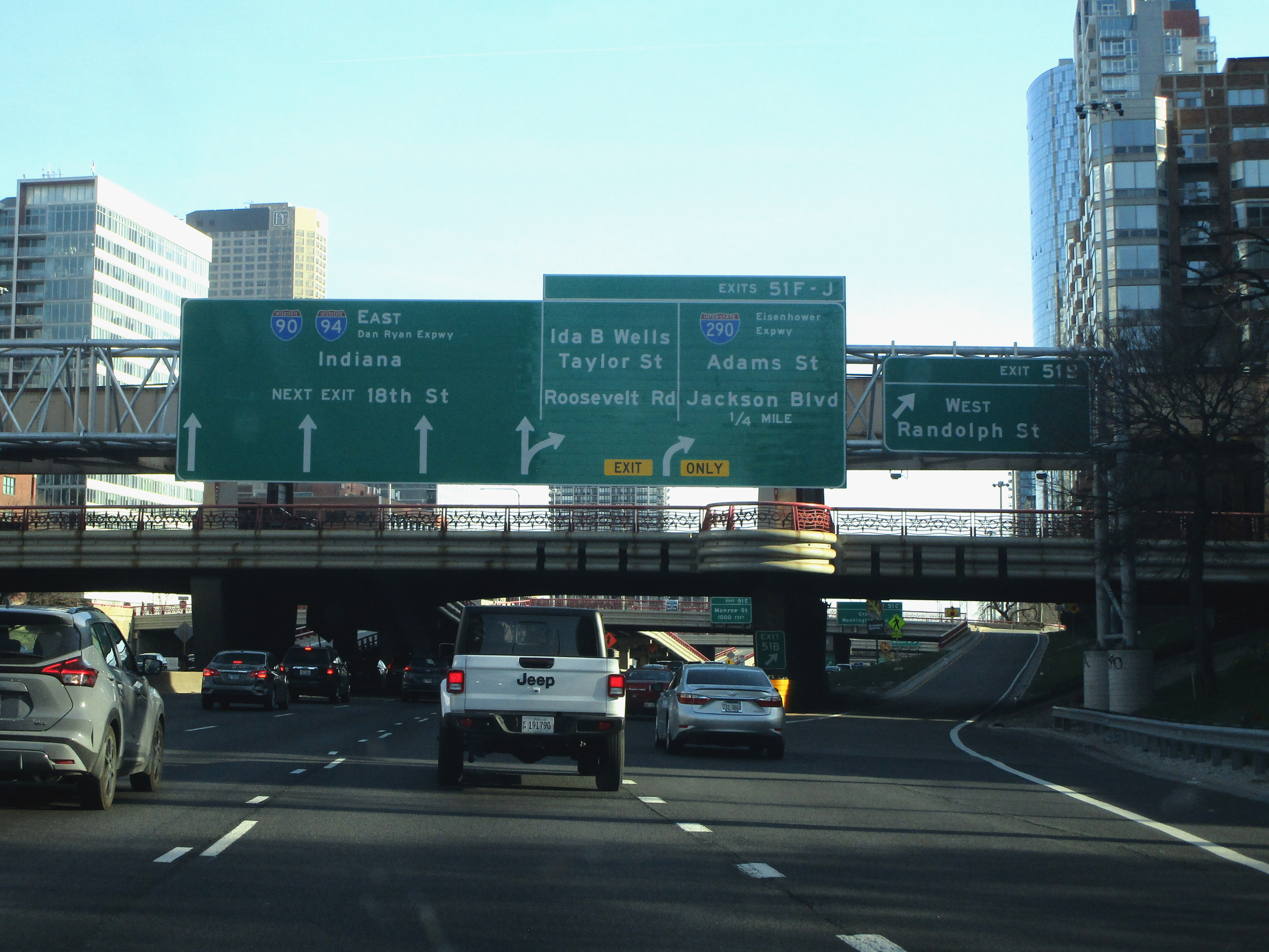
Exit 51F is for Adams Street westbound, with access to/from the north only:
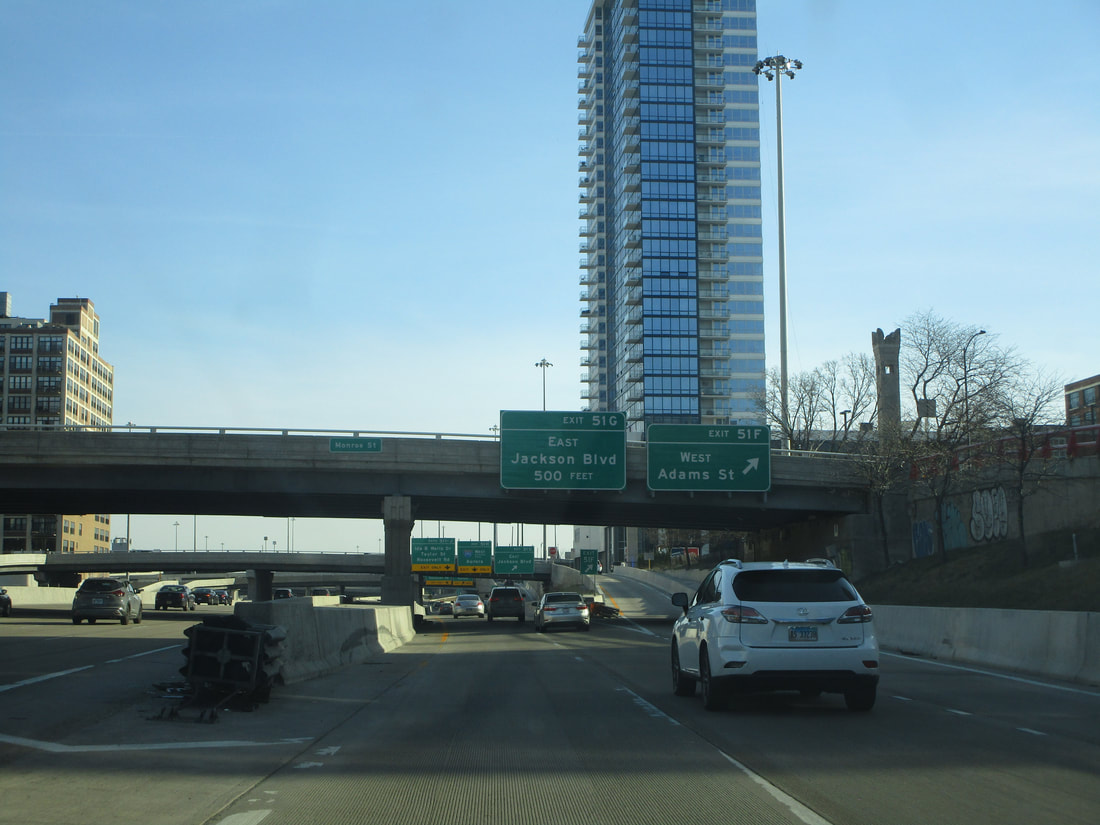
Exit 51G is for Jackson Boulevard eastbound, with access to/from the north only:
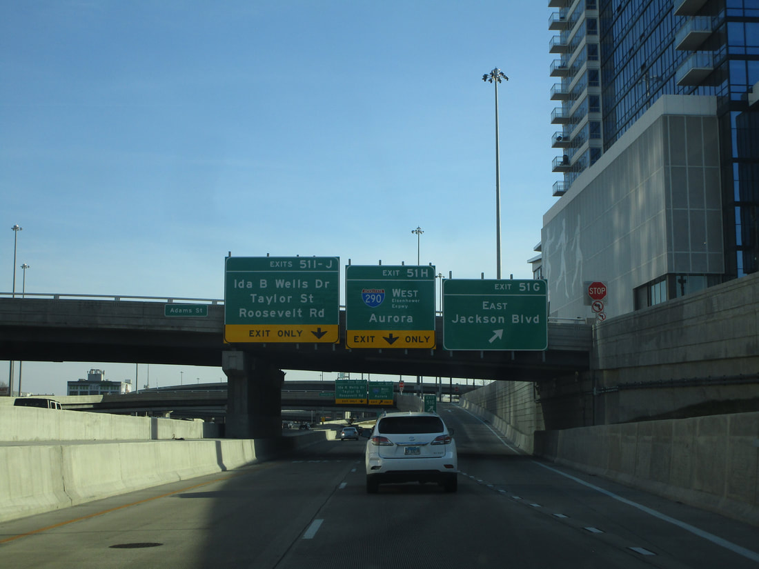
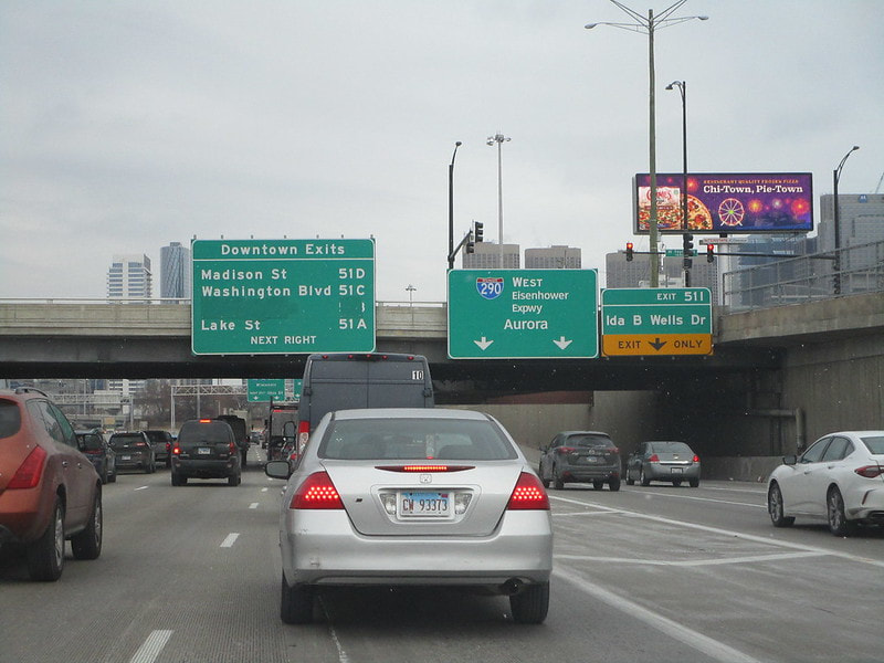
Exit 51H is the first half of the "Circle Interchange," newly redubbed the "Jane Byrne Interchange", and this ramp leads to the eastern beginning of Interstate 290 westbound, on the Eisenhower Expressway toward Aurora:
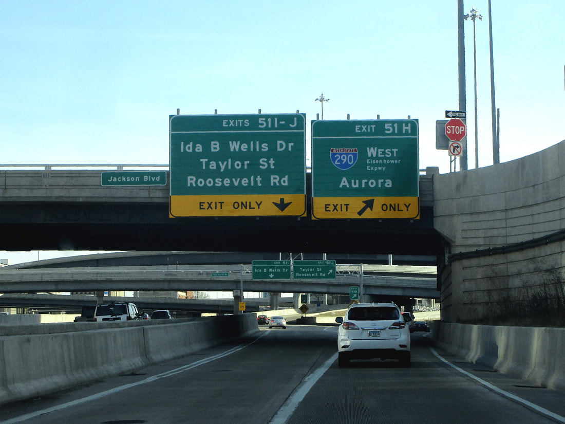
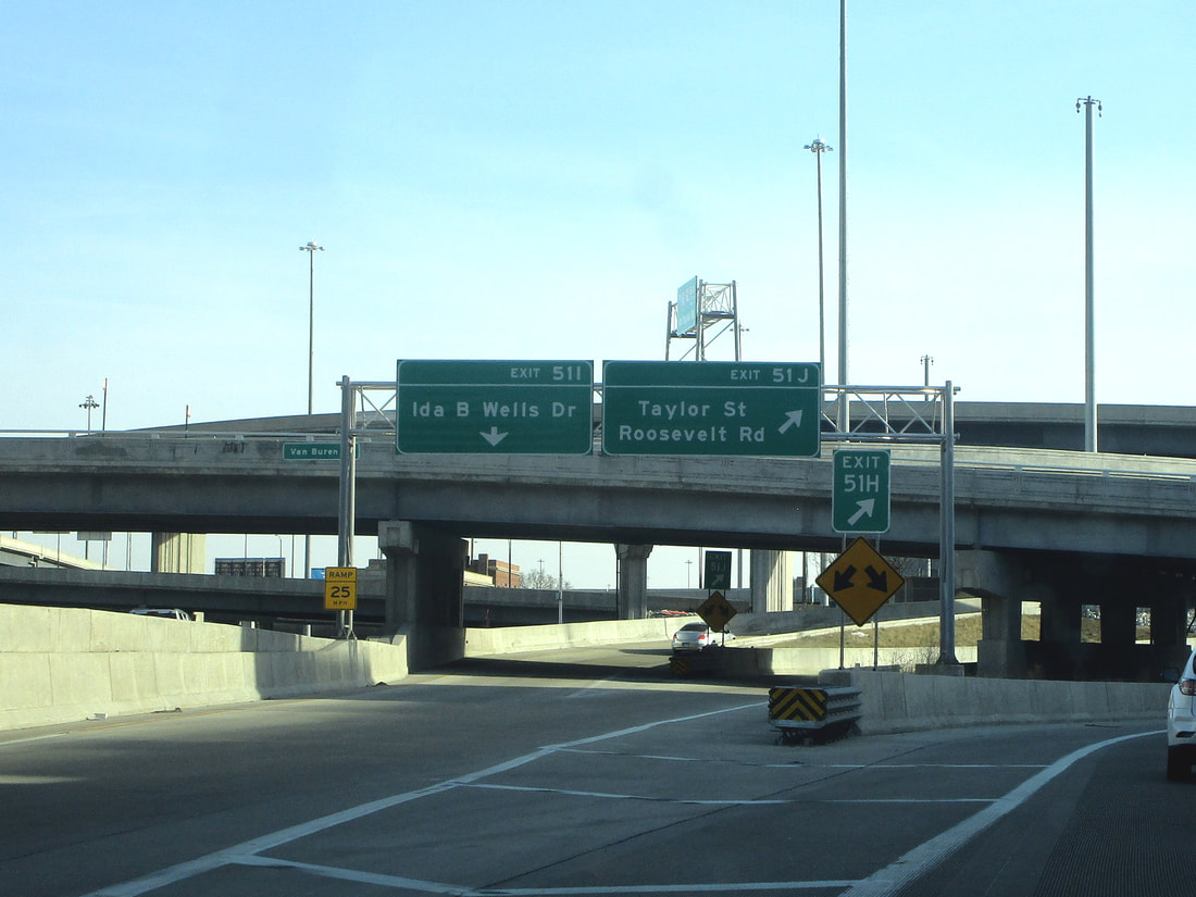
Exit 51I is part of the second ramp of the Circle Interchange/Jane Byrne Interchange, and it leads to Congress Parkway, the eastern feeder extending the carriageways of Interstate 290 into downtown Chicago; this has recently been renamed at "Ida B Wells Drive," much to the chagrin of locals noting that downtown Chicago already has a "Wells Street":
Exit 51J is a ramp splitting from the southbound offramp to Ida B. Wells Drive (formerly known as Congress Parkway) to become an access road to Taylor Street and Roosevelt Road farther south:
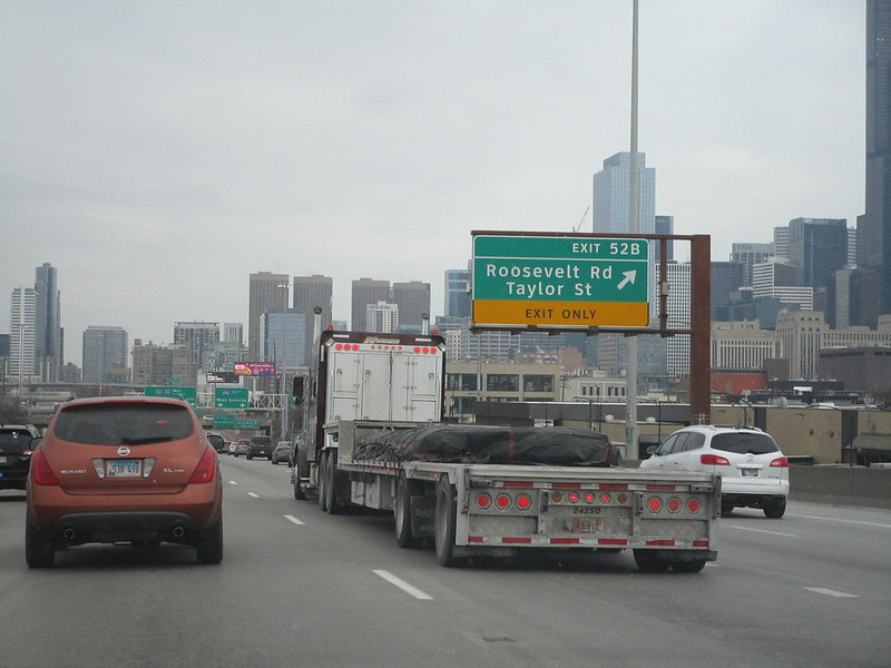
Exit 52B is next, as exit 52A no longer exists, and it leads to Roosevelt Road and Taylor Street to/from the south:
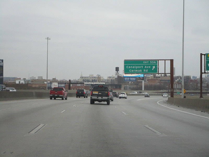
Exit 53A is for Cermak Road and Canalport Road, but with access only to/from the south:
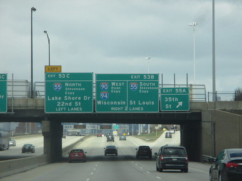
Exit 53B is to access Interstate 55 southbound toward St. Louis...
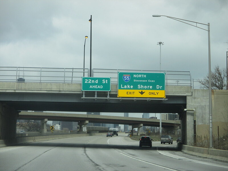
Exit 53C is to access the remaining stub of Interstate 55 east toward Lake Shore Drive, with a sub-ramp to Cermak Road/22nd Street; the offramps to Interstate 55 from Interstates 90/94 north are simply labeled "exit 53" with no letters, though:
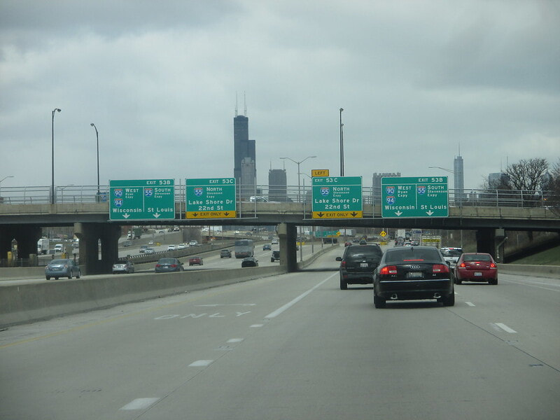
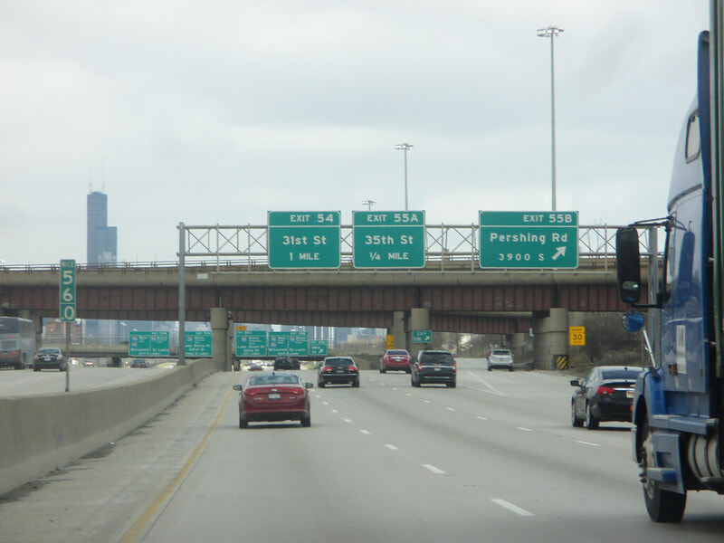
Exit 54 is for 31st Street, with full access:
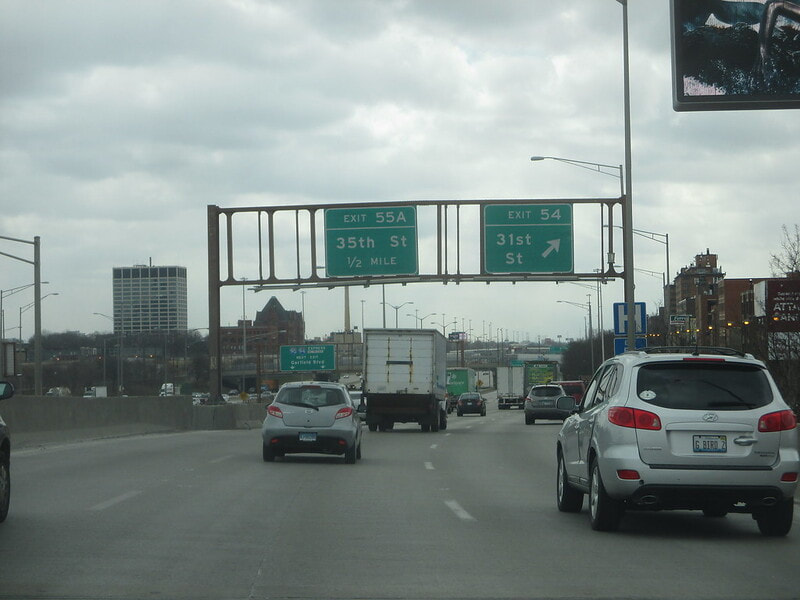
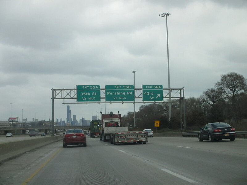
Exit 55A is for 35th Street, with full access:
Exit 55B is for Pershing Road, also known as 39th Street:
Exit 56A is for 43rd Street:
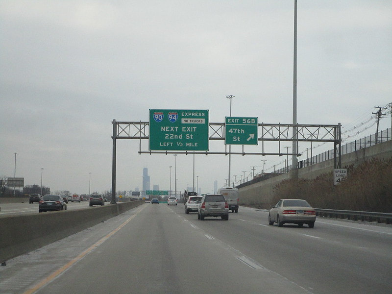
Exit 56B is for 47th Street:
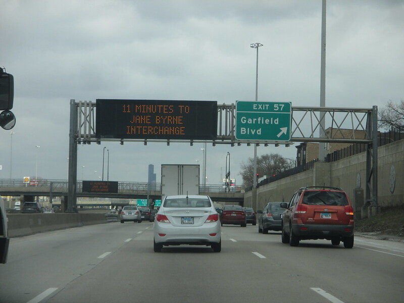
Exit 57 is for Garfield Boulevard (also known as 55th Street):
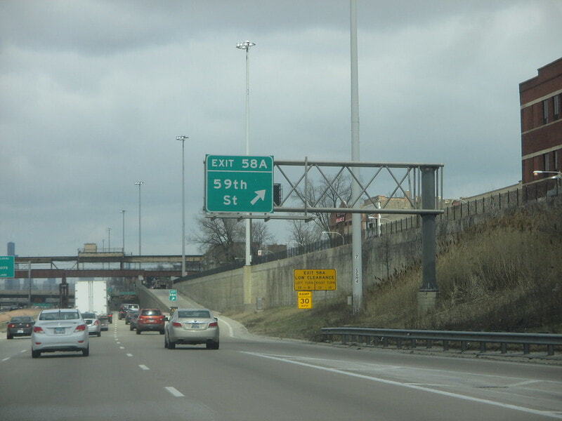
Exit 58A is for 59th Street, with access only provided to/from the south:
Exit 58B is for 63rd Street, with access only provided to/from the north...
Exit 59A is the ramp to the start of the tolled Chicago Skyway, which carries Interstate 90 eastward to the Indiana Toll Road...
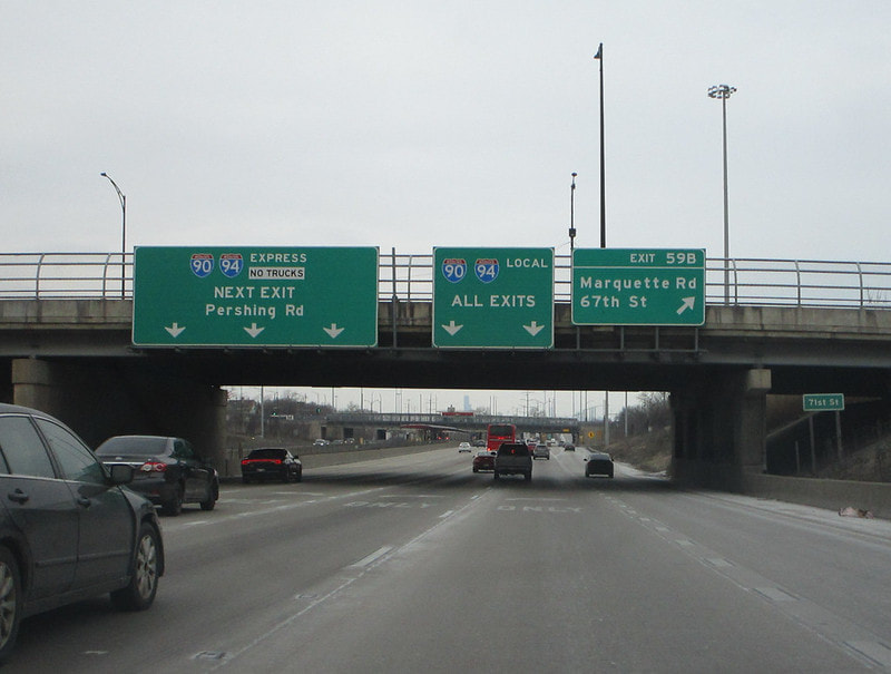
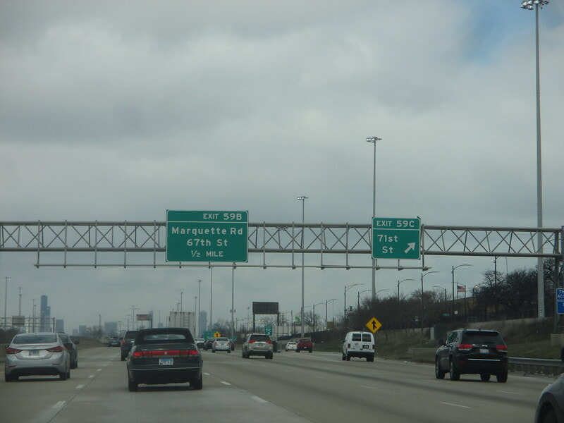
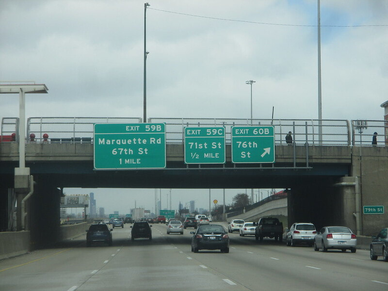
Exit 59B is for Marquette Road (also known as 67th Street), with access only provided for those going to/from the south:
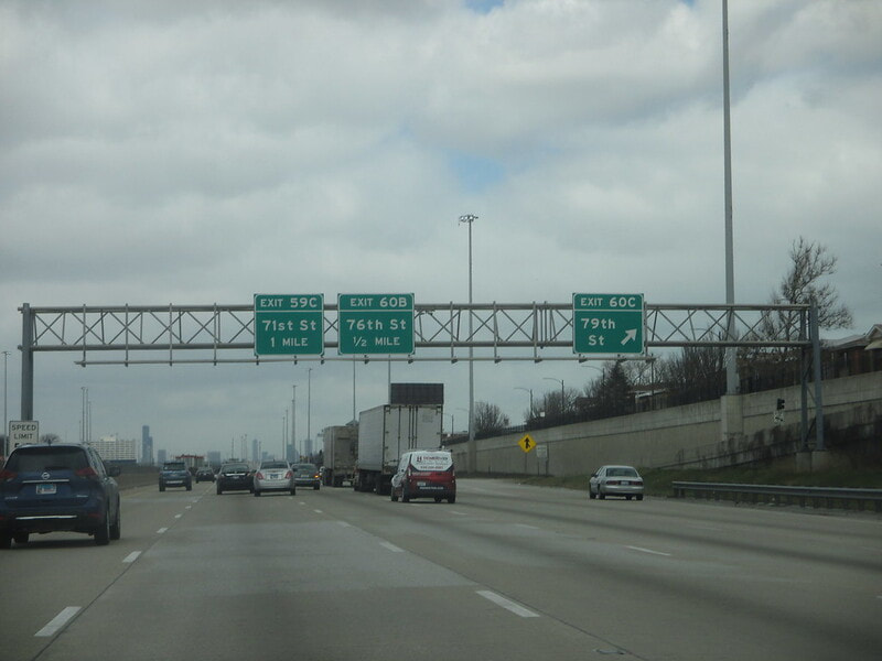
Exit 59C is for 71st Street, providing full access:
Exit 60A is for 75th Street, with access to/from the north only...
Exit 60B is for 76th Street, with access to/from the south. Honestly, exits 60A and 60B could be listed as the same diamond interchange connecting to both 75th and 76th Streets:
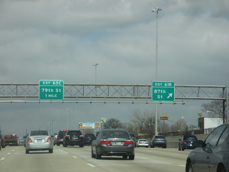
Exit 60C is for 79th Street, with full access provided for all 4 ramps:
Exit 61A is for 83rd Street, but only access to/from the north is provided:
Exit 61B is a full diamond interchange to 87th Street:
Exit 62 is for 95th Street, which carries US Routes 12 and 20, but access is only provided to/from the north (use exit 65 to Stony Island Avenue for connectivity to/from the south)...
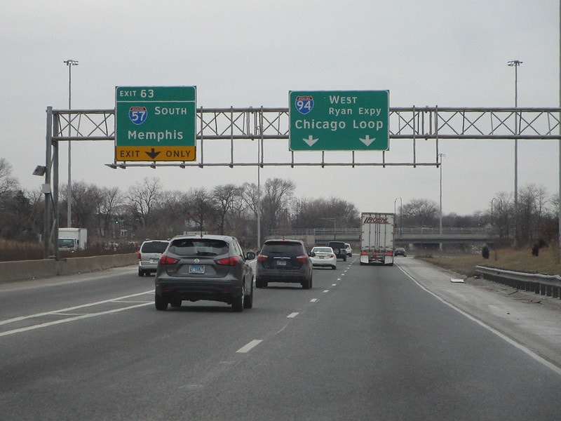
Exit 63 leads to the northern beginning of Interstate 57, signed as the way to Memphis (an exit numbered 358 leads to Wentworth Avenue from the north, but it's really an exit from Interstate 94):
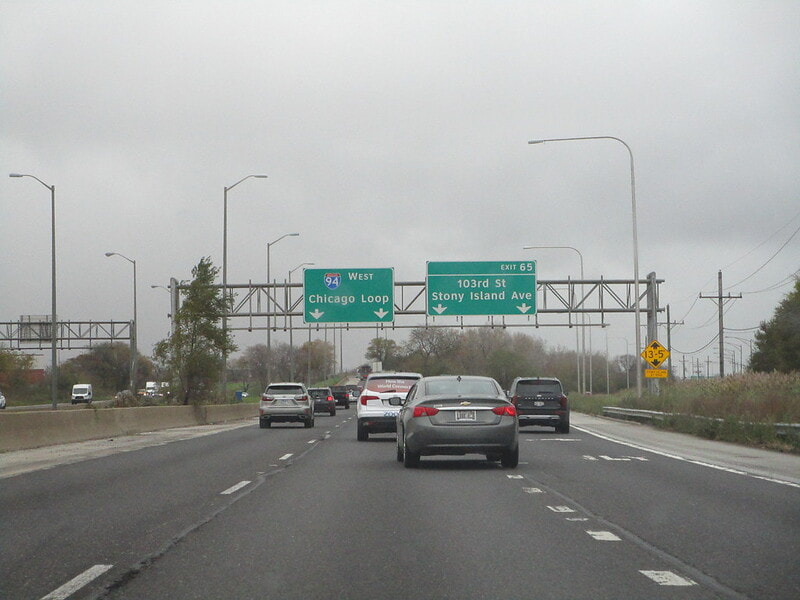
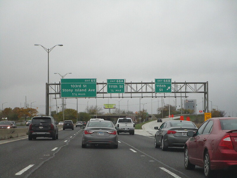
Exit 65 is for Stony Island Avenue along the portion of Interstate 94 now known as the Bishop Ford Freeway, and this Stony Island Avenue spur leads to 103rd Street and north to 95th Street:
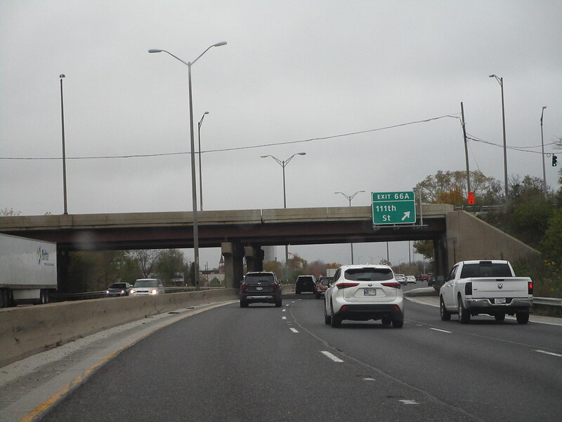
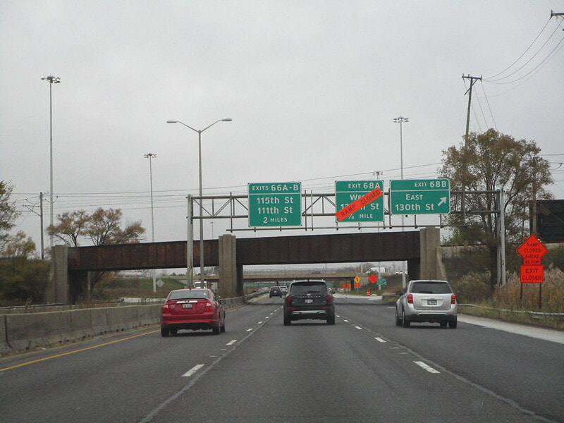
Exit 66A is a full diamond interchange to 111th Street:
Exit 66B is a full interchange to 115th Street:
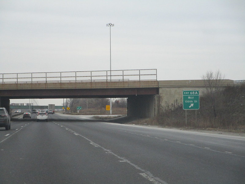
Exit 68A is the first ramp at a cloverleaf with 130th Street; this first ramp leads to westbound 130th Street:
Exit 68B, the latter half of the cloverleaf, leads to 130th Street eastbound toward Indiana:
Exit 69 leads to the Beaubien Woods Forest Preserve, but only to/from the north on Interstate 94...
Exit 70A leads to Dolton Avenue westbound, but only to/from the north...
Exit 70B is for Dolton Avenue eastbound, but access is only provided to/from the north...
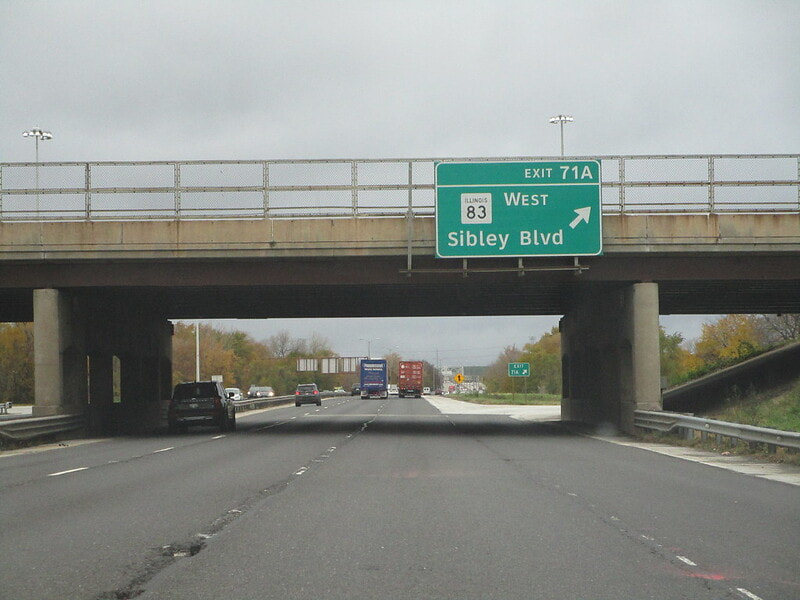
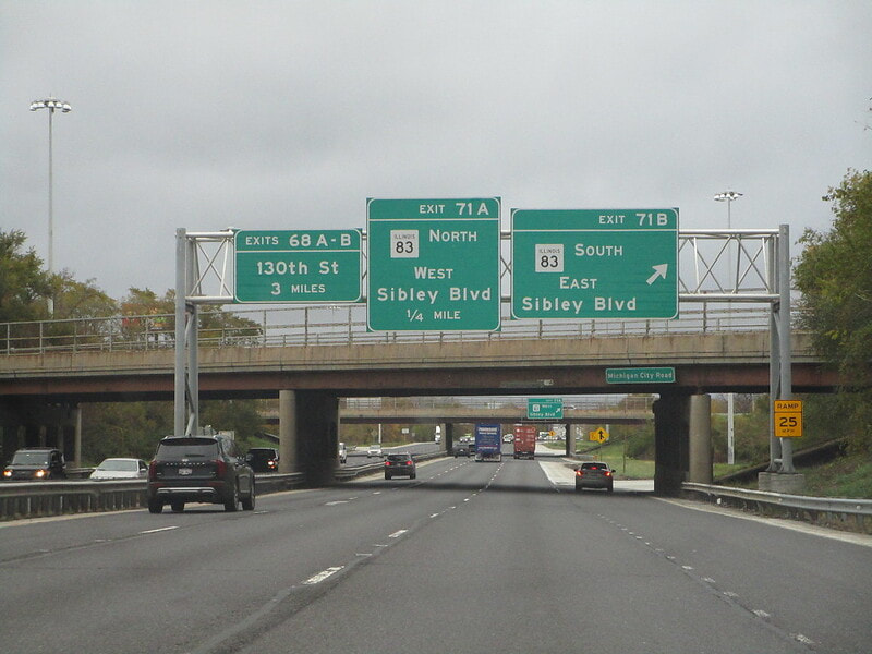
Exit 71A is the first ramp of a cloverleaf interchange to Sibley Blvd., which carries Illinois 83; this first ramp leads to westbound:
Exit 71B, the latter of the cloverleaf ramps, leads to Illinois 83 and Sibley Blvd. eastbound:
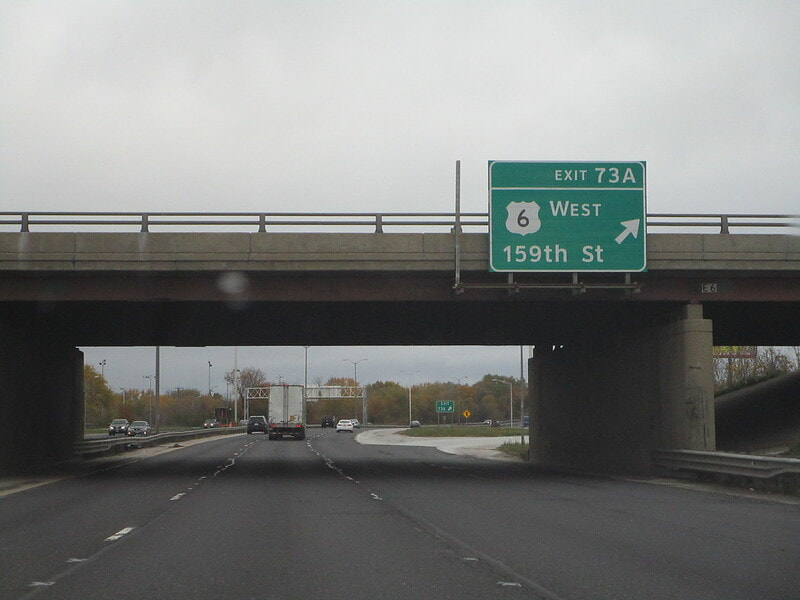
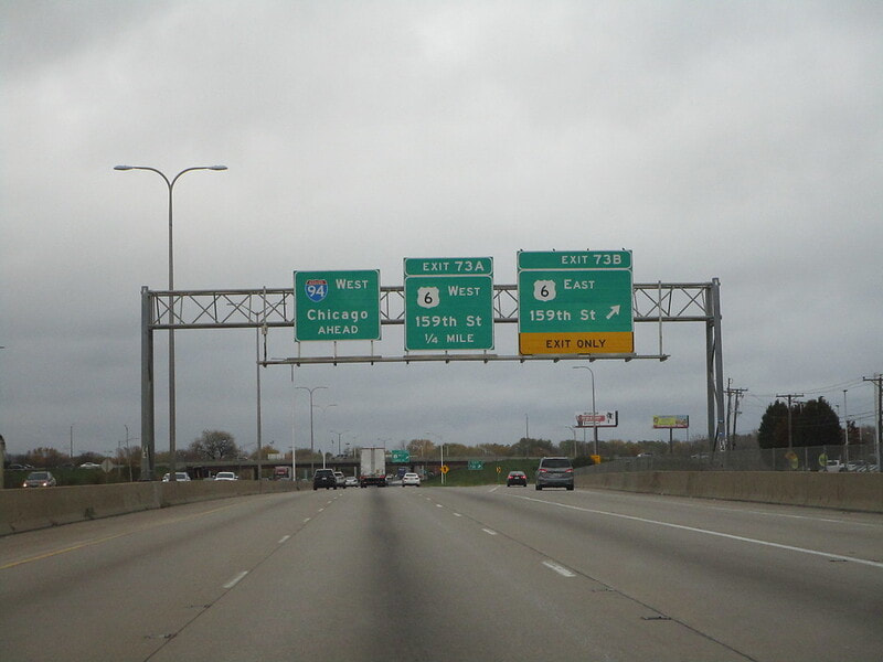
Exit 73A is the start of another cloverleaf interchange, with this first ramp leading to US Route 6 and 159th Street westbound:
Exit 73B is the latter half of the cloverleaf interchange with 159th Street and US Route 6; this second ramp leads eastbound:
Exit 74A is a split that creates the northern beginning of Illinois 394, signed as a way to Danville; meanwhile, Interstate 94 joins Interstate 80 east toward the Indiana border...
Exit 74B allows access between the northern leg of Interstate 94 coming from Chicago, to the western leg of Interstate 80 toward Iowa that also carries the southern start of Interstate 294 toward Wisconsin...
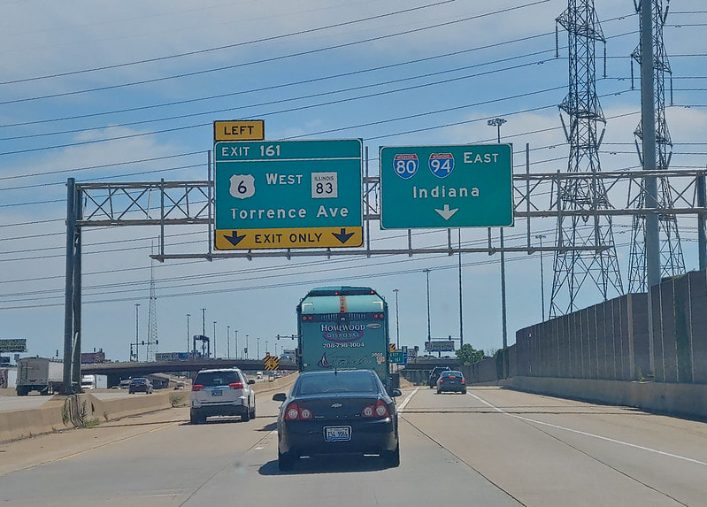
One last exit before the Indiana border appears as Exit 161 because it uses Interstate 80's numbering scheme; this exit is a single-point interchange with US Route 6 and Illinois 83, two designations carried along Torrence Avenue:
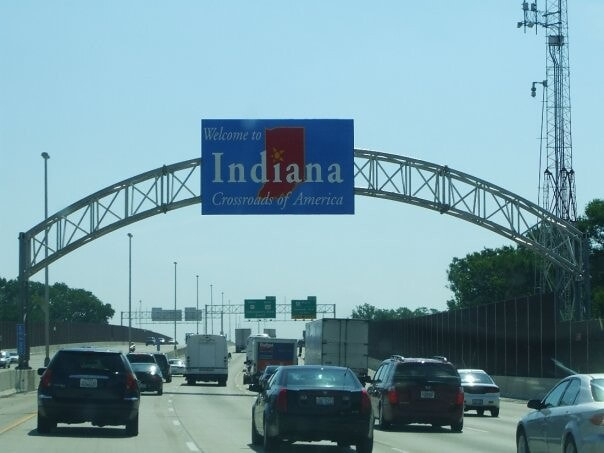
Interstate 94 heads east into Indiana concurrent with Interstate 80 and US Route 6, near Hammond, Indiana. From here, Interstate 94 continues northeast into Michigan, east through Detroit, and up to Port Huron, Michigan, on the border with Ontario, Canada.