Ohio State Route 681 runs east-west across northern Meigs County, with the western end developing a northerly component that takes it into southwestern Athens County. It serves Reedsville and Albany in southeastern Ohio. The eastern end is in the Ohio River town of Reedsville, at Ohio Route 124. Ohio Route 681 starts out westerly from there, crossing Ohio Route 7 at Tuppers Plains. Just north of Pageville, Ohio Route 681 meets the northern end of Ohio Route 684, and it bends northwesterly into Athens County. The rest of Ohio Route 681 maintains a northwesterly course, including the portion meeting US Route 50 and Ohio Route 32 in Albany. The final northwesterly piece of Ohio Route 681 ends at Ohio Route 356 near the Waterloo State Forest.
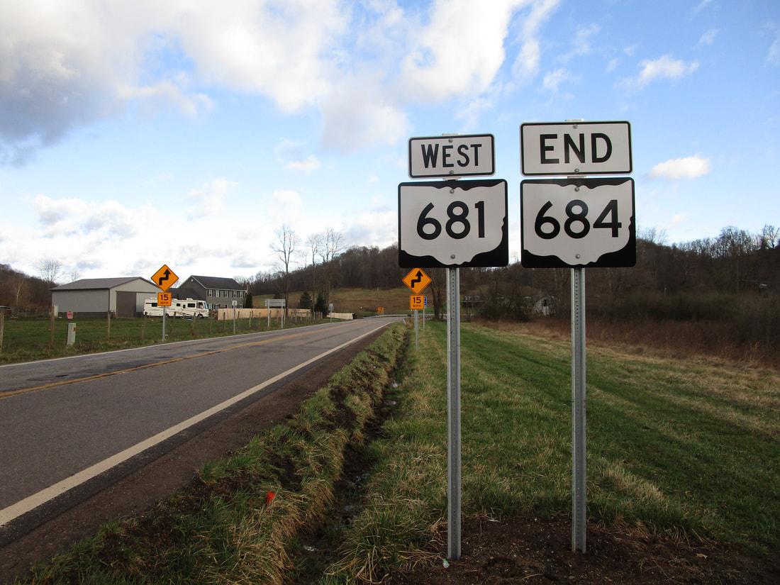
My photo for Ohio Route 681 comes from the northern end of Ohio Route 684, just north of Pageville. The northern end marker for Ohio Route 684 is shown here, next to a westbound trailblazer for Ohio Route 681, in an unusual juxtaposition of route markers. Ohio Route 681 bends from westerly to northerly at this point, and Ohio Route 684 comes from the south. For this reason, vehicles proceeding from south to north will experience the end of Ohio Route 684, followed by the western continuation of Ohio Route 681. That's why you see this unusual combination of highway markers side by side. This photo of Ohio Route 681 was taken in March 2021, during the grand tour around the southeastern quarter of Ohio.
Back to Ohio Routes 600-699.
Back to the Ohio main page.
Back to the home page.
Back to Ohio Routes 600-699.
Back to the Ohio main page.
Back to the home page.

