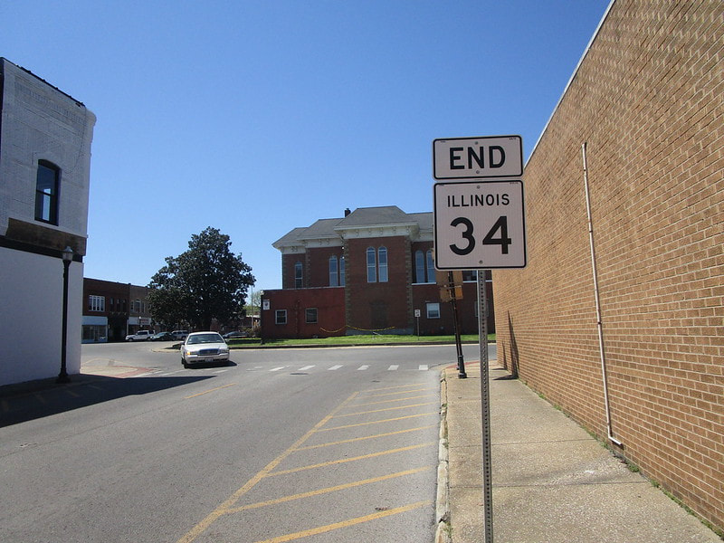
^Illinois Route 34 looking west at its terminus at the courthouse square in Benton, February 2023.
Illinois Route 34, not to be confused with US Route 34, runs northwest-southeast in southern Illinois, connecting Benton, Harrisburg, and Rosiclare. It starts along the backbone of southernmost Illinois at Benton, and runs southeast to end in Rosiclare, a town on the Ohio River near the southeastern corner of the state. It's useful for trying to reach Garden of the Gods Recreation Area, a unit of the Shawnee National Forest that is my favorite hiking spot in the entire state.
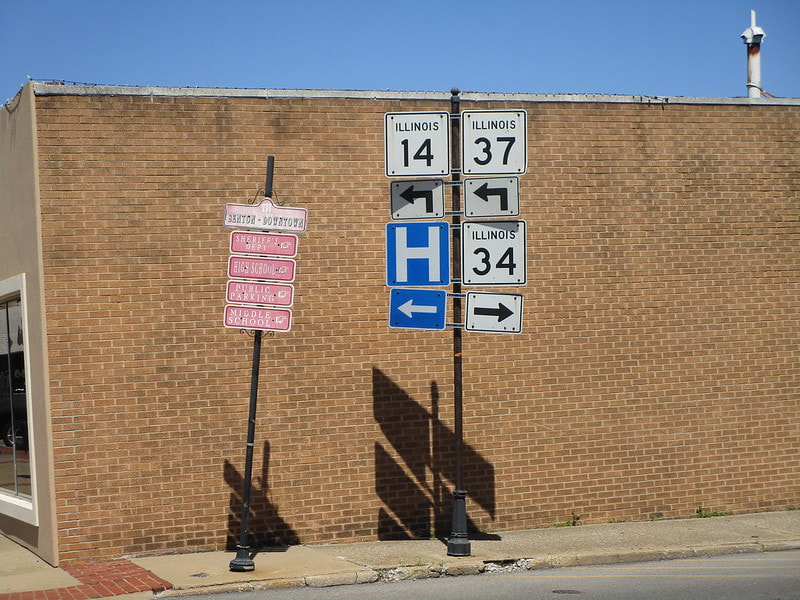
Illinois 34 begins at the central town square rotary in Benton, Illinois, which also carries Illinois Routes 37 and 14 through town:
Illinois 34 begins at the central town square rotary in Benton, Illinois, which also carries Illinois Routes 37 and 14 through town:
|
|
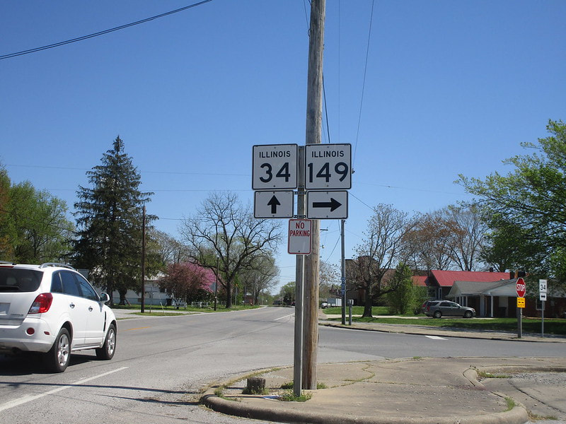
Illinois 34 heads easterly and southeasterly, meeting the eastern end of Illinois 149 at Thompsonville:
After passing through Galatia and Raleigh, Illinois 34 heads south into Harrisburg, where it joins Illinois 13 east:
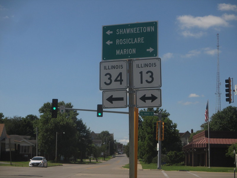
On the northeast side of Harrisburg, Illinois 13 crosses US Route 45, and Illinois 34 turns southerly onto a new concurrency with US Route 45:
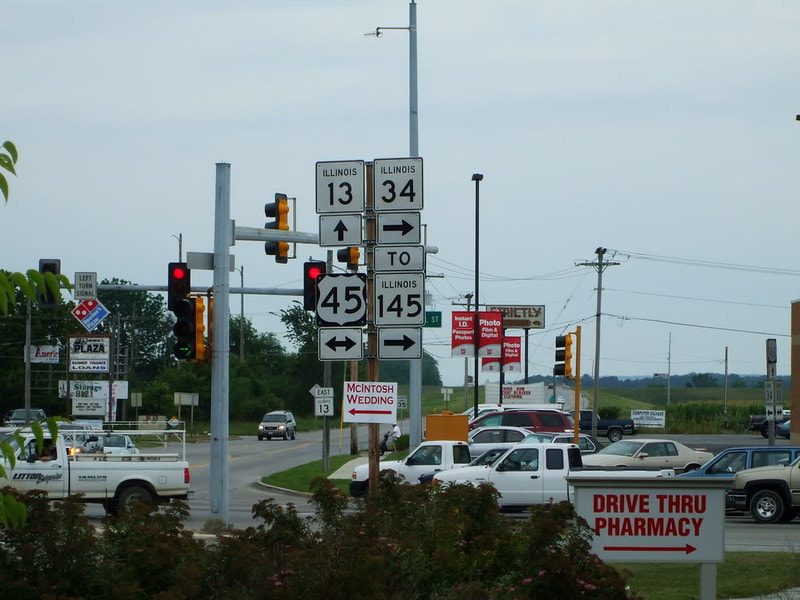
Then, as US Route 45 is leaving Harrisburg to the south, it spawns the northern beginning of Illinois 145, and Illinois 34 turns southerly onto the newly-formed Illinois 145:
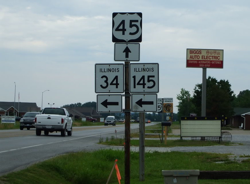
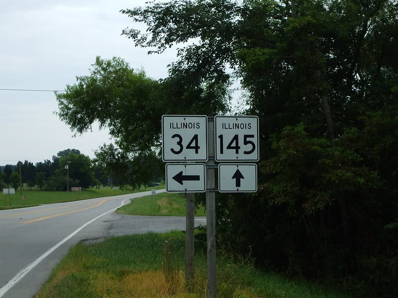
After three consecutive duplexes with no space between them, Illinois 34 finally runs independently again as it splits from Illinois 145:
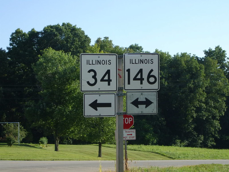
West of Elizabethtown, Illinois 34 encounters Illinois 146, which runs along the Ohio River, and it joins that route eastward:
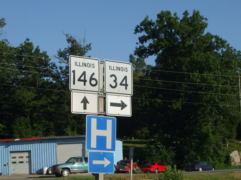
Illinois 34 doesn't follow Illinois 146 all the way into Elizabethtown; instead, it splits to head south into Rosiclare:
The southern end of Illinois 34 is in the town of Rosiclare, a very dilapidated town on the Ohio River: