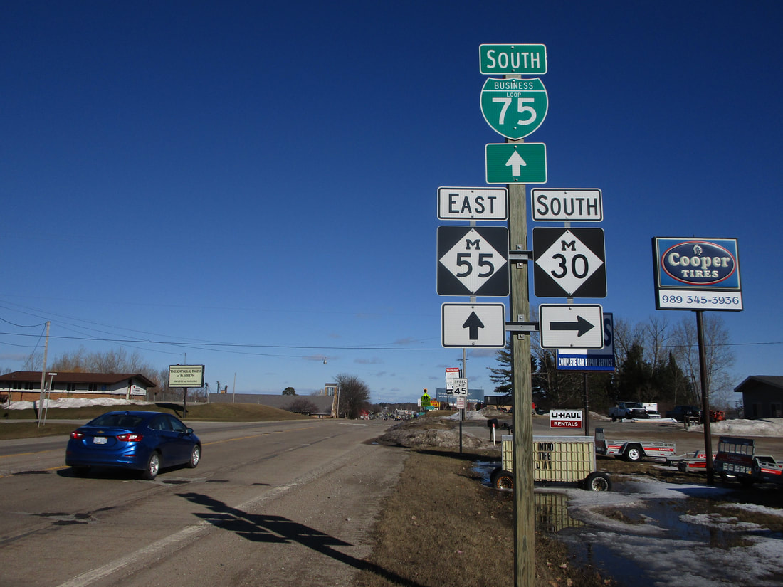
Michigan Highway 30 is a north-south highway about fifteen to twenty miles west of Saginaw Bay. That's a comfortable claim to make, because the north-south distance covered by Michigan Highway 30 closely matches the north-south measurement across Saginaw Bay. The southern end of Michigan Highway 30 is at US Route 10 west of Midland (I wrote the same thing about Michigan Highway 18, but that road is even farther west.) Sanford is a small town at this southern endpoint. From Sanford and US Route 10, Michigan Highway 30 heads north to West Branch, a town along Interstate 75. Michigan Highway 30, having passed through no towns between its two endpoints, reaches finality at Michigan Highway 55 in West Branch.
My photo for Michigan Highway 30 signage comes from the highway's northern terminus at Michigan Highway 55 in West Branch. The guide marker assembly depicted faces west for eastbound vehicles on Michigan Highway 55. It indicates the point where those vehicles can turn onto Michigan Highway 30's northern beginning. This photo was taken in March 2019, on a trip around the central and south-central portions of the Lower Peninsula.
Back to the Michigan main page.
Back to the home page.
Back to the Michigan main page.
Back to the home page.

