Interstate 29, while in Iowa, hugs the east side of the Missouri River for as long as it forms the western border of Iowa. That means it enters the state in the very southwest corner of Iowa, running north through Council Bluffs to cross into South Dakota at Sioux City. Interstate 29 comes from Kansas City and St. Joseph in Missouri, and heads north into Iowa near Hamburg, Iowa. From there, it enters the metropolitan area anchored by Omaha, Nebraska and Council Bluffs, Iowa, where it serves as the main north-south Interstate Highway (despite the fact that it never enters Nebraska). It joins Interstate 80 west for a few miles, and along this concurrency, the eastbound and westbound directions are each split into separate collections of collector and local lanes, due to a fairly recent highway reconstruction. This is in Council Bluffs. Beyond Council Bluffs, Interstate 29 heads north on its own again, still just east of the Missouri River. It passes the eastern end of Interstate 480, the eastern end of Interstate 680, and the western end of Interstate 880. At Sioux City, Interstate 29 meets an interchange with another freeway carrying US Route 20, US Route 75, and Interstate 129's eastern extent. Interstate 29 curves westerly along side the Missouri River, which does the same, in Sioux City. This leads to Interstate 29's exit from Sioux City, and from the state of Iowa as a whole, on a bridge crossing over the Big Sioux River. Interstate 29's departure from Iowa takes it into the far southeast corner of South Dakota. Below, I've included a full exit list for Interstate 29 in Iowa, along with photos of exit signage for each one!
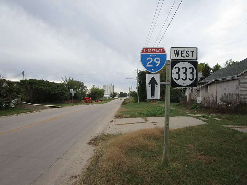
First of all, though, here is the photo showing where I got my shield image for Interstate 29. It's a guide marker along Iowa Route 333 in Hamburg, Iowa!
First of all, though, here is the photo showing where I got my shield image for Interstate 29. It's a guide marker along Iowa Route 333 in Hamburg, Iowa!
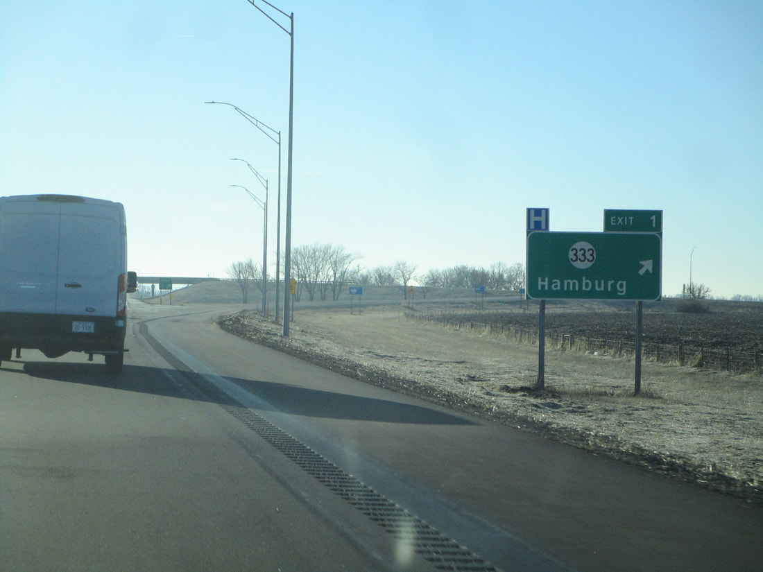
Exit 1 is for Iowa Route 333, which leads to Hamburg:
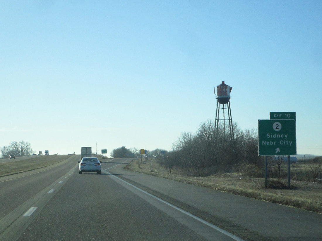
Exit 10 leads to Iowa Route 2, which provides access to Sidney and Nebraska City (Nebraska):
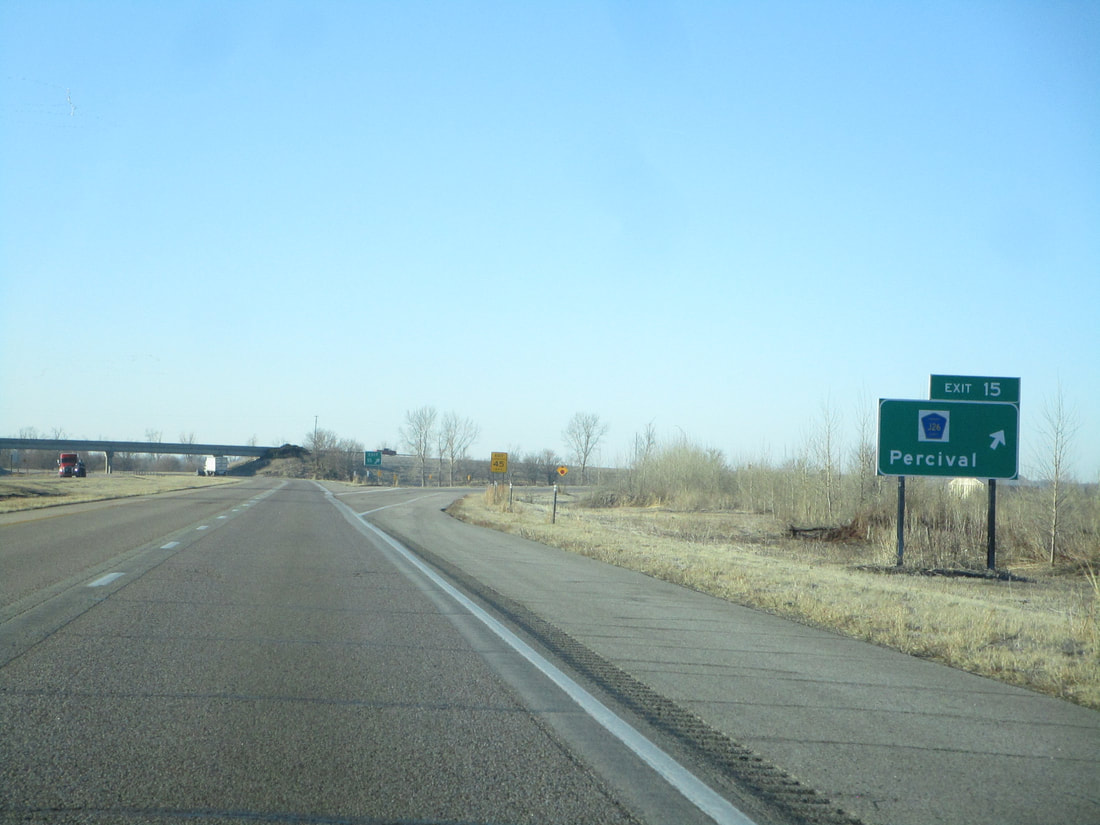
Exit 15 is the exit to Percival, and to County Highway J26:
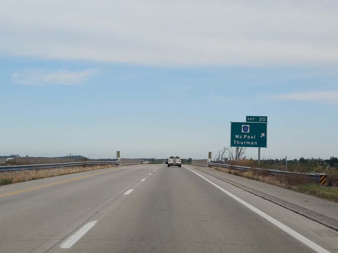
Exit 20 connects with County Highway J24, signed as the way to McPaul and Thurman:
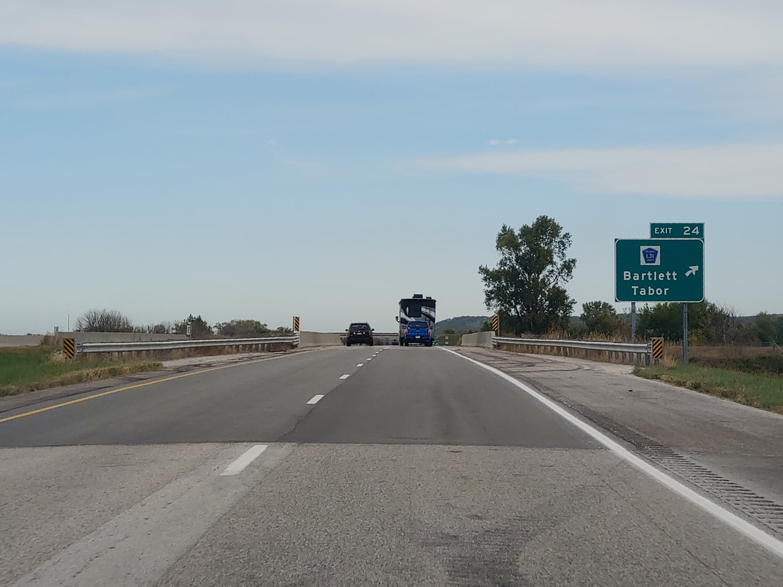
Exit 24 helps travelers on the Interstate get to County Highway L31, Bartlett and Tabor:
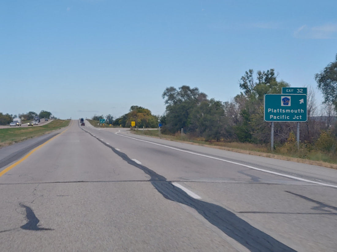
Exit 32 leads to County Highway L35, a road bringing people to Plattsmouth and Pacific Junction:
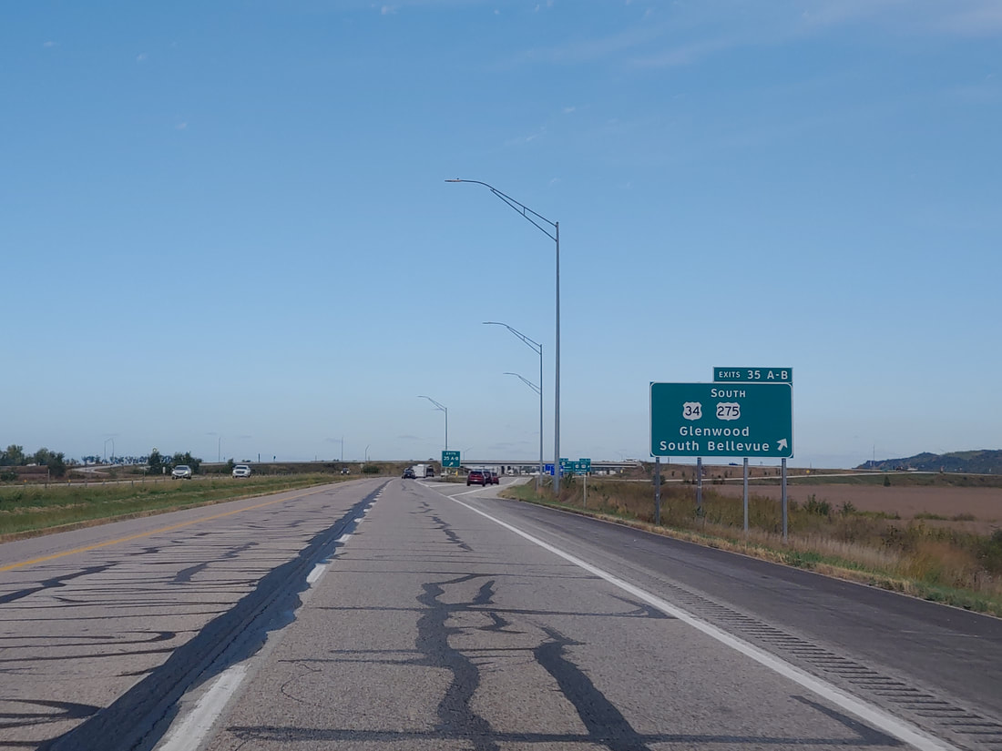
Exit 35 links to US Route 34 and the southern continuation of US Route 275. Glenwood and South Bellevue are signed as control cities, and US Route 275 joins Interstate 29 at this point:
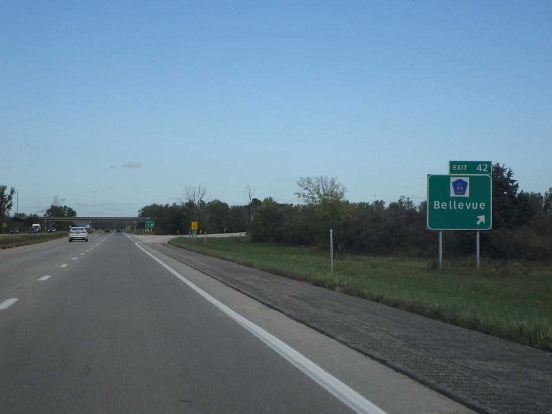
Exit 42 helps people get to County Highway H10 and the town of Bellevue:
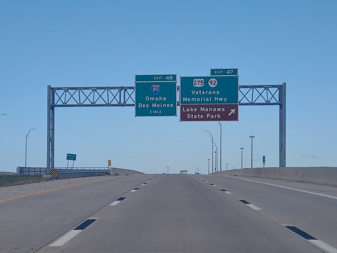
Exit 47 marks the entry into Council Bluffs, and it leads to US Route 275's western continuation, Iowa Route 92, and Veterans Memorial Highway:
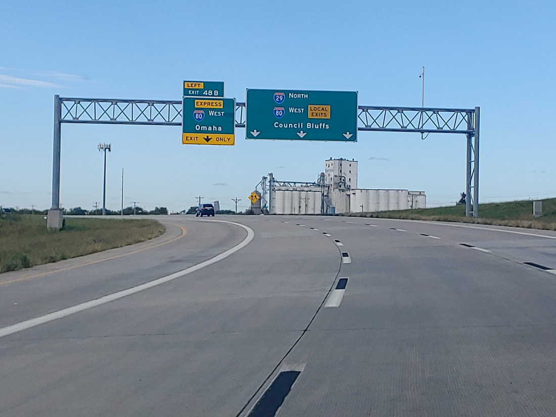
Exit 48A leads to Interstate 80 eastward toward Des Moines. This is where Interstate 29 joins Interstate 80 westward, but both routes share a pair of carriageways in each direction. The concurrency has separate express lanes and local lanes that reach the onramps and offramps of interchanges.
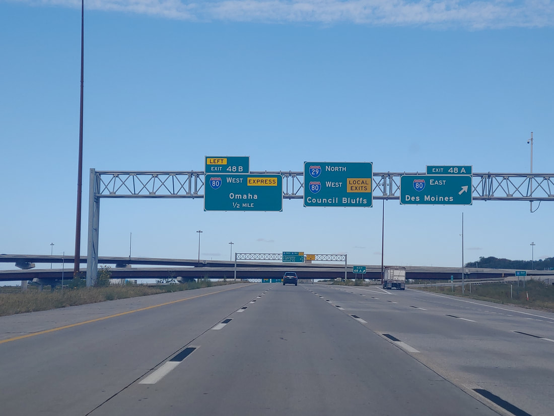
Exit 48B is the split away to the express lanes that bypass all the intermediate exits as Interstate 29 and Interstate 80 go west together:
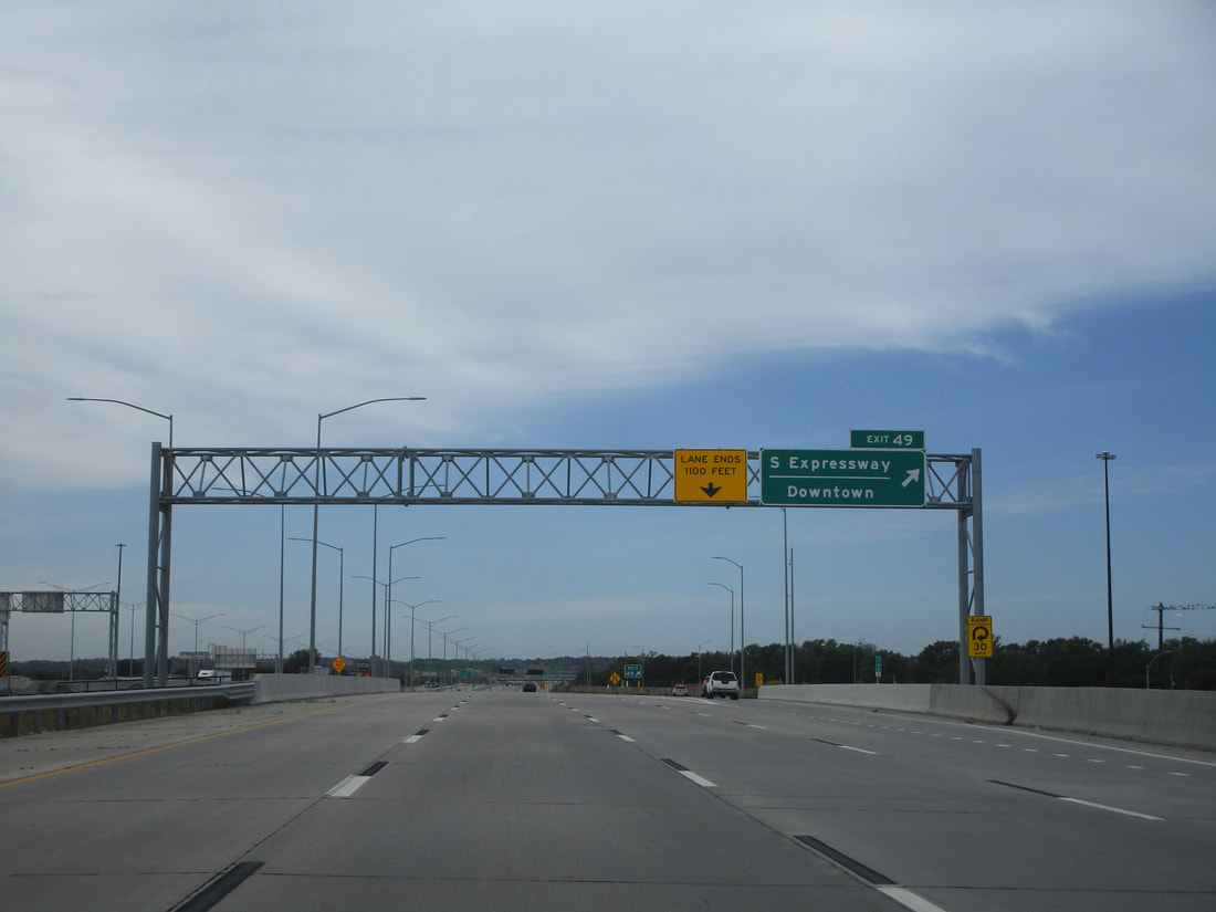
The local lanes for Interstates 29 and 80 use Interstate 29's exit numbers. Exit 49 leads to South "Expressway", which is the name of a non-expressway surface street. It leads to downtown Council Bluffs:
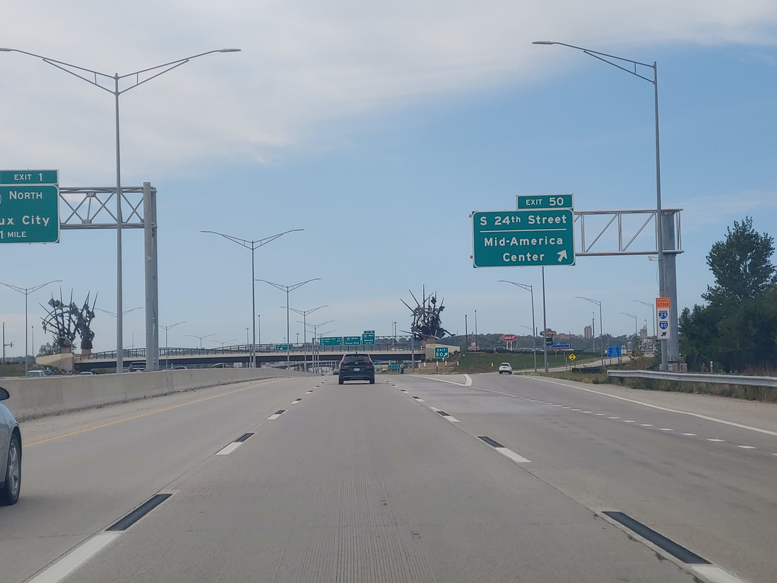
Exit 50 beings people to South 24th Street and the Mid-America Center:
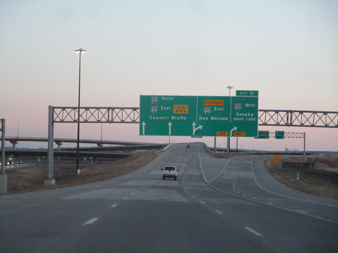
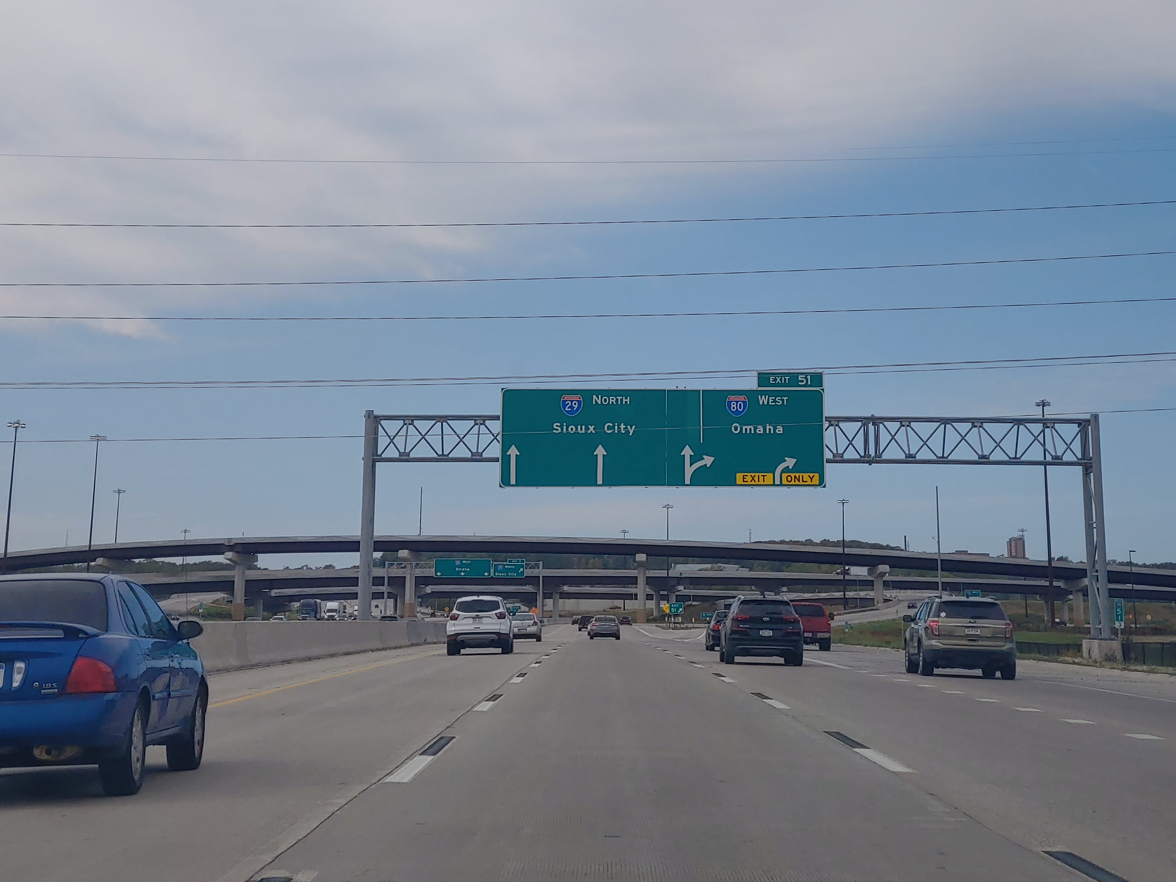
Exit 51 is where the express lanes and local lanes converge, but the concurrency between Interstate 29 and Interstate 80 splits apart. The offramp leads to Interstate 80 west, into Omaha:
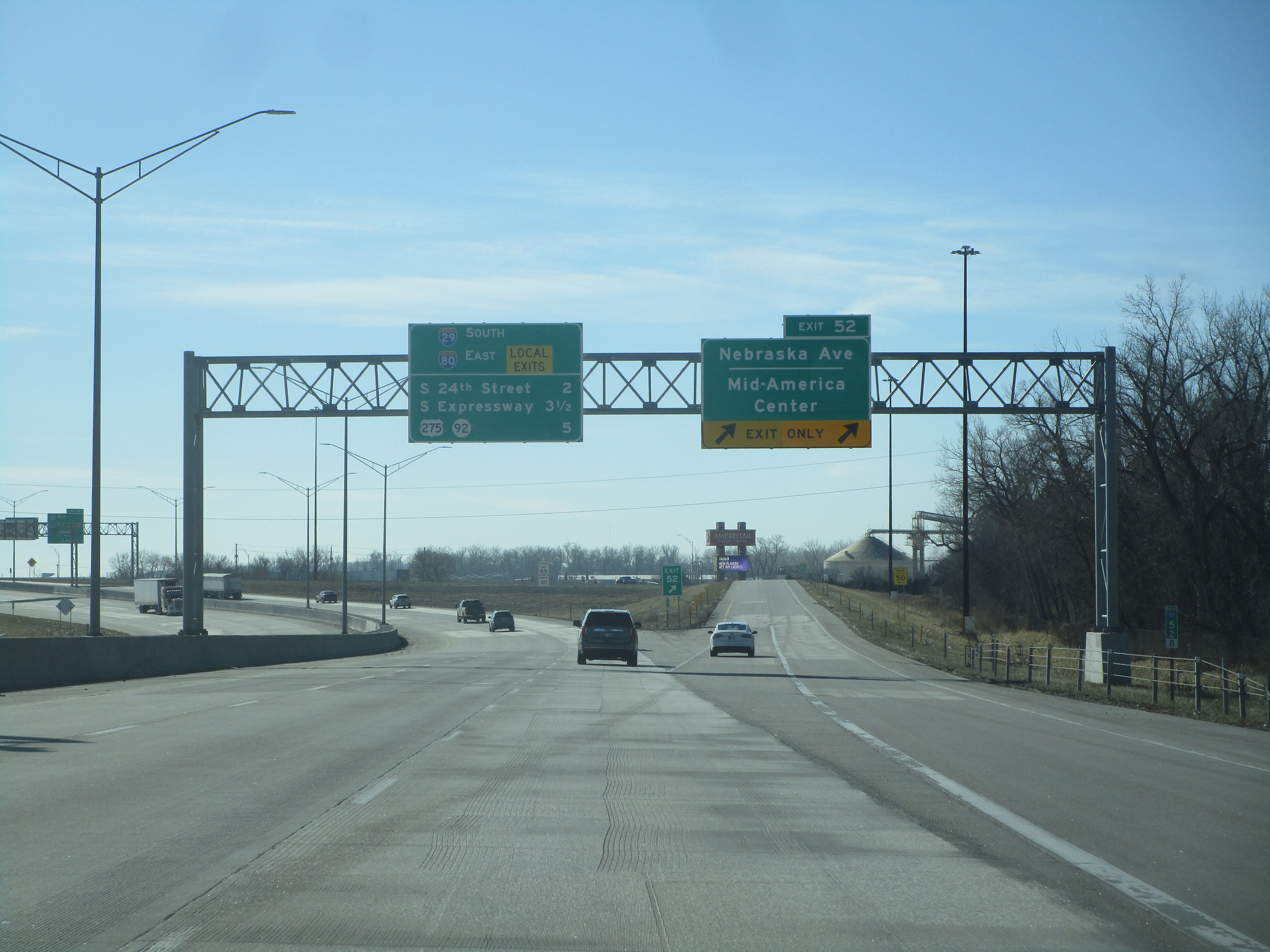
Exit 52 connects to Nebraska Avenue and the Mid-America Center:
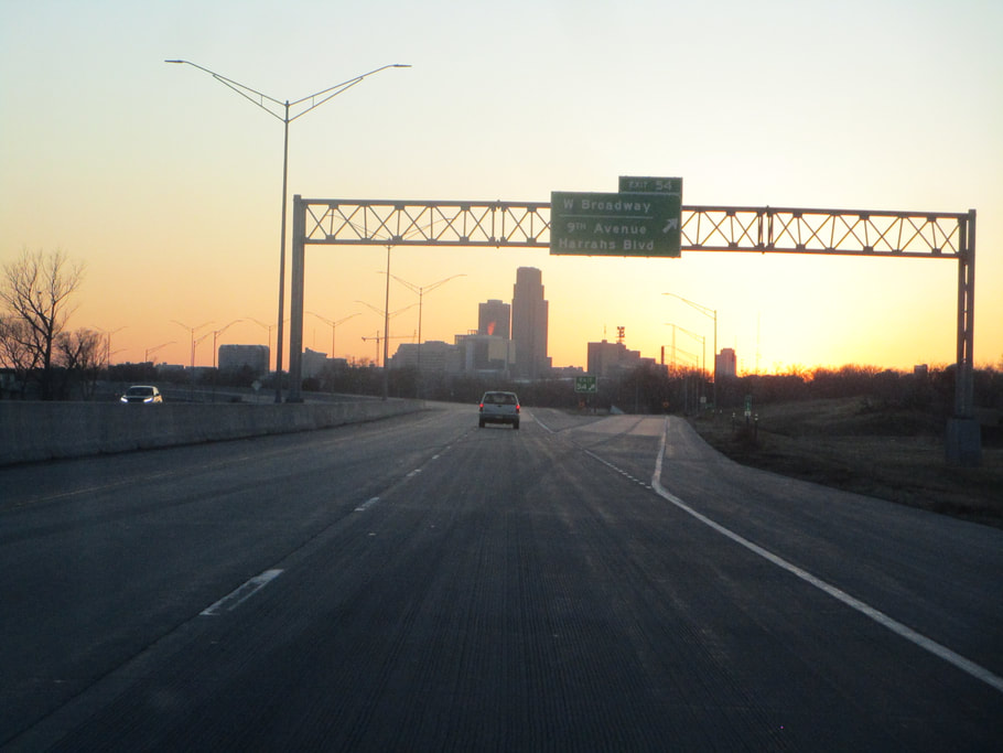
Exit 53A leads to 9th Avenue and Harrahs Blvd.; West Broadway is accessible via the other streets here. Southbound I-29 has no offramp here, though:
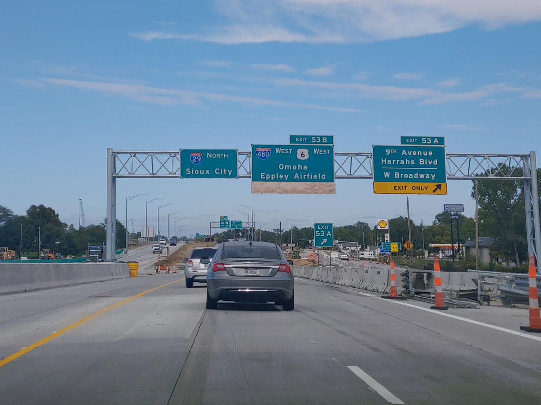
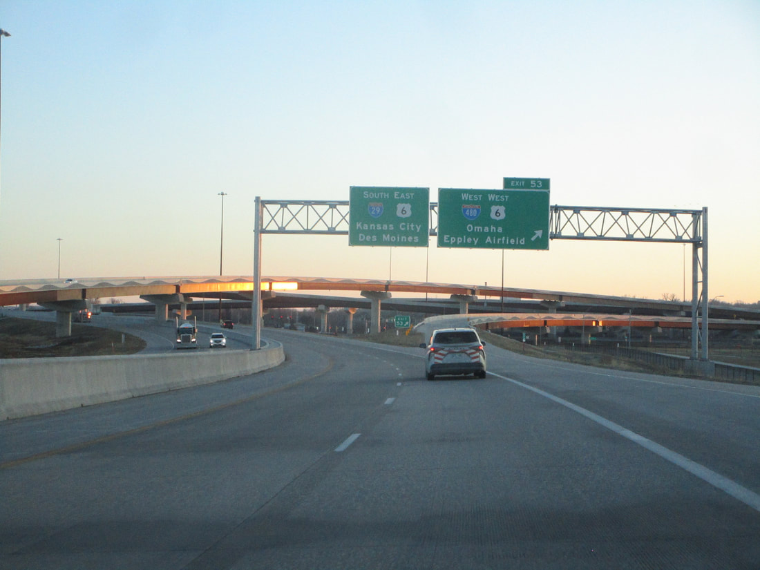
Exit 53B leads to Interstate 480 westbound, which carries US Route 6 over the Missouri River into downtown Omaha. It's used for accessing Eppley Airfield, too. For southbound, this exit is just labeled as "Exit 53":
Exit 54 leads to West Broadway in Council Bluffs. For those going northbound who couldn't use the offramp at Exit 53A to 9th Avenue and Harrahs Blvd., this is signed as the way to get those tangentially:
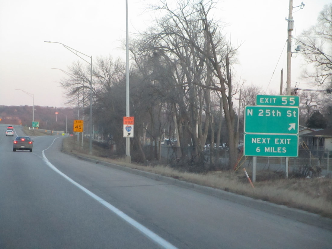
Exit 55 links with N. 25th Street:
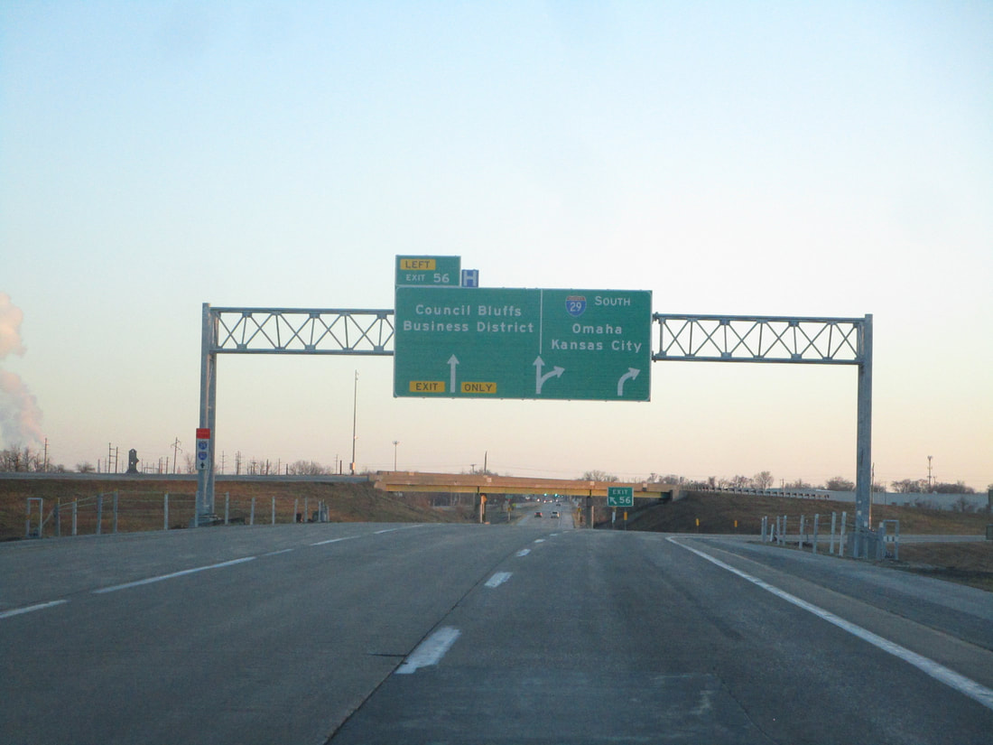
Exit 56 is an exit to-from the north on Interstate 29 only, and it leads to the Council Bluffs Business District:
Exit 61A is the first ramp of a cloverleaf interchange involving Interstate 680 and County Highway G37; this first ramp leads to County Highway G37 toward Crescent, Iowa:
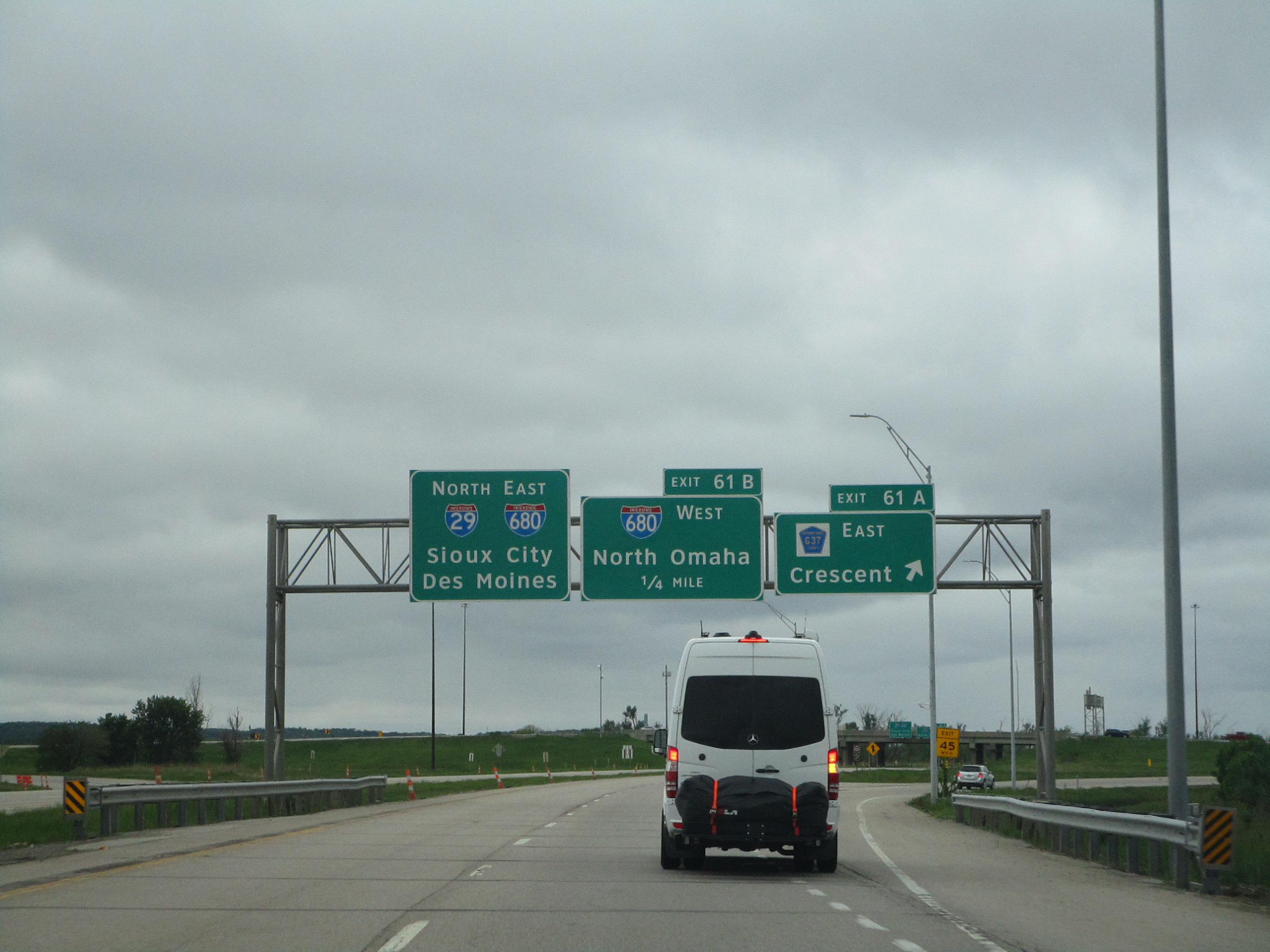
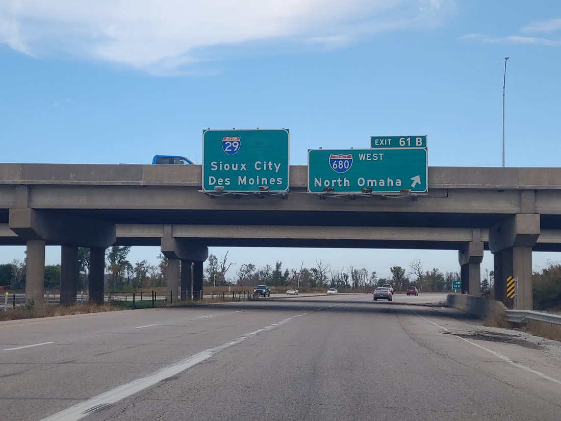
Exit 61B is the second ramp of the cloverleaf, taking people to Interstate 680 westbound, into Nebraska, namely the North Omaha area:
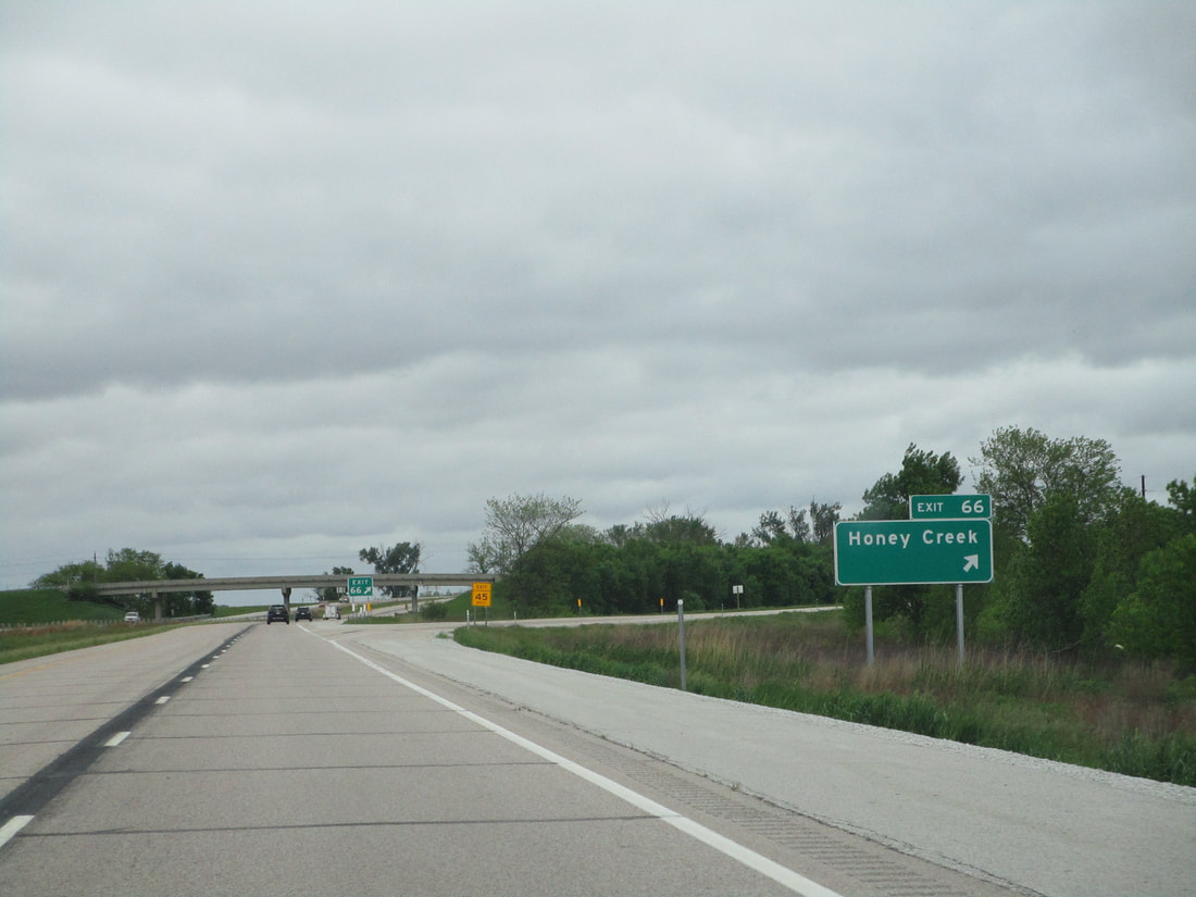
Exit 66 connects with Honey Creek:
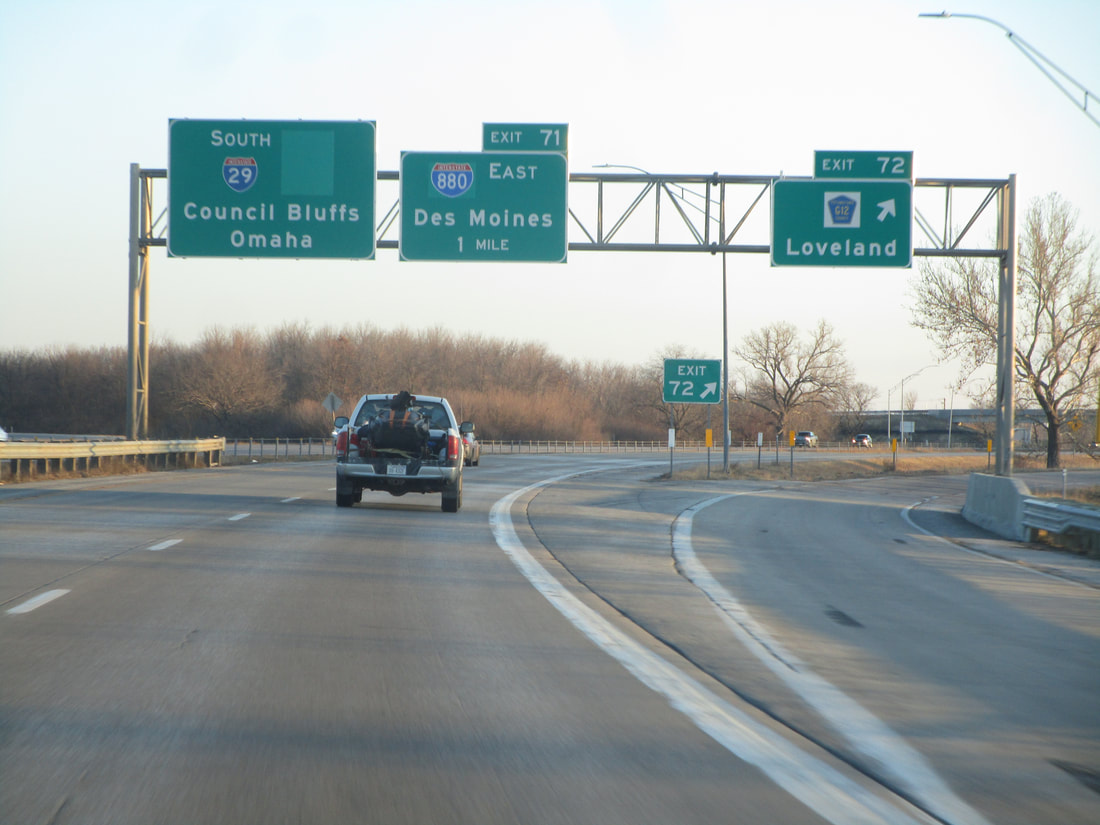
Exit 71 is a trumpet interchange with the western end of Interstate 880, signed as a pathway to Des Moines:
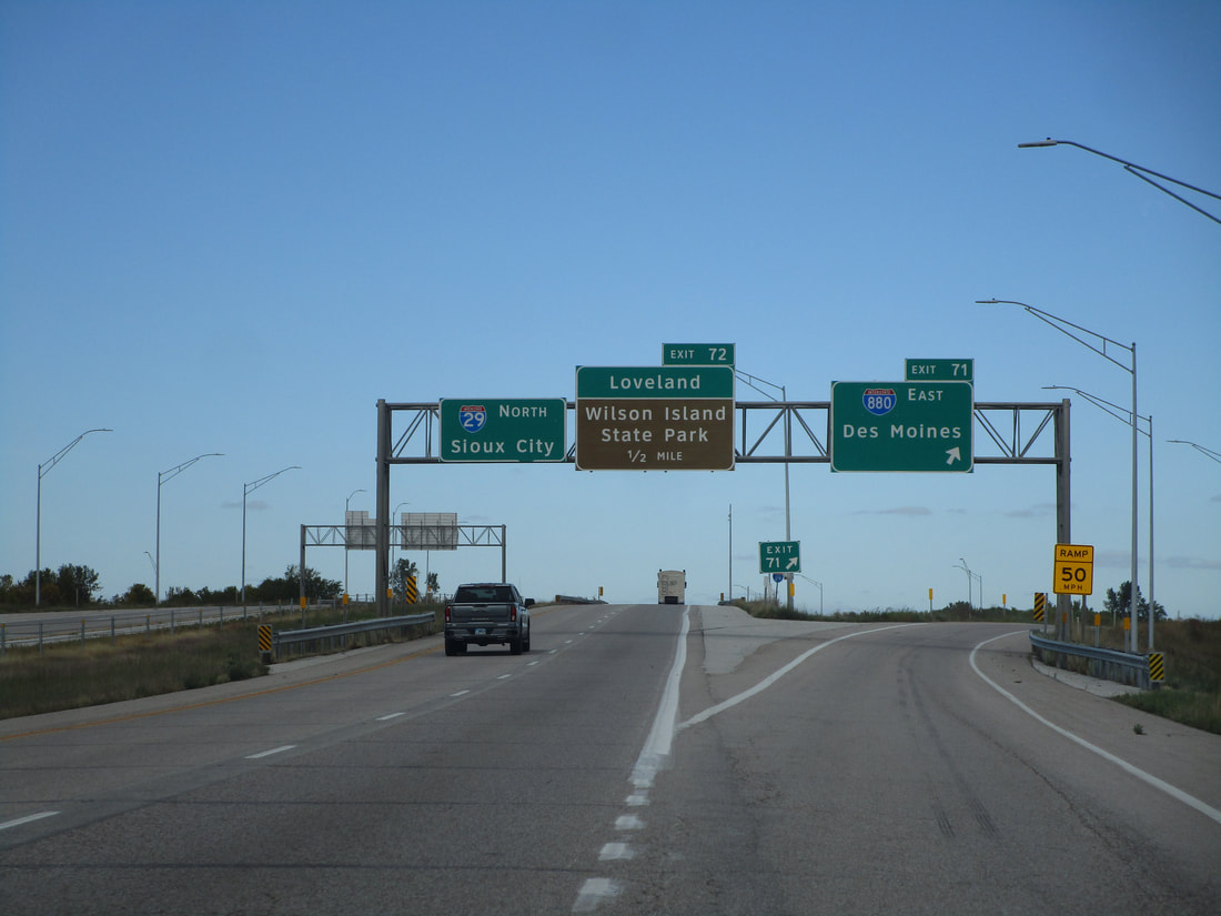
Exit 72 is for County Highway G12 and the town of Loveland:
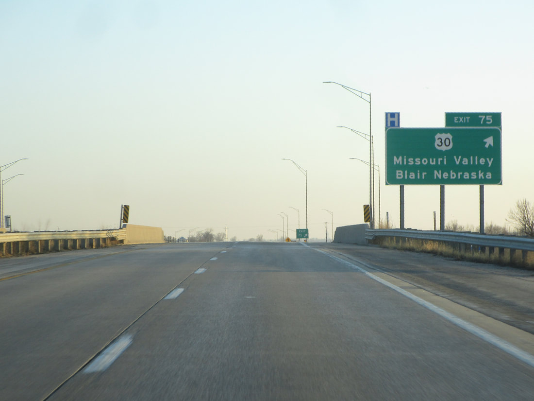
Exit 75 links to US Route 30, a highway branching out to Missouri Valley, Iowa, and Blair, Nebraska:
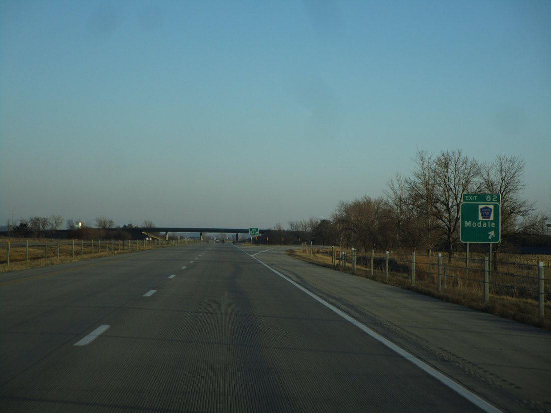
Exit 82 is for County Highway F50 and Modale:
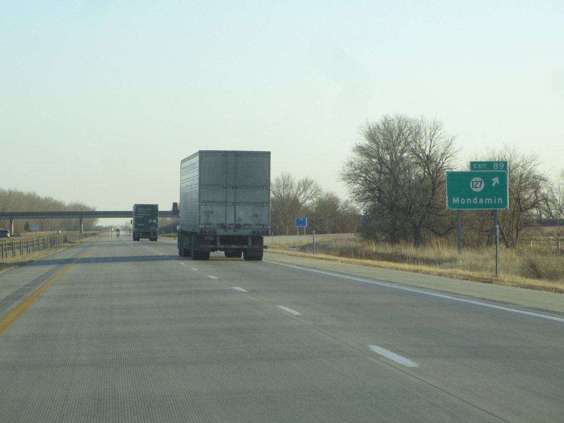
Exit 89 provides access to the western end of Iowa Highway 127 and to the village of Mondamin:
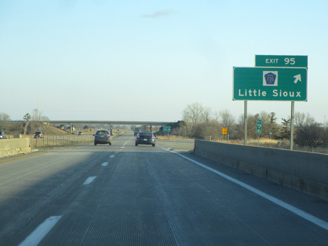
Exit 95 is an exit to Little Sioux and County Highway F20:
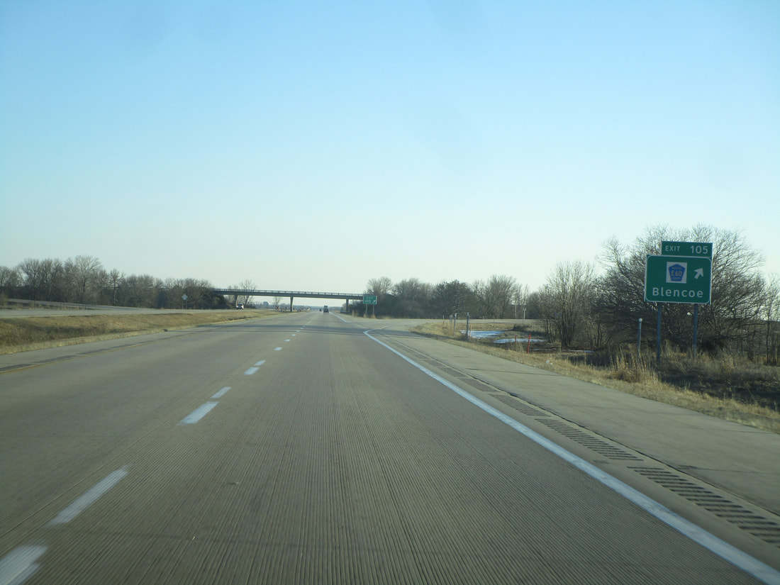
Exit 105 connects drivers to County Highway E60 and Glencoe:
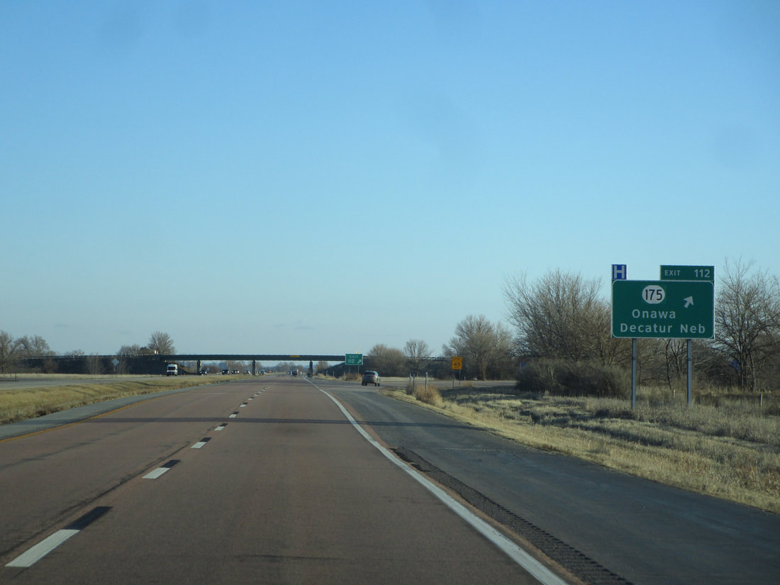
Exit 112 leads to Iowa Route 175, which stems eastward to Onawa, and which crosses a bridge to Decatur, Nebraska:
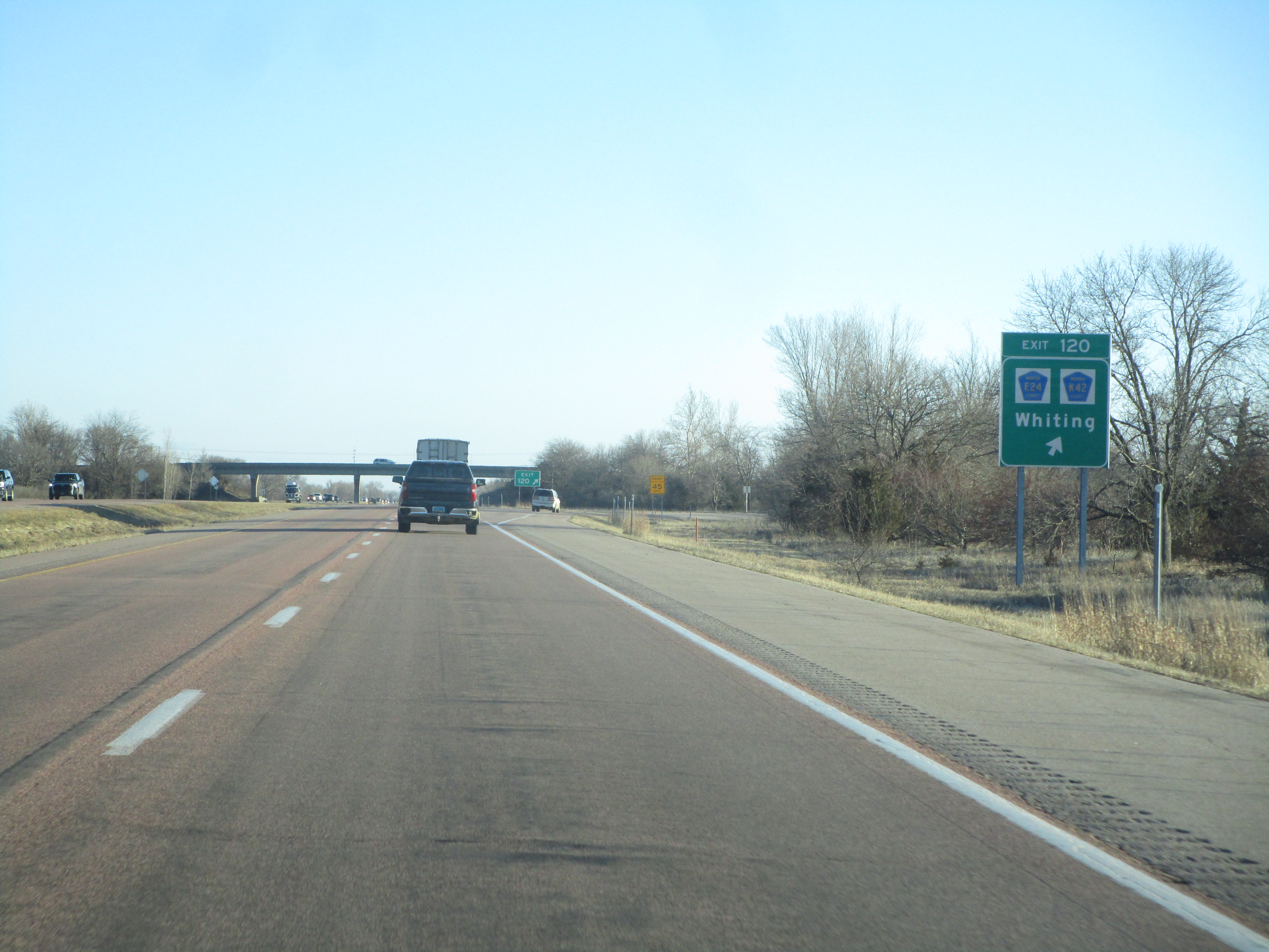
Exit 120 connects to Whiting, County Highway E24 and County Highway K42:
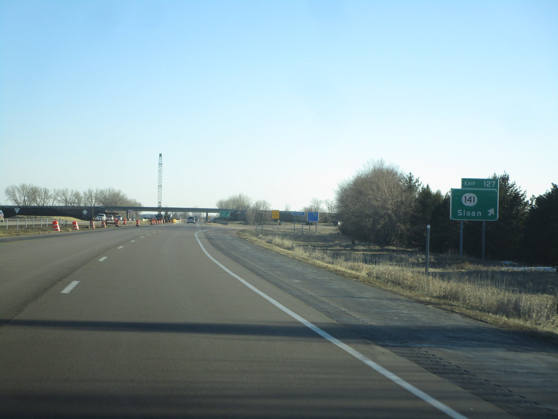
Exit 127 provides access to Iowa Route 141 and the village of Sloan:
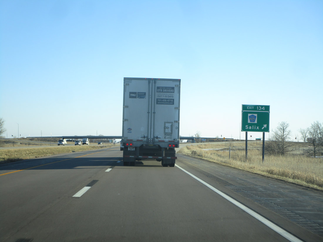
Exit 134 is the exit for County Highway K25 and Salix:
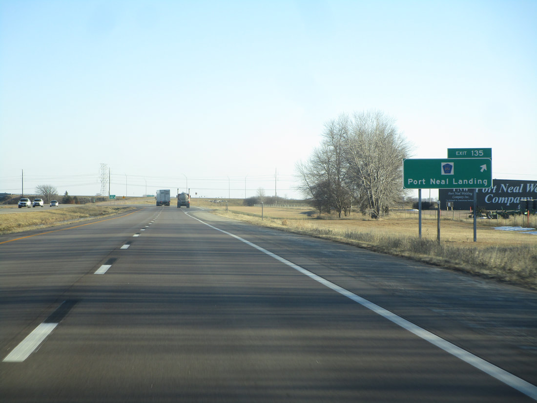
Exit 135 leads to County Highway D51 and Port Neal Landing:
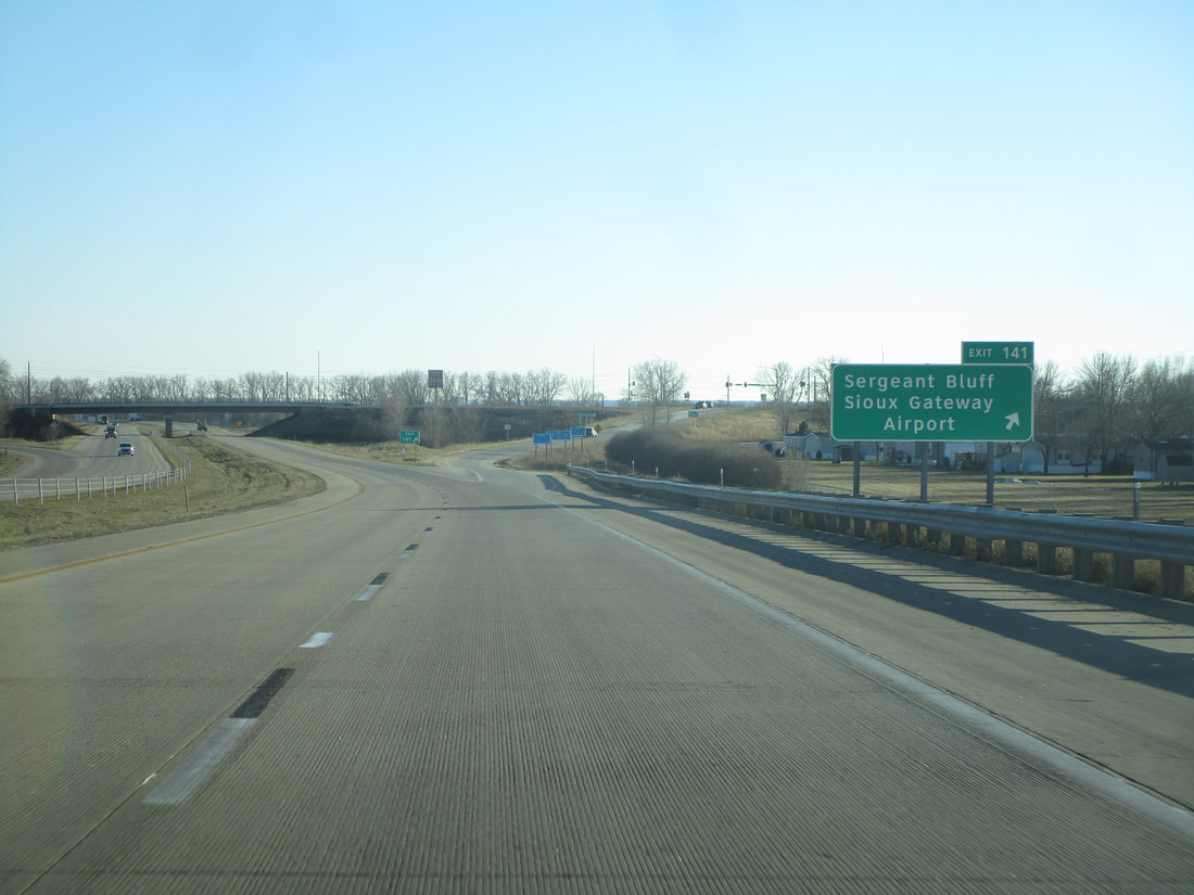
Exit 141 is signed as the way to Sergeant Bluff and the Sioux Gateway Airport:
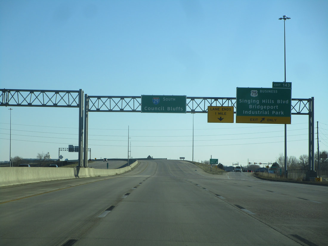
Exit 143 connects with the south end of Business US Route 75, or Singing Hills Boulevard; the sign mentions that this exit is the way to Bridgeport Industrial Park:
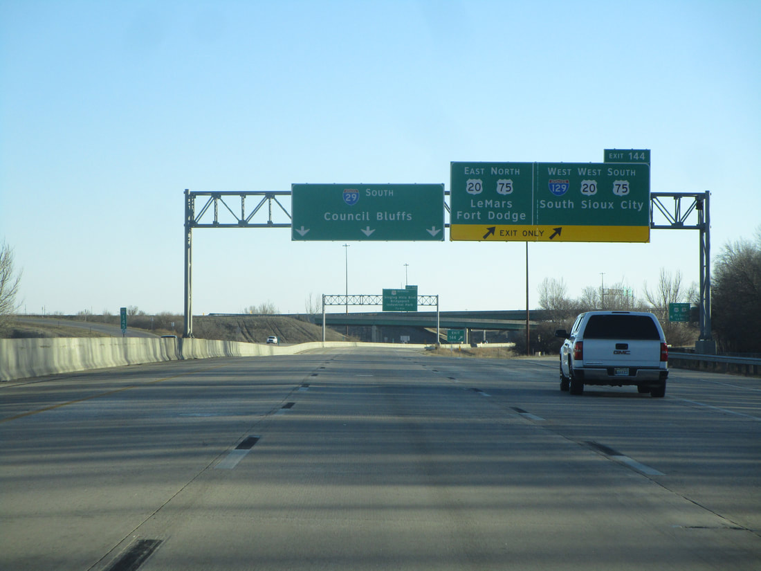
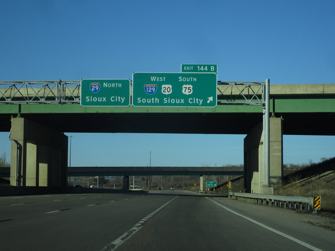
Exit 144A is the first half of an interchange involving US Route 20 and US Route 75, which run concurrently with one another. This first ramp leads to US Route 75 northbound toward Le Mars and US Route 20 eastbound toward Fort Dodge:
Exit 147A is the first exit in the heart of Sioux City, and it leads to Floyd Blvd. and Virginia Street. This exit is labeled simply as 147 for southbound vehicles:
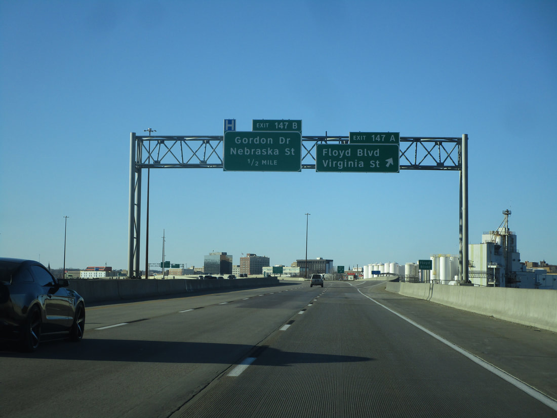
Exit 147B connects with Gordon Drive and Nebraska Street:
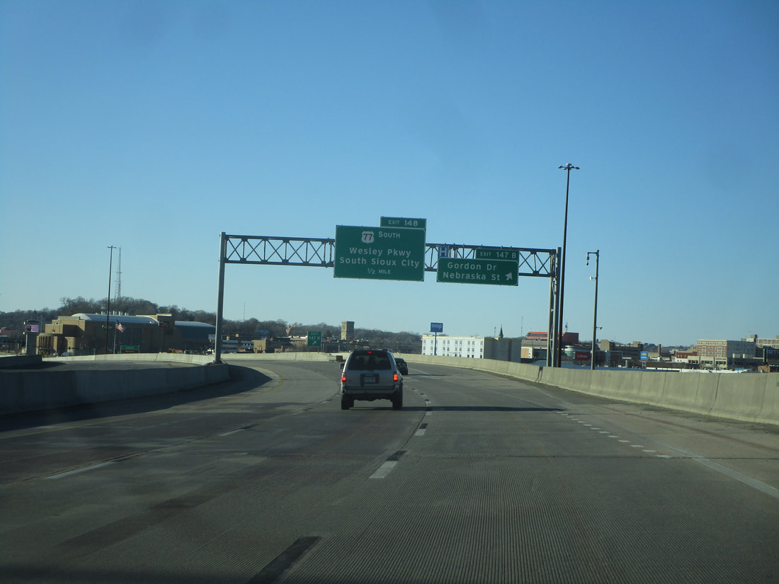
Exit 148, for northbound I-29, reaches the tiny fragment of US Route 77 that exists within the state of Iowa, at its northern end. This ramp is signed as the way to reach Wesley Parkway and South Sioux City, Nebraska:
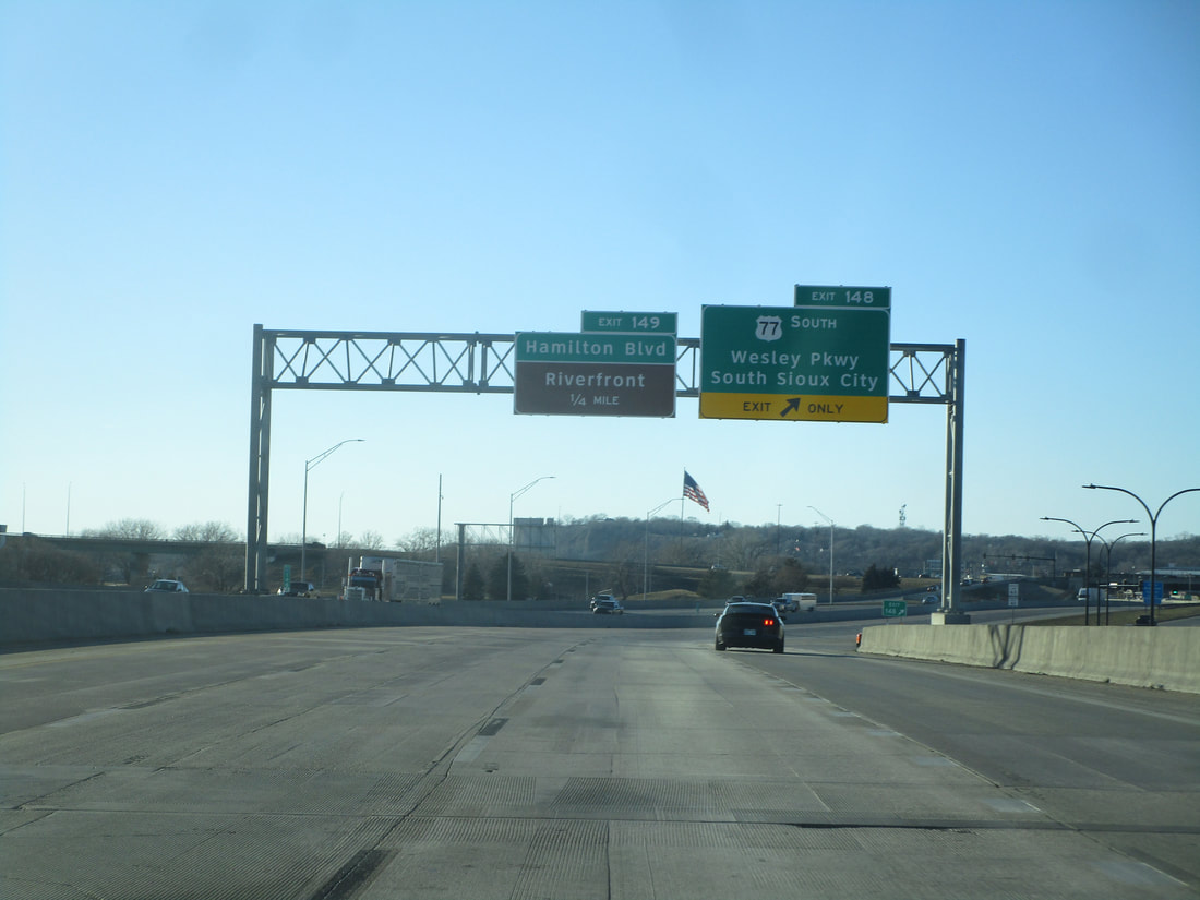
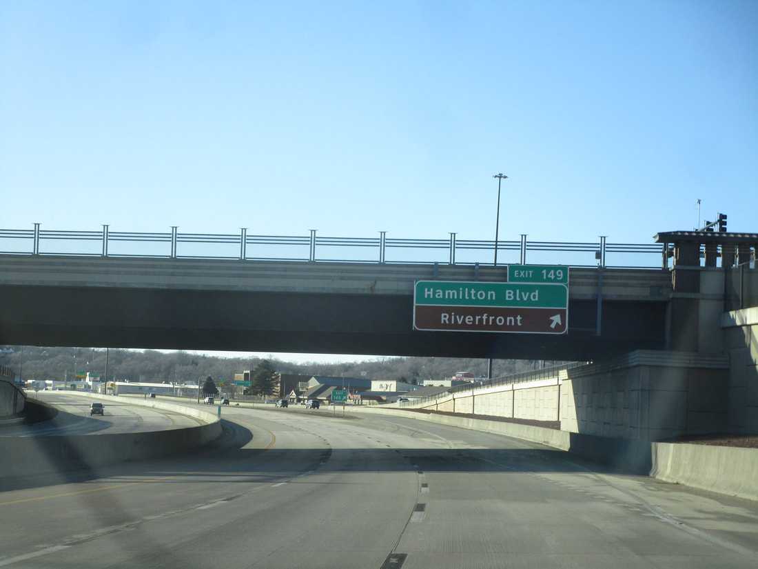
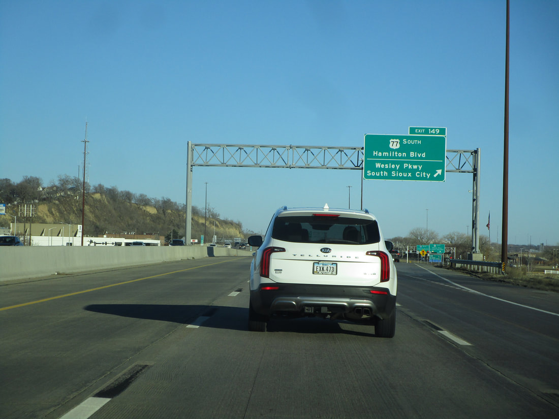
Exit 149 connects with Hamilton Boulevard and the Riverfront. For southbound, this is the ramp that leads to an access road needed to reach US Route 77:
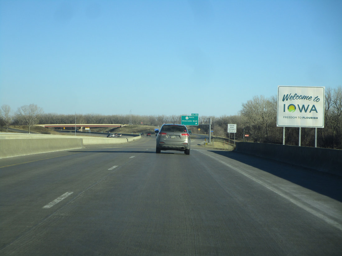
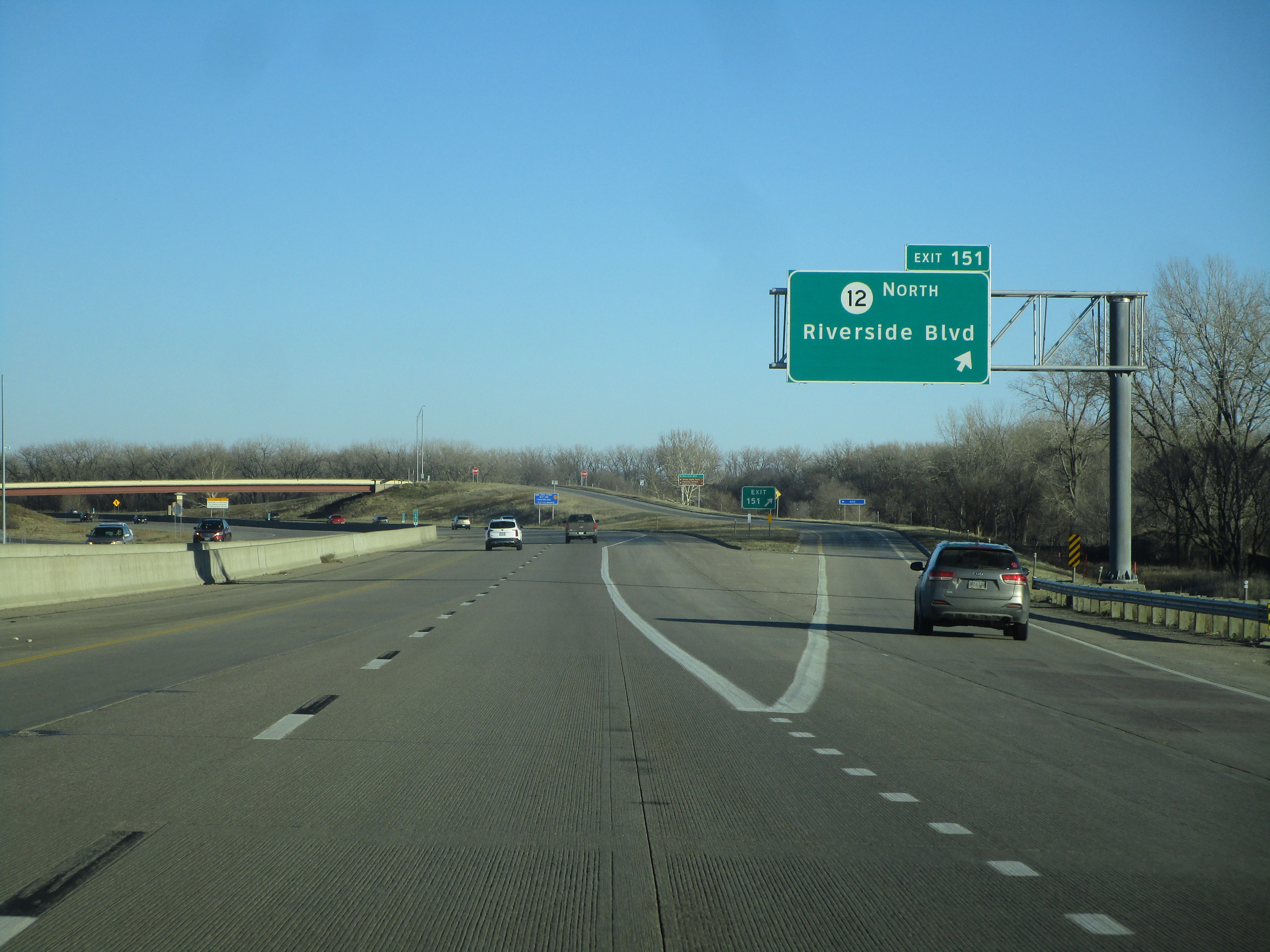
Exit 151 is for the south end of Iowa Route 12, known as Riverside Boulevard:
Interstate 29 leaves Iowa by crossing into the southeast corner of South Dakota. In the opposite direction, Interstate 29 crosses out of South Dakota's southeast corner into Iowa, by way of a bridge over the lowest stretch of the Big Sioux River.