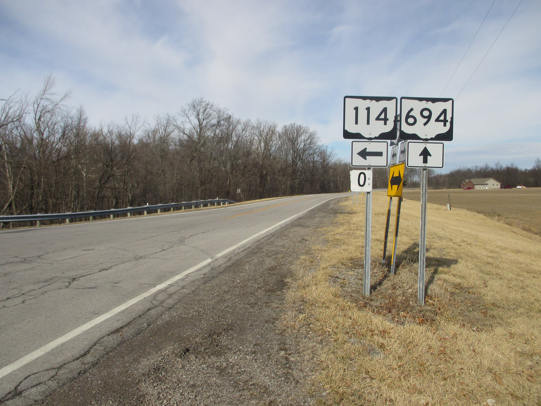
Ohio State Route 694 is a short east-west route in Putnam County, in northwestern Ohio. The route connects Cloverdale in the west to Glandorf and Ottawa in the east. Starting in the west, Ohio Route 694 gets going at a junction with Ohio Route 114, just east of the north-south Ohio Route 634. Ohio Route 694 begins at the east-west Ohio Route 114 whose easterly course bends southeast toward Kalida. Ohio Route 694 goes straight east to pass north of Kalida, so it can reach the town of Glandorf. In Glandorf, Ohio Route 694 bends southerly for its final stretch, so it can end on the western edge of Ottawa, Ohio, at US Route 224.
My photo for Ohio Route 694 comes from its western end at Ohio Route 114, on the east edge of Cloverdale. The photo looks north at an intersection on the east side of the Auglaize River, which is crossed by Ohio Route 114 just to the left (west). Ohio Routes 694 and 114 converge so that the traffic from both roads can use this same bridge, but of course, the Ohio Route 694 designation doesn't continue any farther west beyond this junction. So, in this photo. Ohio Route 114 comes from the background and leaves toward the left. Ohio Route 694 comes from the east to curl northward and end here. The signs in the photo explain this. This photo was taken on Leap Day 2016, on the way northwest from Columbus toward home.
Back to Ohio Routes 600-699.
Back to the Ohio main page.
Back to the home page.
Back to Ohio Routes 600-699.
Back to the Ohio main page.
Back to the home page.

