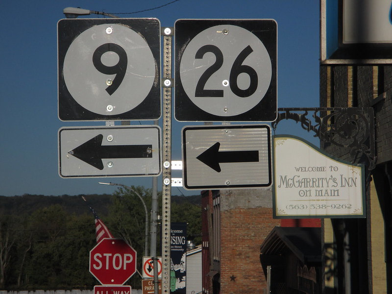
Iowa Route 26 is a short north-south highway in the far northeast corner of Iowa. The highway follows the western bank of the Mississippi River north out of Lansing, the town home to Iowa's northernmost bridge across the great river. The northern end of Iowa Route 26 is the Minnesota border at the town of New Albin, Iowa, where the roadway continues north along the Mississippi River as Minnesota Route 26. The southern end of Iowa Route 26 rests at Iowa Route 9, at the western approach to the bridge over the Mississippi River. That bridge connects Iowa Route 9 and Wisconsin Highway 82. Iowa Route 26 is only about eleven miles long, winding through the Driftless Region immediately adjacent to an equally-winding set of railroad tracks.
My photo of Iowa Route 26 comes from Lansing, at a point near the southern end. As Iowa Route 9 heads east toward the Mississippi River, it has to jog north along Lansing's Second Street to reach the western approach to the bridge to Wisconsin. That northward job lasts for three blocks, and as travelers on eastbound Iowa Route 9 are about to turn north onto it, they see the sign assembly depicted. An Iowa Route 26 sign is included to show that turning left is required not only to stay on Iowa Route 9, but to access Iowa Route 26 as well. This photo was taken in early October 2016, on a little westward detour from a trip around southwestern Wisconsin.
Back to the Iowa main page.
Back to the home page.
Back to the Iowa main page.
Back to the home page.

