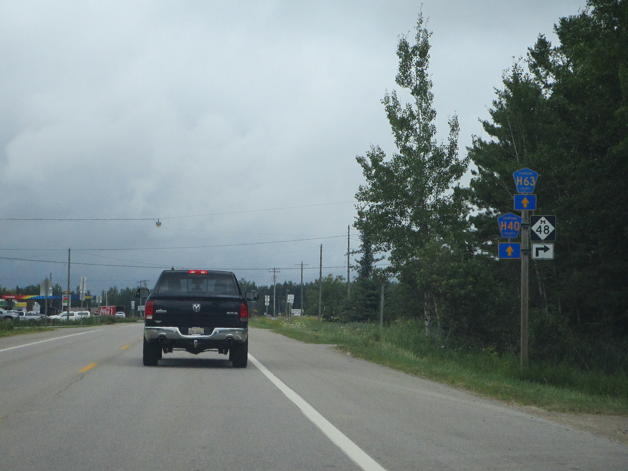
Michigan Highway 48 is a lightly-traveled highway in the eastern Upper Peninsula. It's signed as east-west, running from Rudyard toward De Tour. Rudyard is home to the interchange with Interstate 75 that serves as the western terminus, though traffic reaching this terminus will face east. Michigan Highway 48 starts out heading slightly backwards into Rudyard; it initially juts westward to make southern turn onto the Mackinac Trail, a surface road that closely parallels Interstate 75. A couple miles to the south, Michigan Highway 48 gets its real start turning toward the east. Michigan Highway 48 joins Michigan Highway 129 south through Pickford, and then it splits away to head easterly again. It zigzags a couple times eastward and southward, before reaching its final southward stretch. That final stretch ends at Michigan Highway 134 on the northern shore of Lake Huron; this is several miles west of De Tour Village, the town at the southeastern corner of the Upper Peninsula.
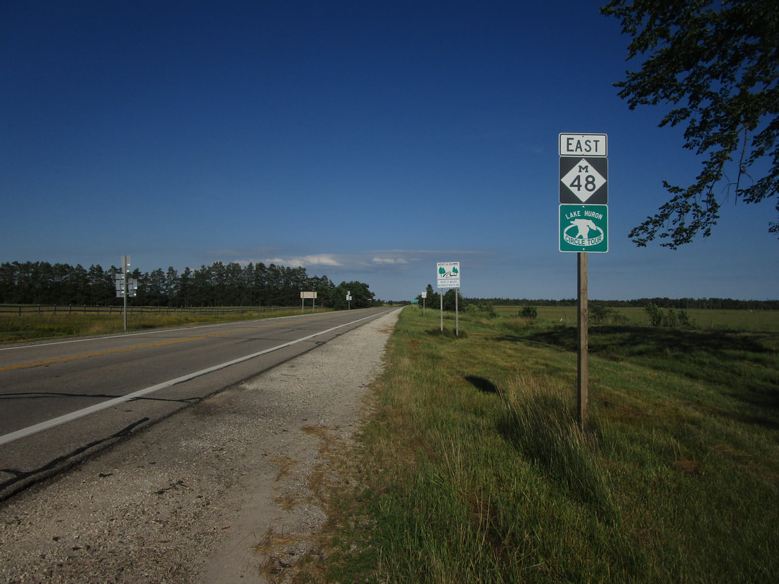
My photo of Michigan Highway 48 comes from the southern junction with Michigan Highway 129, at the southern end of the concurrency shared by the two routes. This is just south of Pickford. The sign shown is a reassurance marker for traffic seeking to continue on Michigan Highway 48, east of Michigan Highway 129. This photo was taken at the start of August 2022, as I was touring around northern Michigan.
Here are some more photos of Michigan Highway 48, since I've driven the entire length of it:
Here are some more photos of Michigan Highway 48, since I've driven the entire length of it:
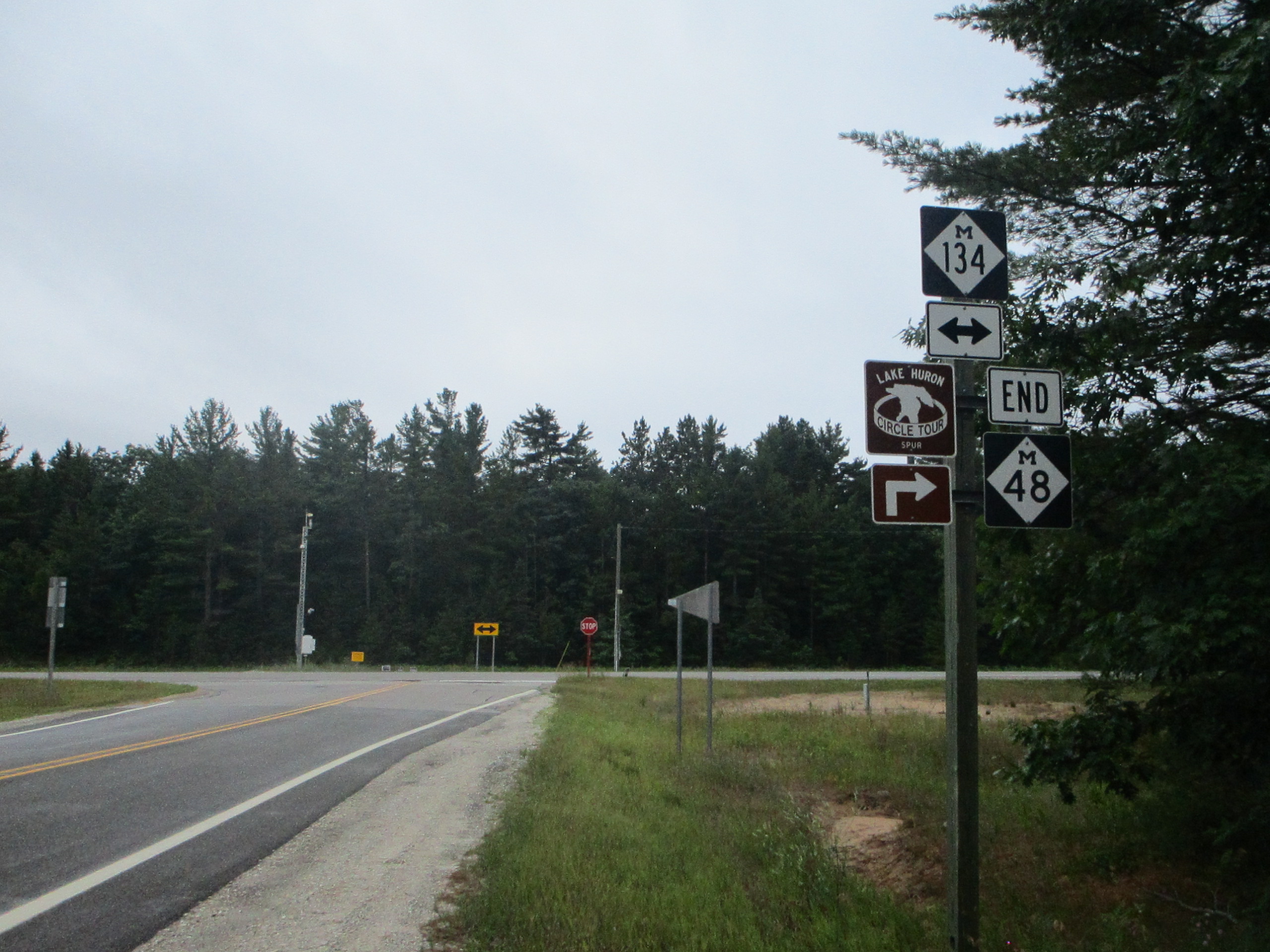
The southeastern end of Michigan 48, at Michigan 134. This point is west of De Tour, but east of Cedarville, along the northern shores of Lake Huron.

The T-intersection that could be the western end of Michigan 48, had Interstate 75 never been built. From here, M-48 turns from west to north, and then it turns back east onto a short stub later on.
Michigan Highway 48 approaching its western end, which is actually a bend from north to east toward the penultimate interchange with Interstate 75.
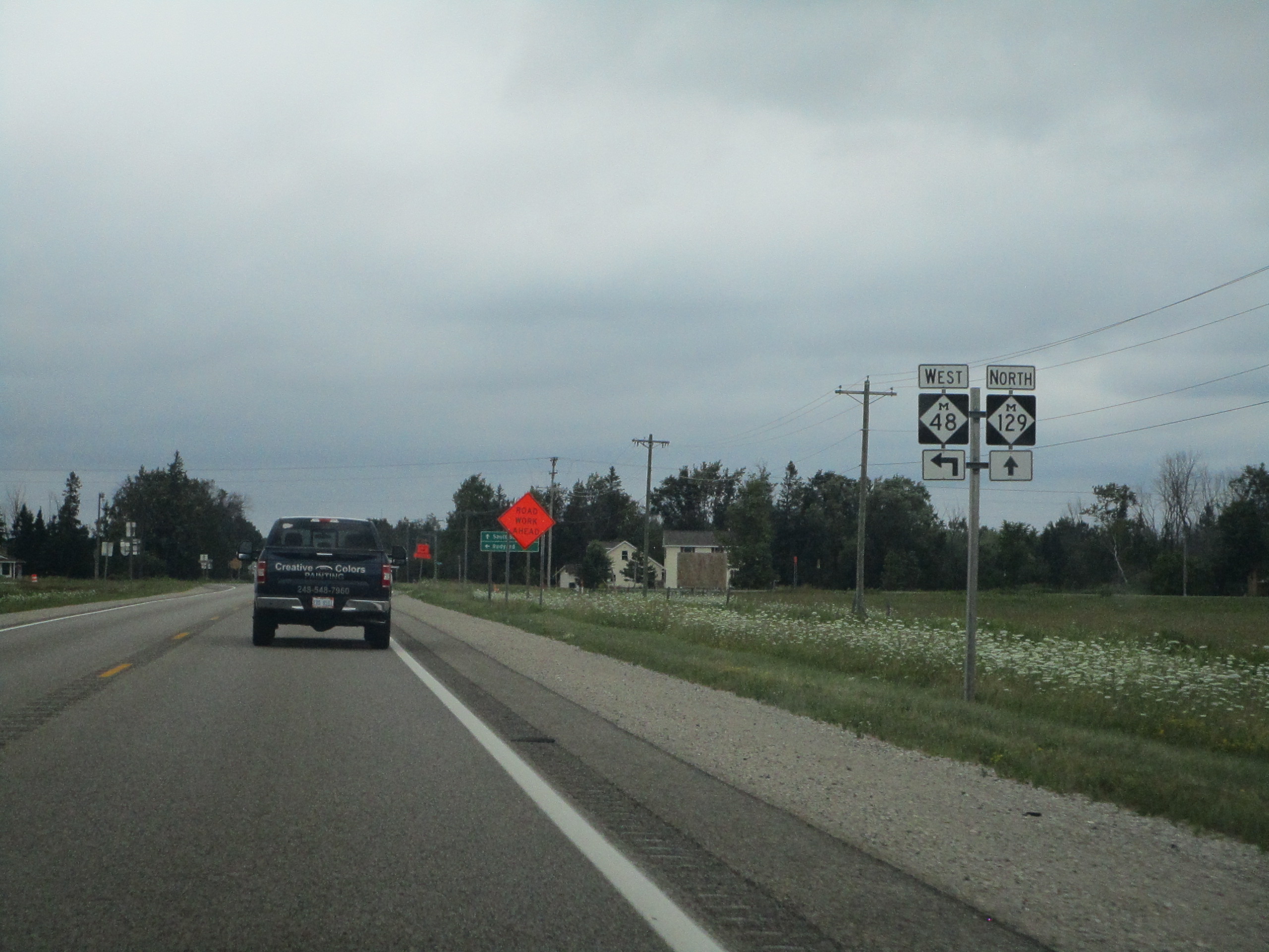
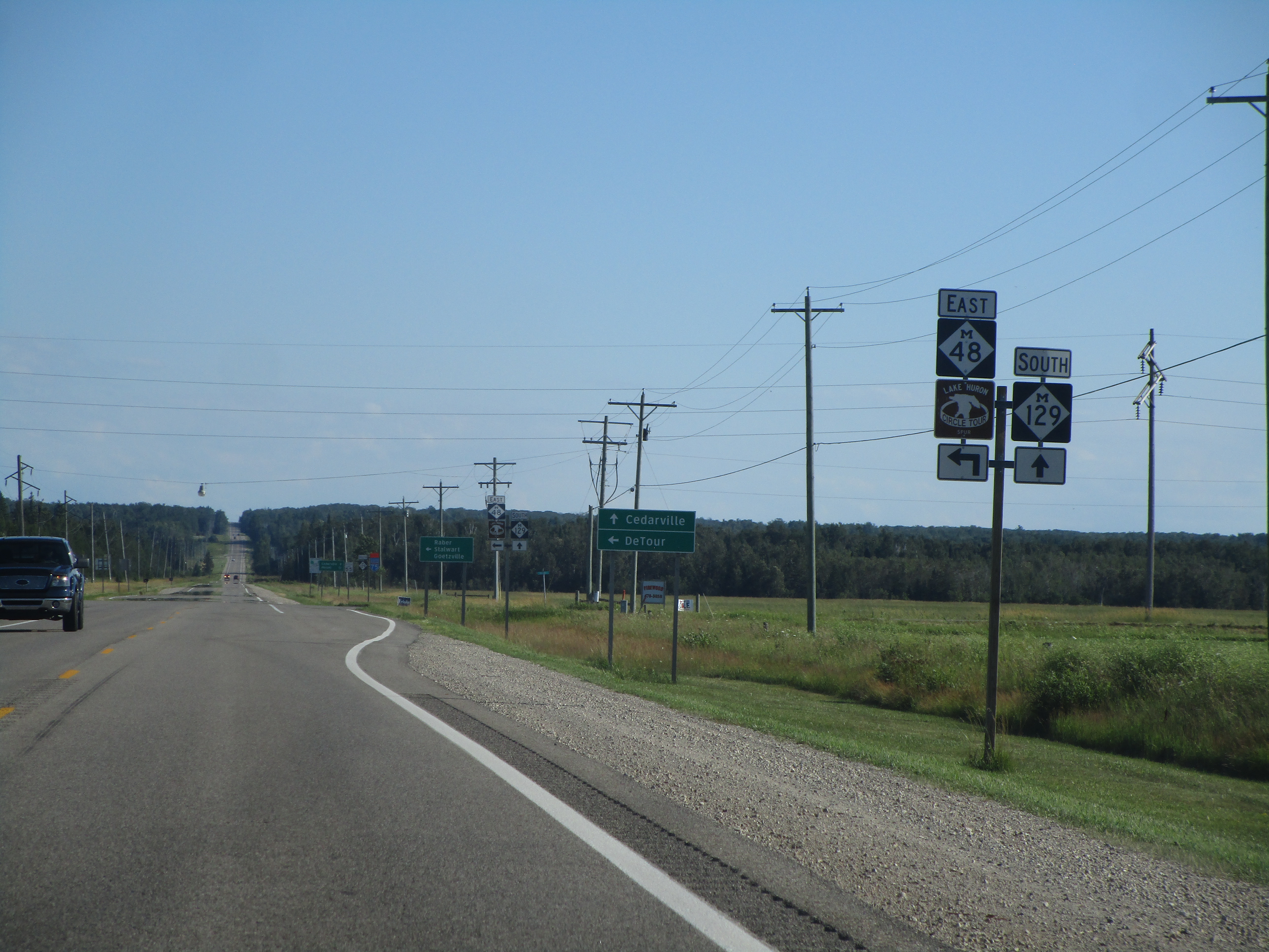
The northern split of Michigan Highways 48 and 129, looking north.
The southern split of Michigan Highways 48 and 129.
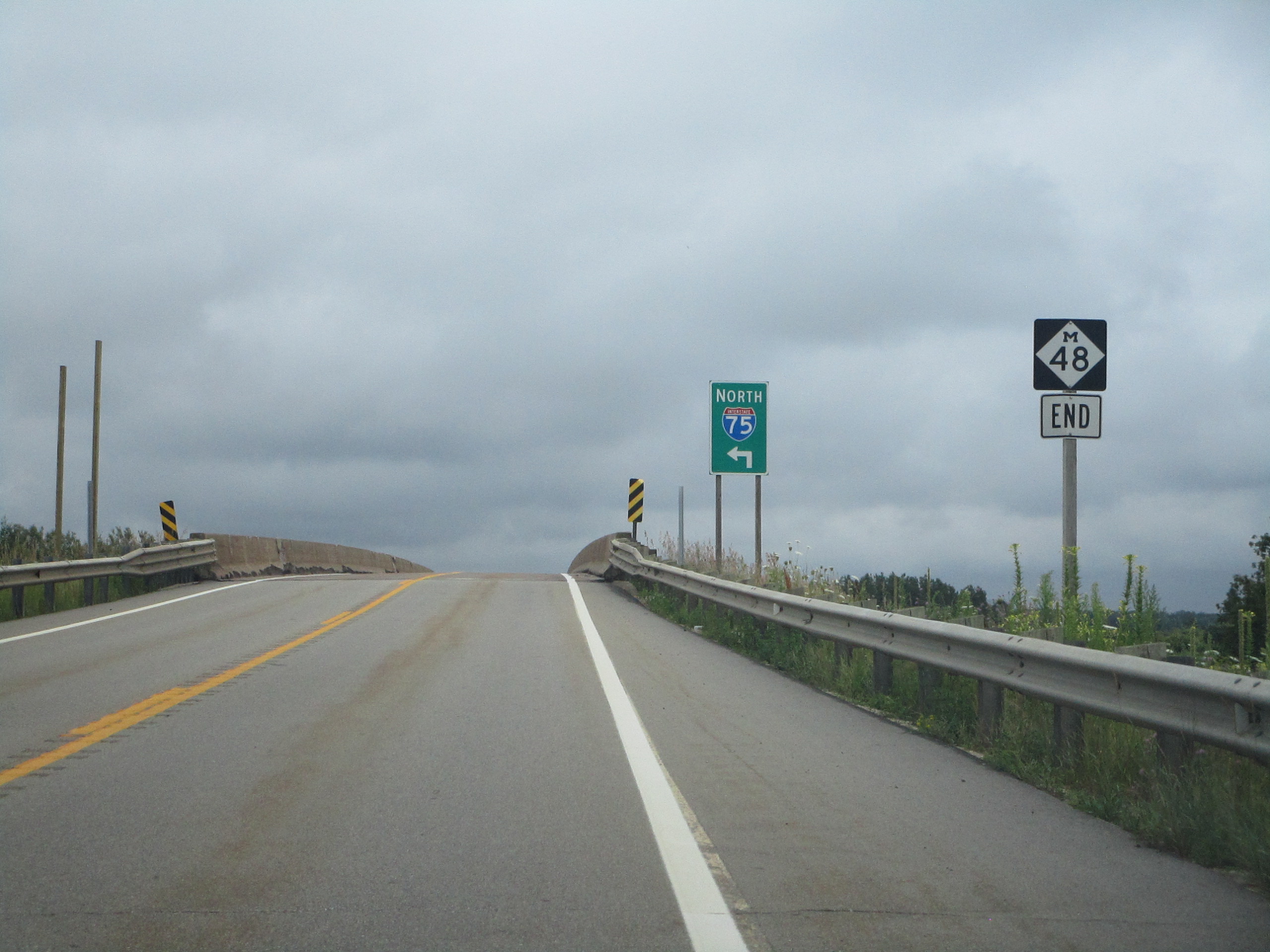
Michigan 48's western end is actually a short stub stemming to the east from County H63, the alignment of old US highway supplanted by Interstate 75. This convoluted western end was devised so M-48 could weasel its way to an interchange with Interstate 75. Oddly, the aperture is looking east at this western end marker.
