US Route 601States traversed: North and South Carolina
|

|
US Route 601 runs north-south across central portions of North Carolina and central portions of South Carolina. The northern end is near the northern border of North Carolina, at US Route 52 in Mount Airy; the southern end is near the southern tip of South Carolina, at US Route 321. In North Carolina, US Route 601 runs almost due north-south, serving as the next major longitudinal corridor east of Interstate 77 (and US Route 21). For that reason, it passes around the east side of Charlotte, entering South Carolina. It cuts through Camden and Orangeburg in South Carolina. Ultimately, US Route 601 ends at US Route 321, at a point west of Ridgeland and north of Hardeeville.
The featured photo for US Route 601 is coming up next, but an older photo once stood here as the featured photo for the route. That older photo is still available for viewing at the bottom of this page.
The featured photo for US Route 601 is coming up next, but an older photo once stood here as the featured photo for the route. That older photo is still available for viewing at the bottom of this page.

My photo of US Route 601 shows the northern end of US Route 601 at US Route 52 in Mount Airy, North Carolina. Travelers moving northward on US Route 601 will encounter this sign assembly when they reach the bypass alignment of US Route 52 around Mount Airy. This photo was taken on the way south to Florence and Myrtle Beach along US Route 52 in June, 2024.
Another photo for US Route 601 once held the title of this page's featured photo. That photo is shown below as an added bonus.
Another photo for US Route 601 once held the title of this page's featured photo. That photo is shown below as an added bonus.
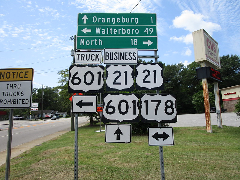
The former featured photo of US Route 601 comes from Orangeburg, South Carolina. The sign assembly depicted faces north at the southeast corner of the intersection, and downtown Orangeburg lies just to the south, or just into the photo's background. US Route 601 penetrates into the downtown area, whereas US Route 21 and US Route 178 run east-west bypassing downtown just to the north (save for US Route 21's business route). This photo was taken in July 2019, as part of the day I spent detouring around South Carolina.
Back to the nationwide main page.
Back to the home page.
Back to the nationwide main page.
Back to the home page.
