US Route 75States traversed: Minnesota, Iowa, Nebraska, Kansas, Oklahoma, and Texas
|
|
US Route 75 runs from Dallas, Texas, north to he Canadian border in the northwest corner of Minnesota. The northern end is a closed border crossing at Noyes, Minnesota, and it's closed because it's just across the river from the border crossing used by Interstate 29 in Pembina, North Dakota. From this northern end, US Route 75 heads south along Minnesota's entire western border, penetrating into northwestern Iowa up until Sioux City. At Sioux City, US Route 75 crosses into Nebraska, to follow along that states' eastern border; it forms the main north-south freeway passing through Omaha's city limits (Interstate 29 lies just to the east in Iowa, technically). US Route 75 continues south through eastern Kansas and eastern Oklahoma, passing through Topeka and Tulsa. In McAlester, Oklahoma, US Route 75 deflects southwest to end as a freeway in Dallas, Texas. The southern extent of the US Route 75 freeway becomes the northern extent of Interstate 45 in Dallas, at an interchange with Interstate 30.
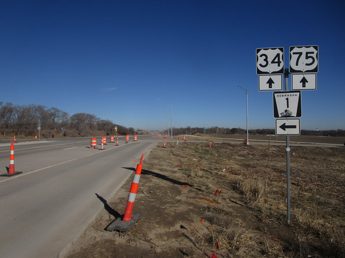
My photo for US Route 75 comes from its junction with Nebraska Highway 1 near the small town of Murray, Nebraska. This junction is about 20 miles south of Omaha, in eastern Nebraska. Note that US Route 34 is present here, as its eastward course is interrupted by a northward jog along US Route 75 to a bridge out of Plattsmouth, Nebraska. The guide assembly points out that Nebraska Highway 1 is reachable by a left turn from the drivers' northward orientation, and that US Route 34 keeps going north along US Route 75. This photo was taken during a trip around Iowa to clinch the mainline Interstates in that state (I had gotten done with Interstate 29 southbound, and was tracking north to clinch Interstate 80 across Iowa).
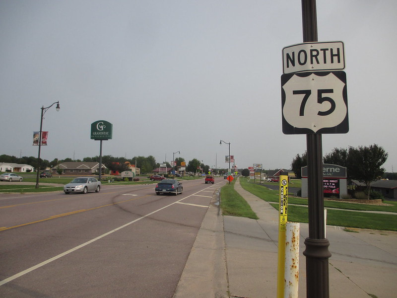
I had featured another photo of US Route 75 on this page previously. That photo, from Luverne, Minnesota, is shown below. It shows a northbound trailblazer seen by those leaving Interstate 90 northward. It was really easy to walk from the fuel pump to this song, as I was in the process of fueling up at a gas station off to the right of the frame in August 2018.
I had featured another photo of US Route 75 on this page previously. That photo, from Luverne, Minnesota, is shown below. It shows a northbound trailblazer seen by those leaving Interstate 90 northward. It was really easy to walk from the fuel pump to this song, as I was in the process of fueling up at a gas station off to the right of the frame in August 2018.