Ohio State Route 114 is an east-west route through farmland and some very small towns in northwestern Ohio. The eastern beginning of Ohio Route 114 is in Kalida, in Putnam County. The junction where Ohio Route 114 begins is at Ohio Route 115 and US Route 224, and the route starts out going west along US Route 224. After a few blocks, Ohio Route 114 opts for a more northwesterly course, and US Route 224 continues west with a more southerly component to its direction. Soon, Ohio Route 114 straightens out to head due westerly. It passes through some very small towns like Cloverdale, Grove Hill, and Haviland. After 33 miles, Ohio Route 114 ends at the Indiana state line, a fraction of a mile north of US Route 30.
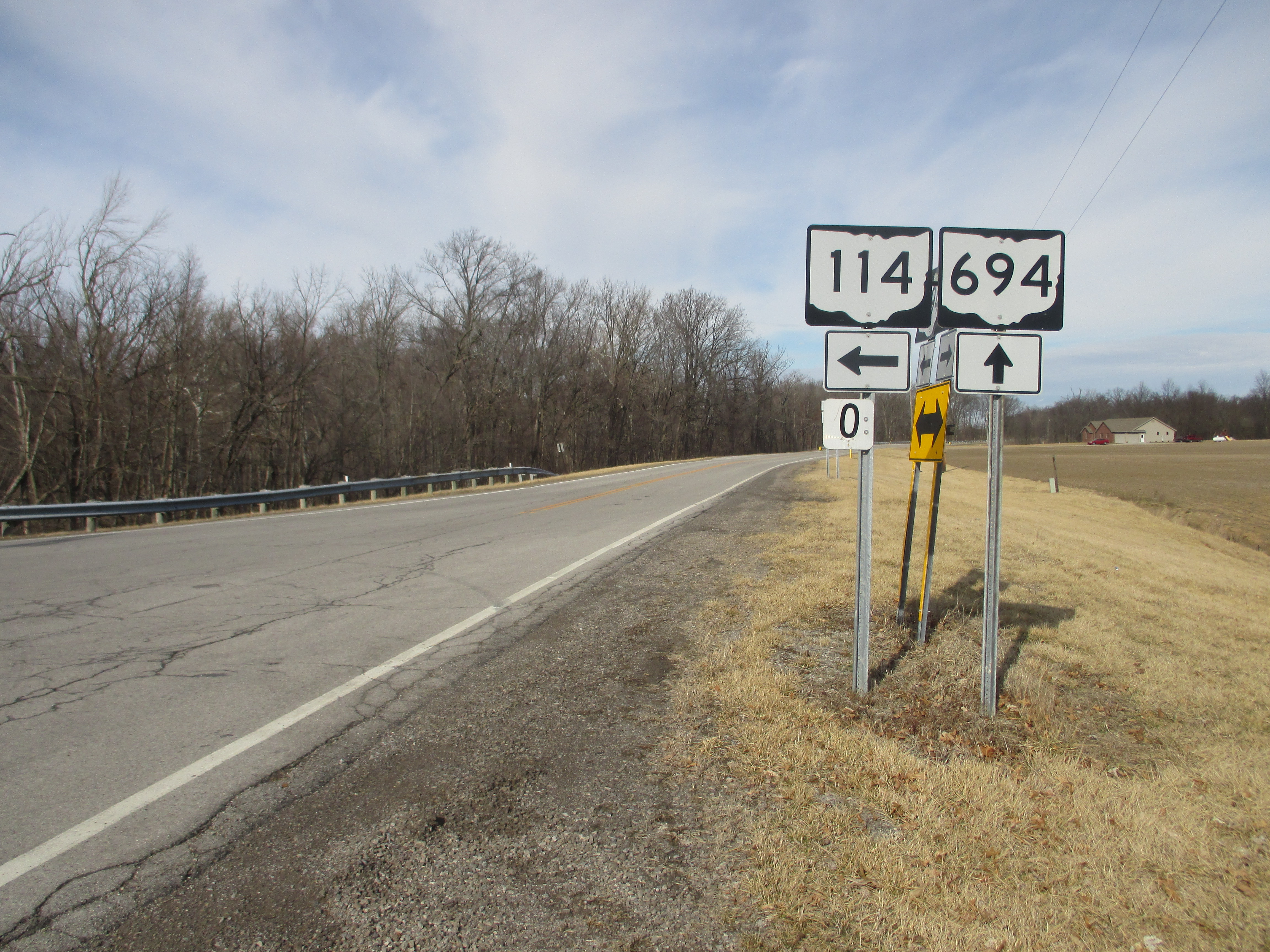
My photo of Ohio State Route 114 comes from its junction with Ohio Route 694, just barely east of Cloverdale. (The cover photo at the top of the page looks east from the Indiana state line.) The Auglaize River disturbs Ohio Route 114's westerly course, sending it on a bit of a northerly detour so it can reach a bridge over the river. At the northern end of this detour is the intersection photographed, where Ohio Route 114 turns back toward the west across the river. Ohio Route 694's traffic also seeks to cross the river here, and the two routes converge. The guide assembly in the photo describes how Ohio Route 114 turns toward the west, but continuing toward the north will put travelers on Ohio Route 694. This photo was taken on Leap Day 2016, as I was taking rural roads home from Columbus.
Back to Ohio Routes 100-199.
Back to the Ohio main page.
Back to the home page.
Back to Ohio Routes 100-199.
Back to the Ohio main page.
Back to the home page.

