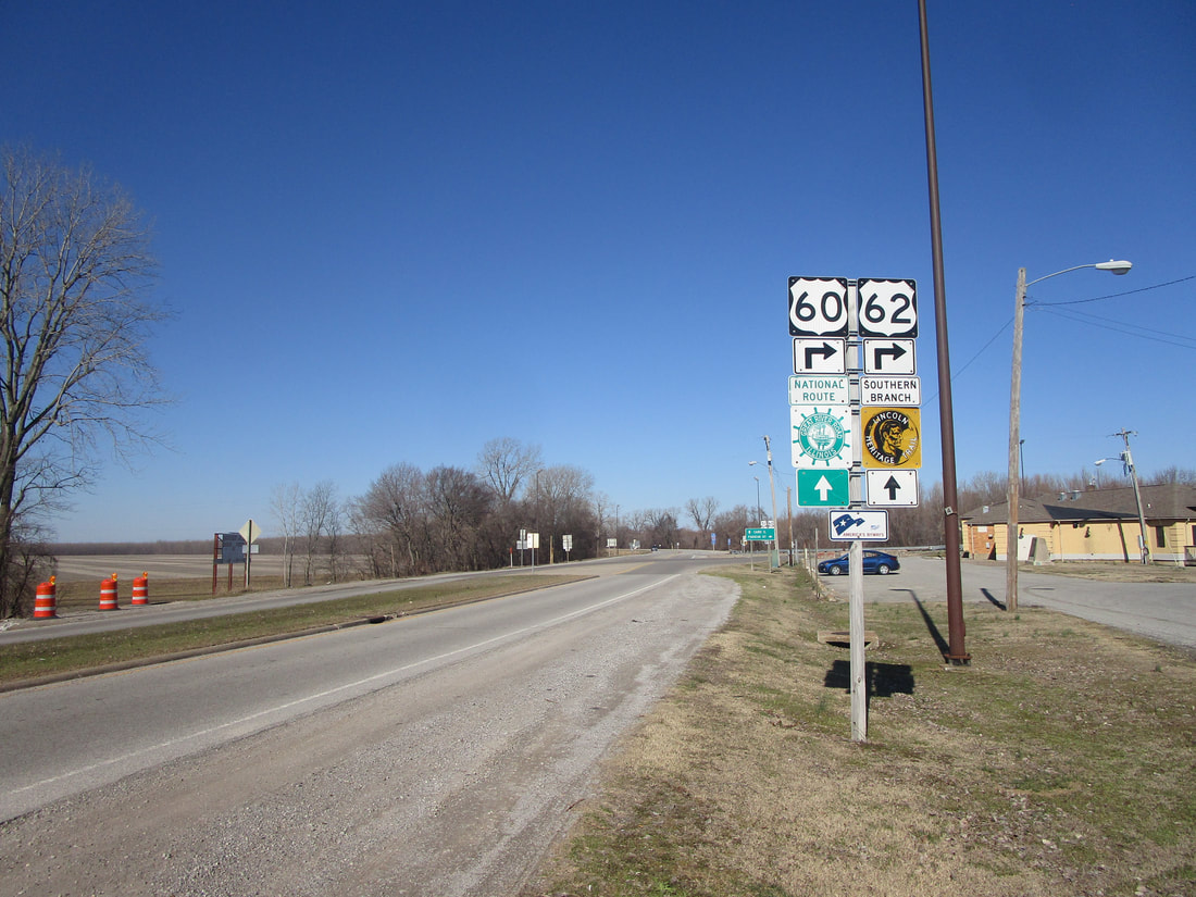
^Westbound trailblazer for both routes leaving the junction with US Route 51, February 2023.
US Routes 60 and 62 cut through the very southern tip of Illinois, from a bridge over the Mississippi River, immediately onto a bridge over the Ohio River into Kentucky. US Routes 60 and 62 head out of Missouri concurrently, pick up US Route 51 after its long journey through Illinois, and bring US Route 51 across the Ohio River into Kentucky. These two even-numbered routes don't even spend a mile within the borders of the State of Illinois, right where the Ohio River flows into the Mississippi River near Cairo. US Routes 60 and 62 simply enter Illinois on a long bridge over the Mississippi River, and immediately leave the state on another long bridge over the Ohio River, picking up US Route 51 to take it into Kentucky.
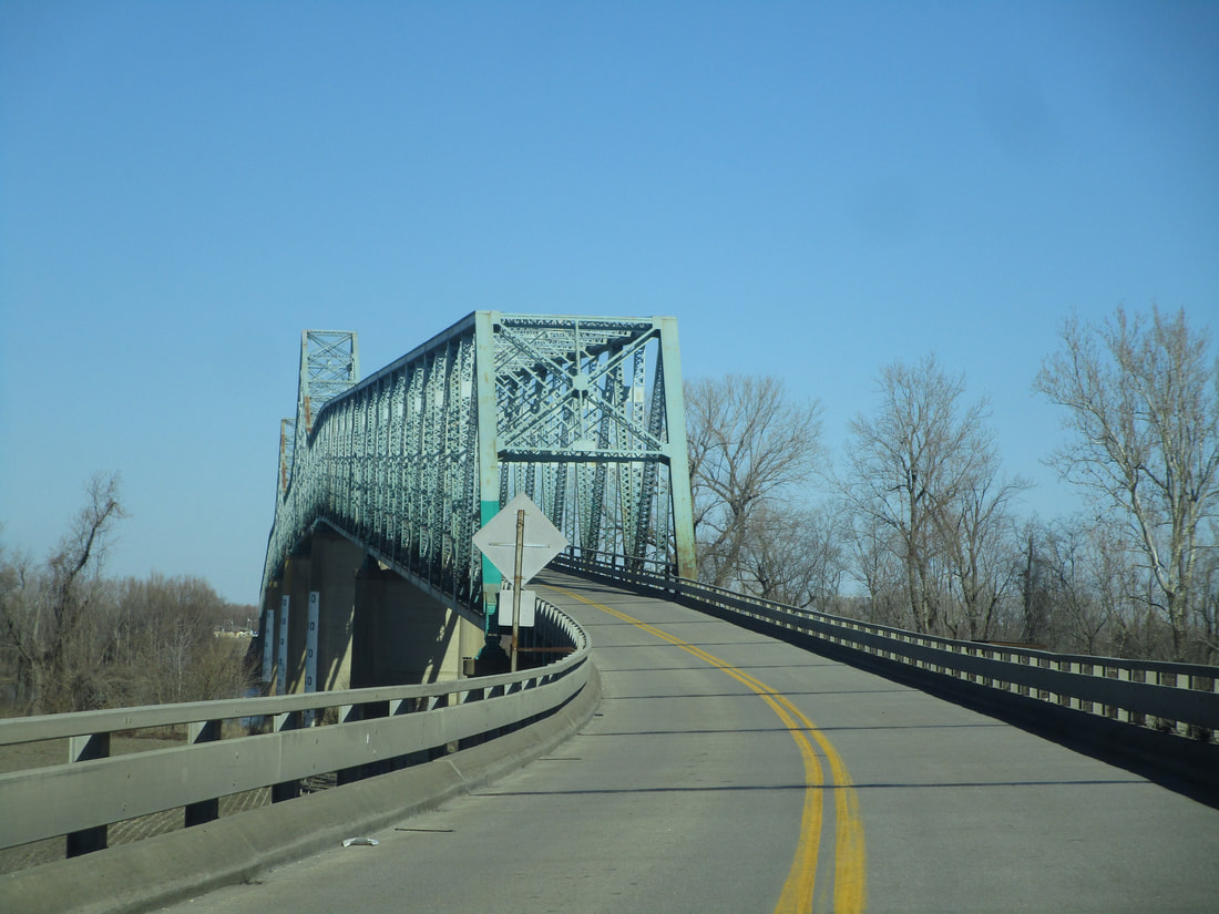
This first photo shows the western entrance of the bridge taken by US Routes 60 and 62 out of Missouri into Illinois. This bridge spans the Mississippi River, and it begins taking US Route 60 and 62 east with a sharp left-hand curve onto the main bridge deck:
This first photo shows the western entrance of the bridge taken by US Routes 60 and 62 out of Missouri into Illinois. This bridge spans the Mississippi River, and it begins taking US Route 60 and 62 east with a sharp left-hand curve onto the main bridge deck:
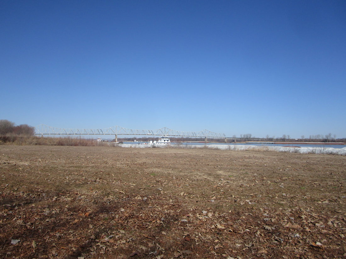
Here is a side view of the bridge, shot from Fort Defiance State Park. I was looking westerly taking this photo:
Immediately after crossing the Mississippi River, US Routes 60 and 62 make a right turn onto another bridge across the Ohio River. Continuing straight will put you on US Route 51 north toward Cairo:
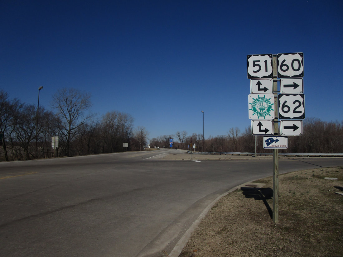
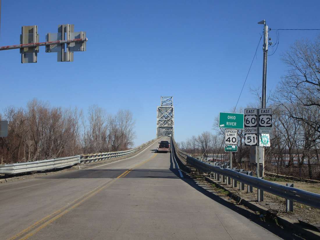
This is the scene you will see if you make the right turn to continue on US Routes 60 and 62. You're immediately greeted by the other bridge, which takes you over the Ohio River into Kentucky:
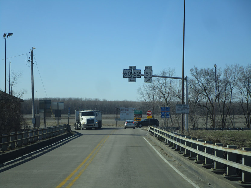
The previous shot shows a bit of a mast arm with signage facing east. Looking in the opposite direction, the signage shown below greets those entering Illinois from Kentucky. Note that US Route 51 joins the other two routes on that bridge over the Ohio River, so the signage includes mention of how to stay on US Route 51 as it exits Kentucky into Illinois:
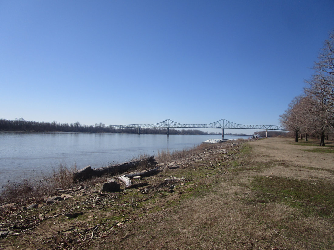
This last shot shows the Ohio River bridge, viewed from the south: