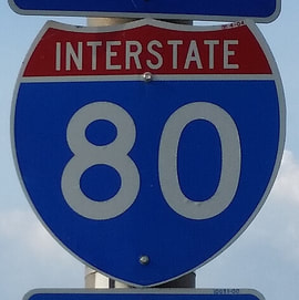
Interstate 80States traversed: California, Nevada, Utah, Wyoming, Nebraska, Iowa, Illinois, Indiana, Ohio, Pennsylvania, and New Jersey
|
|
Interstate 80 was the first Interstate to connect an Atlantic Ocean locale to a Pacific Ocean locale, completing a continuous coast-to-coast expressway for the first time. It runs from San Francisco to a bridge in New Jersey, just across the Hudson River from New York City. Interstate 80 connects a lot of important locales, including the San Fransicso Bay area, Sacramento, Reno, Salt Lake City, Cheyenne, Omaha, Des Moines, the Quad Cities, Chicago, Toledo, Cleveland, and New York City's metroplex. Interstate 80 starts at a junction with US Route 101 in San Francisco, and crosses the San Francisco Bay Bridge into Oakland. It continues northwest across the rest of northern California, passing through Sacramento. It crosses into Nevada near Donner Pass, the height of Interstate 80's elevation through the Sierra Nevada Mountains. Soon after this, it passes through Reno, Nevada. Interstate 80 continues beyond Reno, crossing northern Nevada and northwest Utah, which is home to the longest stretch of Interstate without an exit: 37 miles through the desolation that is the Bonneville Salt Flats. After this, Interstate 80 passes through Salt Lake City to start out across southern Wyoming. After passing through Cheyenne in southeastern Wyoming, Interstate 80 aims to cross all of Nebraska, as the only major Interstate in all of Nebraska (besides the two miles of Interstate 76 in Nebraska). It passes through the state capital of Lincoln, and runs northeast through Omaha, where it crosses the Missouri River into Iowa. Interstate 80 spans the width of Iowa from Council Bluffs in the west to the Quad Cities in the east, passing through Des Moines and Iowa City along the way. In its next state, Illinois, Interstate 80 connects the Quad Cities to the southern suburbs of Chicago; Interstates 55, 57, or 94 can provide direct access to the city of Chicago itself. Next, Interstate 80 enters northwestern Indiana, where it joins Interstate 90 on the Indiana Toll Road, which hugs the northern border of the state. At the Ohio border, Interstates 80 and 90 continue together, and they continue to be tolled, through Toledo to the Cleveland area. At the Cleveland area, Interstate 90 splits toward the city proper, whereas Interstate 80 curves southeasterly on the still-tolled Ohio Turnpike. Near Youngstown in eastern Ohio, Interstate 80 ricochets off of Interstate 76 as the routes trade places. From here, Interstate 80 turns due easterly as a freeway that crosses the entire width of northern Pennsylvania. Near Stroudsburg, Pennsylvania, Interstate 80 crosses the Delaware River to run across nearly all of northern New Jersey. At a point a few miles west of the George Washington Bridge, used by Interstate 95 to cross the Hudson River into Upper Manhattan, Interstate 80 ends at Interstate 95 near Leonia, New Jersey. This is at an inner portion of the New York metropolitan area.
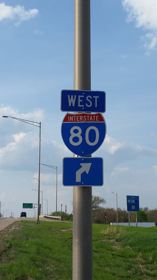
My photo for Interstate 80 comes from Joliet, Illinois. The route marker shown faces south on Illinois Route 7, showing northbound traffic that the cloverleaf ramp to westbound Interstate 80 is coming up ahead. The ramp to eastbound Interstate 80 sat just behind me as I pointed the aperture north to take this photo. This photo was taken in May 2015.
Back to the nationwide main page.
Back to the home page.
Back to the nationwide main page.
Back to the home page.
