Michigan Highway 25 traces the outline of Michigan's Thumb, hugging the shore of Lake Huron from Bay City to Port Huron. Starting at Bay City, it runs easterly to Unionville, northeasterly to Port Austin, and south to Port Huron. Michigan Highway 25 used to be a portion of US Route 25, which currently doesn't make it north of Cincinnati, Ohio. Regardless, the start of Michigan Highway 25 is at a cloverleaf interchange with Interstate 75 on the west side of Bay City, Michigan. This interchange is also home to the current eastern endpoint of US Route 10. From here, Michigan Highway 25 runs east through downtown Bay City. Not long after its stint in Bay City, Michigan Highway 25 brings drivers within view of Lake Huron, with Saginaw Bay sitting just to the north. At Unionville, Michigan Highway 25 turns onto a roadway that Michigan Highway 24 rides in on. It is here that Michigan Highway 25 traces the outline of Michigan's Thumb, through Caseville, Port Austin, and Port Hope. Michigan Highway 25 continues south along the western shore of Lake Huron to the southern extent of the lake, whose shore was settled as Port Huron. In Port Huron, Michigan Highway 25 ends at Interstates 94 and 69, which run concurrently onto the Blue Water Bridge into Canada just to the east of this point. The roadway continues south into downtown Port Huron as a Business Loop of Interstate 69.
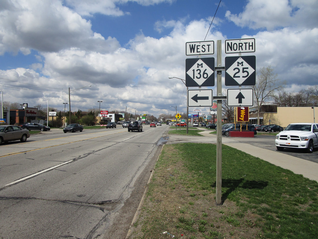
My photo of Michigan Highway 25 comes from Port Huron, at the intersection with Michigan Highway 136. The signage in the photo is the northbound guide assembly for travelers on Michigan Highway 25. This photo was taken during the trip around Metro Detroit and the Thumb, in April, 2021.

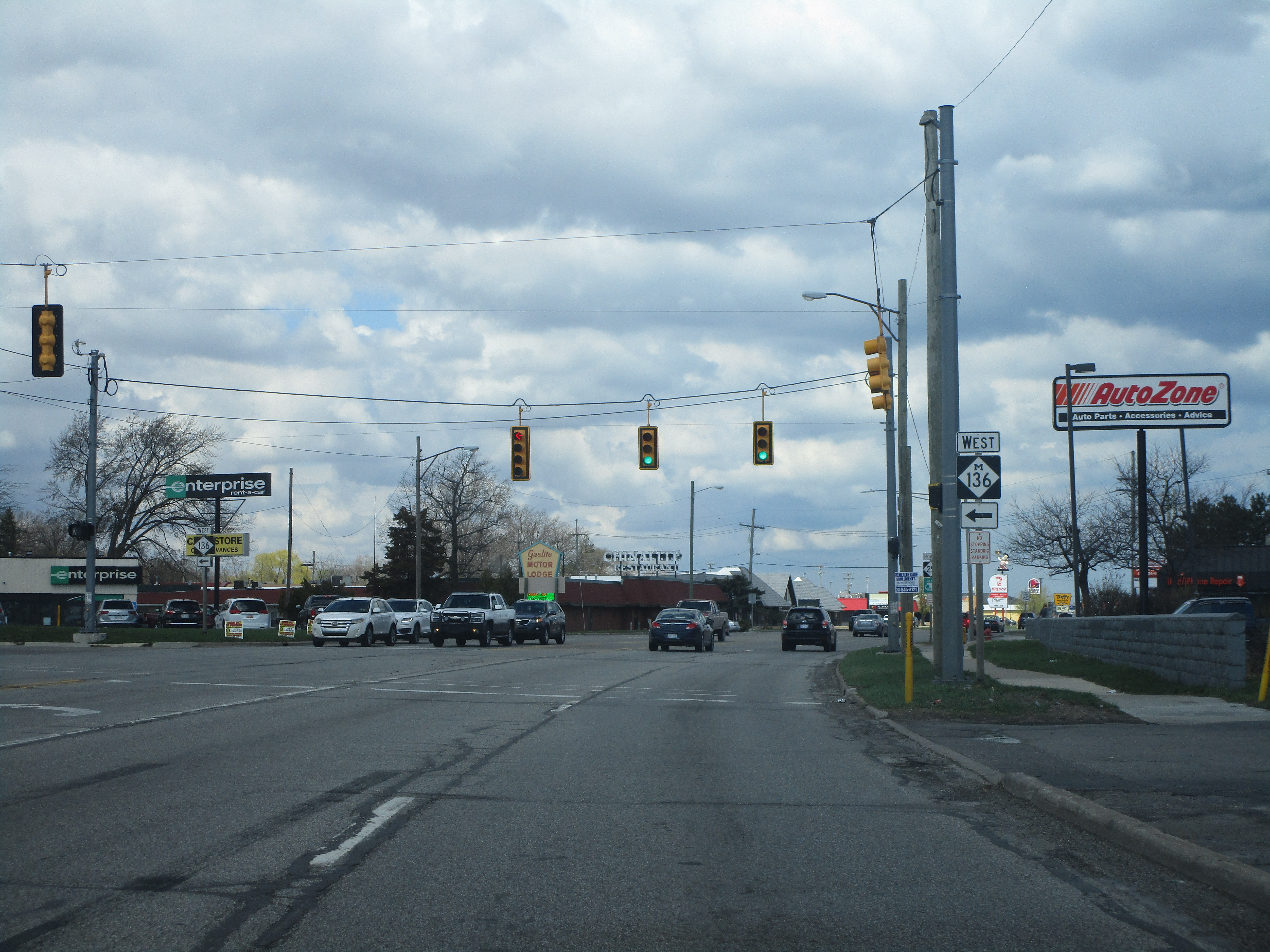
Michigan Highway 25 gets its start going northbound in Port Huron, heading away from Interstate 69/94.
Michigan Highway 25 at Michigan Highway 136 in a northern portion of Port Huron.

Michigan Highway 25 at Michigan Highway 90 in Lexington

Michigan Highway 25 at Michigan Highway 46 in Port Sanilac

Michigan Highway 25 at Michigan Highway 142 in Harbor Beach

Michigan Highway 25 at Michigan Highway 53 in Port Austin. M-25 is heading west here and turning right onto a short stretch that's shared with M-53, which will end at the end of this stretch.
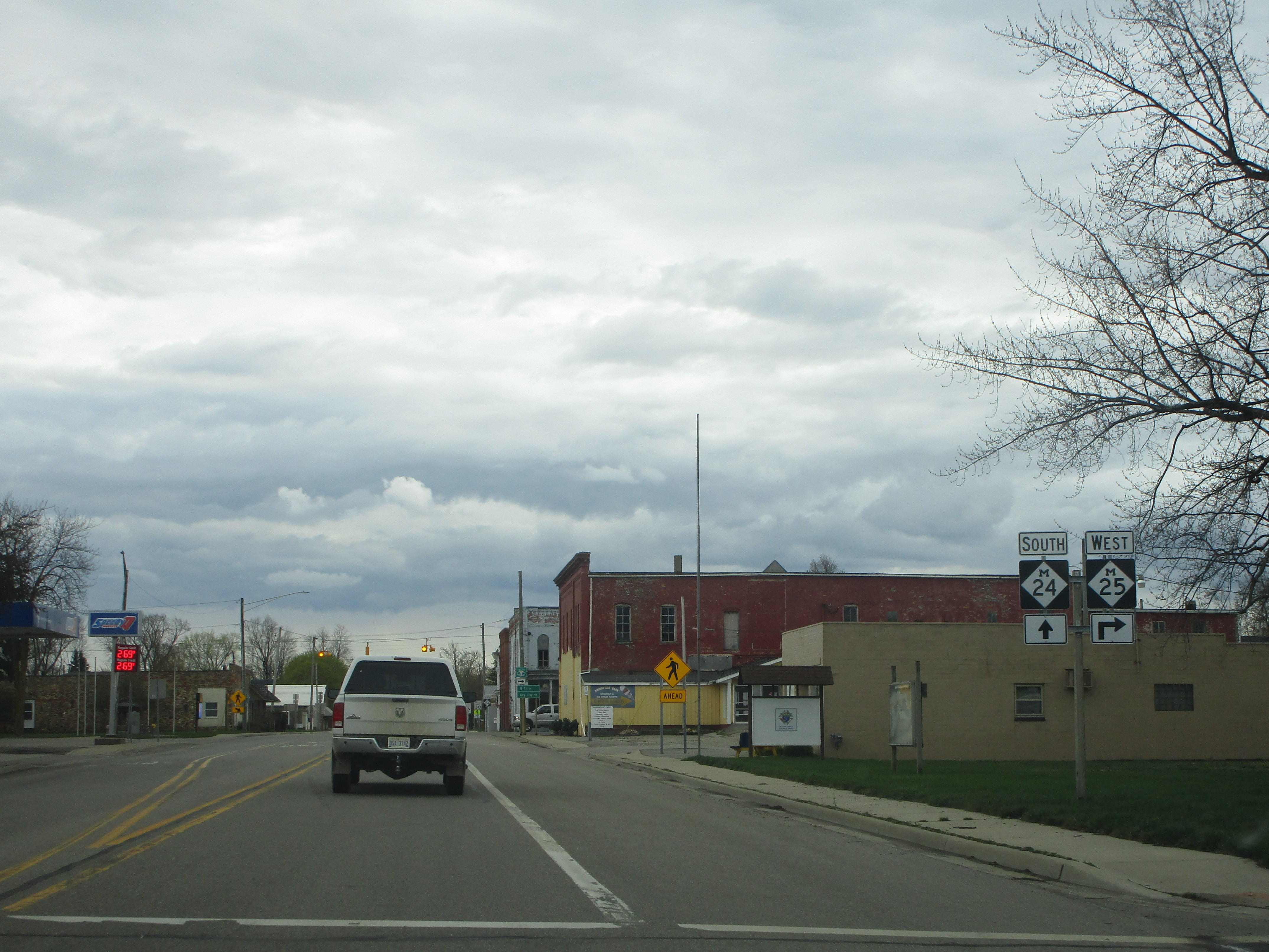
Michigan Highway 25 at the northern end of Michigan Highway 24 in Unionville. This photo was taken facing south.
