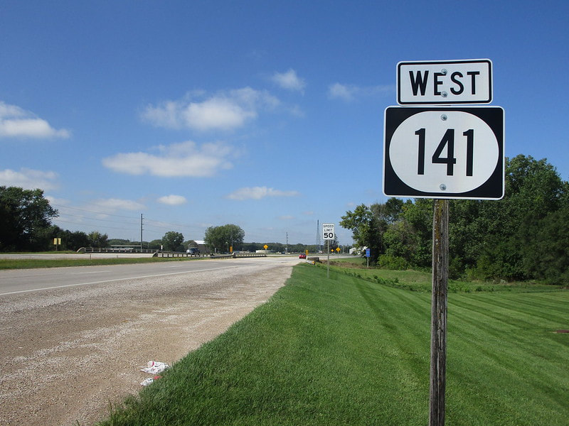
Iowa Route 141 is a long east-west highway across the western half of Iowa. The highway begins in Urbandale, a northwestern suburb of Des Moines, at the point where the concurrency of Interstate 35 and Interstate 80 curves from westward to southward. Leaving the Des Moines metroplex, Iowa Route 141 bends northwesterly and then bends westerly, running as a four-lane highway until the town of Perry. West of Perry, Iowa Route 141 continues as a two-lane rural highway sandwiched between US Route 30 and Iowa Route 44. As those two routes connect the centralized county seats of their respective rows of Iowa counties, Iowa Route 141 is confined to straddling the row of latitudinal county borders. That is the case along Iowa Route 141's westward progression until US Route 59, which is joined north to Denison. Beyond Denison, Iowa Route 141 continues west into the rugged Loess Hills region of west-central Iowa, at a latitude more northerly than that of US Route 30. The western end of Iowa Route 141 is at Interstate 29 near the small town of Sloan; this western terminus is about a five minutes' drive from the Missouri River. I'm not sure why a highway in Iowa with this significant length has such an obscure three-digit number like "141", when numbers like "11" and "41" haven't been used. But that's just not the way the cookie crumbles!
My photo of Iowa Route 141 comes from Perry, Iowa, right alongside the junction with Iowa Route 144. The photo shows the westbound reassurance marker posted for travelers leaving the junction with Iowa Route 141. This photo was taken toward the latter end of my September 2019 trip across northern Iowa.
Back to the Iowa main page.
Back to the home page.
Back to the Iowa main page.
Back to the home page.

