Ohio State Route 10 is a route in the Cleveland metropolitan area that keeps getting tasked with occupying big new highway extensions. The highway has three distinct phases, with the first and last of these phases being extensions of big highways. The second and longest phase is simply a surface road running from the Elyria area into downtown Cleveland, through various suburbs. Ohio Route 10's story begins on the southeast side of Elyria, as US Route 20 is coming from Oberlin to the southwest. The expressway carrying US Route 20 becomes abandoned by the US highway designation as it reaches Ohio Route 57. Because US Route 20 bails toward the north along Ohio Route 57, the expressway is left stark naked with no numbered designation. Ohio Route 10 was tasked with jumping onto this expressway so it could have a designation; in other words, Ohio Route 10 starts here and uses the expressway toward the east-northeast. After several miles, the expressway crosses Interstate 80, and Interstate 80 spawns the western beginning of Interstate 480 along the expressway. Now that Interstate 480 has taken over the expressway, Ohio Route 10 can exit after a fraction of a mile onto Lorain Road, so it continue into its main chapter as a surface route. Ohio Route 10 continues east-northeasterly through North Olmsted and Fairview Park, then entering Cleveland proper.
Ohio Route 10, following Lorain Avenue, then reaches the downtown area, meeting Ontario Street. Ohio Route 10 is then given a new assignment: to serve as a new highway designation for the recently-constructed Opportunity Corridor, a new boulevard serving as an eastern extension of Interstate 490. Ohio Route 10 then picks itself up, dusts itself off, and heads south on Ontario Street with US Route 422, Ohio Route 8, and Ohio Route 87, to its new assignment. Ohio Route 10 jumps onto Interstate 77 south so it can reach the interchange between Interstate 77 and Interstate 490. The interchange is the eastern end of Interstate 490, but the Opportunity Corridor continues as an eastern extension, carrying Ohio Route 10 onward. The Opportunity Corridor marked by Ohio Route 10 winds easterly through portions of eastern Cleveland. It eventually weasels its way onto East 105th Street northbound. The designation of Ohio Route 10 ends looking north at the intersection of East 105th Street and Chester Avenue, which carries US Route 322.
Ohio Route 10, following Lorain Avenue, then reaches the downtown area, meeting Ontario Street. Ohio Route 10 is then given a new assignment: to serve as a new highway designation for the recently-constructed Opportunity Corridor, a new boulevard serving as an eastern extension of Interstate 490. Ohio Route 10 then picks itself up, dusts itself off, and heads south on Ontario Street with US Route 422, Ohio Route 8, and Ohio Route 87, to its new assignment. Ohio Route 10 jumps onto Interstate 77 south so it can reach the interchange between Interstate 77 and Interstate 490. The interchange is the eastern end of Interstate 490, but the Opportunity Corridor continues as an eastern extension, carrying Ohio Route 10 onward. The Opportunity Corridor marked by Ohio Route 10 winds easterly through portions of eastern Cleveland. It eventually weasels its way onto East 105th Street northbound. The designation of Ohio Route 10 ends looking north at the intersection of East 105th Street and Chester Avenue, which carries US Route 322.
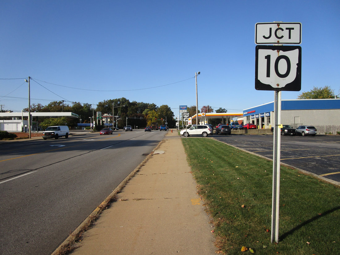
My photo of Ohio State Route 10 signage comes from Ohio Route 252 in North Olmsted. Near the western extent of Ohio Route 10's stint as a surface route, Ohio Route 252 comes from the south to join Ohio Route 10 toward the east-northeast for a short concurrency. The junction marker shown appears to northbound travelers on Ohio Route 252 who are about to turn right onto that concurrency (or they can turn westerly onto Ohio Route 10 if they want; I'm not their dad). This photo was taken looking north on an October day in 2022, as I was completing my grand tour around northeastern Ohio.
Back to Ohio Routes 1 through 99.
Back to the Ohio main page.
Back to the home page.
Back to Ohio Routes 1 through 99.
Back to the Ohio main page.
Back to the home page.

