Ohio State Route 53 is a north-south highway in north-central Ohio. It runs from Kenton to the northern tip of Catawba Island, where the ferry to Put-in-Bay docks. Ohio Route 53 begins on the south side of Kenton at US Route 68 to run north on Main Street. It runs northeast to Forest, then turns east until it reaches Upper Sandusky. Ohio Route 53 runs north out of Upper Sandusky to Tiffin and Fremont. Ohio Route 53 flanks the northwestern side of Fremont using a freeway bypass that also carries US Route 20. Beyond Fremont, Ohio Route 53 sets out for Port Clinton, which lies to the northeast of Fremont. Port Clinton is at the entrance to the peninsula that juts easterly into Lake Erie, north of Sandusky Bay. At Port Clinton, Ohio Route 53 joins the Ohio Route 2 freeway eastward, to a more outer portion of the peninsula. About four miles east of Port Clinton, Ohio Route 53 turns northerly away from the freeway, to reach Catawba Island. The northern end of Ohio Route 53 is at the northern tip of Ohio Route 53, where the ferry dock sits. That ferry takes travelers to South Bass Island, where the town of Put-in-Bay is found.
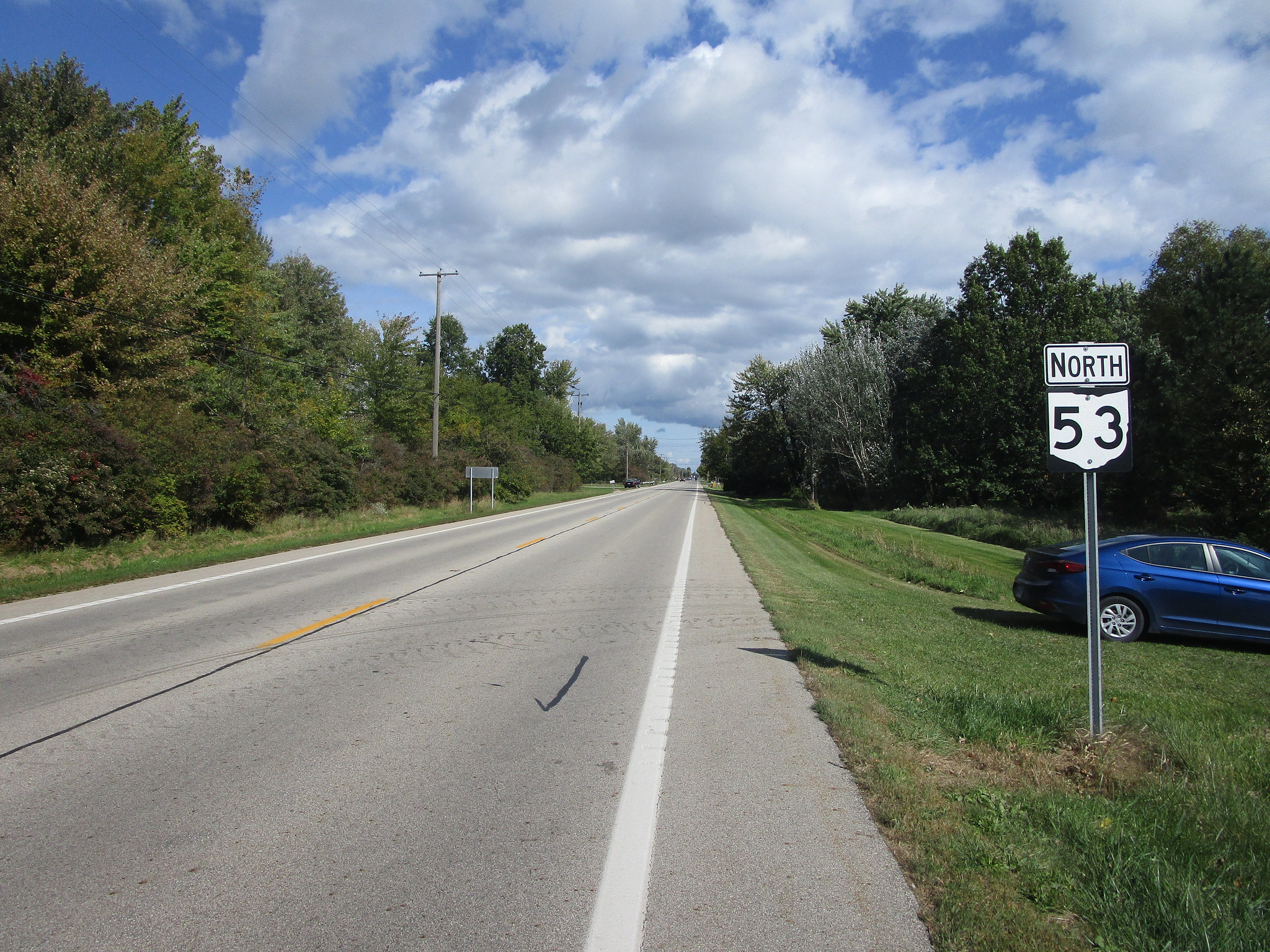
My photo of Ohio State Route 53 shows a trailblazer positioned halfway between Port Clinton and Fremont. The ODOT District in northwestern Ohio likes to put state highway reassurance markers at intersections with most local roads. This photo was taken as I looked northeasterly, toward the end of my northwestern Ohio trip of October 2023.
Back to Ohio Highways 1-99.
Back to the Ohio main page.
Back to the home page.
Back to Ohio Highways 1-99.
Back to the Ohio main page.
Back to the home page.

