Interstate 675 in Michigan is a loop off of Interstate 75, created for the purpose of serving the heart of Saginaw, Michigan. Its path is shaped somewhat like the letter "C" on maps, and it's a decidedly less-direct route than taking Interstate 75 across the area. The southeastern end is at Interstate 75 east of Saginaw, and the northern end is at Interstate 75 north of Saginaw. Downtown Saginaw occurs just south of the southwestern bend in Interstate 675's route. Interstate 675 is about 7.5 miles long.
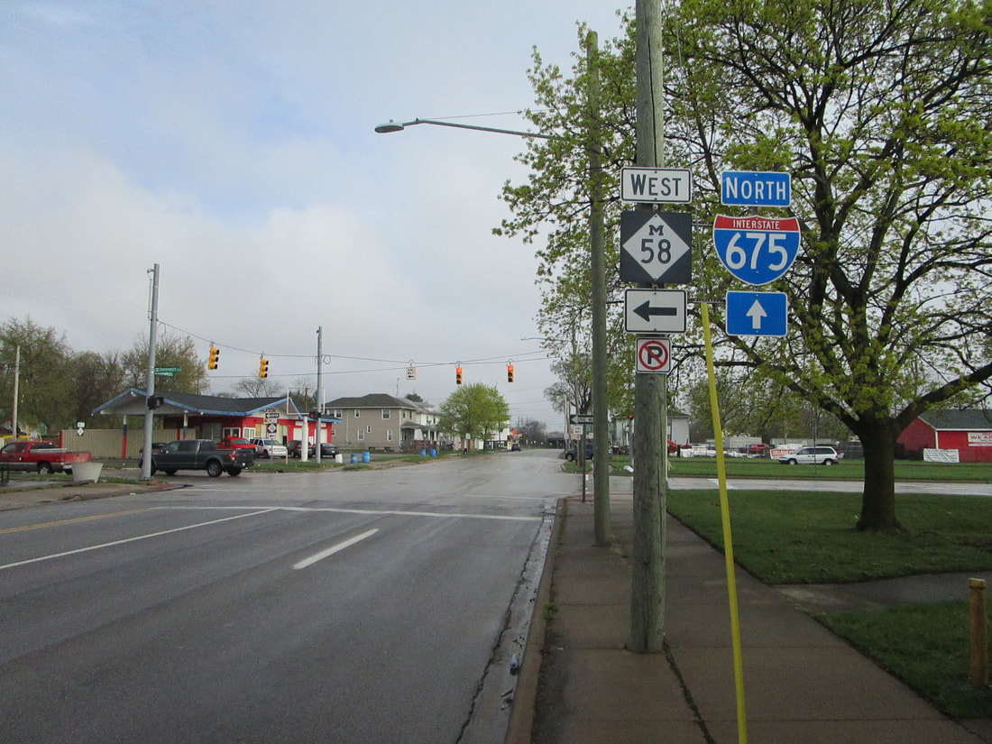
My photo of a cutout shield for Interstate 675 comes from a pair of street corners along the eastern extent of Michigan Highway 58 in Saginaw. A partial interchange connects Interstate 675's eastern leg to a westerly-protruding highway, labeled Michigan Highway 58. Michigan Highway 58 runs along a pair of one-way streets. The sign assembly posted here directs northbound traffic on Michigan Avenue not only to the westbound beginning of Michigan Highway 58, but also toward a separate partial interchange access Interstate 675 northbound. In recent years, the adoption of unisigns for Michigan's Interstate junctions has made cutout shields difficult to find across the state. Usually, I'm relegated to finding these cutout shields on "To" guide markers, distant from the Interstate itself. The cutout shield in this photo basically fits this trend, since it should have a "To" marker above it. It guides the way to a distant onramp to Interstate 675, rather than pointing out an onramp that's immediately visible. This photo was taken in April 2021, after traveling through Metro Detroit and wrapping around the Michigan Thumb.
Michigan Interstate guides will come with complete exit lists and a photo for every exit, at some point in the future when I've driven the full lengths of all of them. This page showing the cutout shield will stay here for now, until that happens.
Back to the Michigan main page.
Back to the home page.

