Interstate 90 runs east west across the entire northern edge of the state of Ohio, in its quest to hug the southern edge of the Great Lakes. Interstate 90 serves Toledo and Metro Cleveland, including downtown Cleveland. It enters the state of Ohio near the very northwest corner of the state, crossing out of Indiana only a few miles south of Michigan. That point of ingress carries Interstate 80 and Interstate 90 from the Indiana Toll Road to the Ohio Turnpike. From tolls springs more tolls! Interstate 80 and 90 both follow the Ohio Turnpike for about fifty miles through uneventful farmland before they reach the Toledo area. Be warned, however; access points to and from the tolled Ohio Turnpike are few and far between. Toledo is no exception to this; access to the Toledo area is only provided via US Route 20, Interstate 75, and Interstate 280. Interstates 80 and 90 continue eastward along the Ohio Turnpike past Fremont and Sandusky to Elyria, where Interstate 90 gets its escape from the tollway. It splits from the Turnpike and Interstate 80 to turn a bit more northeasterly, as a freeway bound for downtown Cleveland. Interstate 90 also serves a great deal of western suburbs of Cleveland--and eastern suburbs as well, after it passes the city proper. In Cleveland proper, Interstate 90 sees the northern endpoint of Interstate 71 and, at that point, creates an eastward spur to the Opportunity Corridor called Interstate 490. It soon meets the northern end of Interstate 77, too. A sharp curve lies where Interstate 90 hooks into Ohio Route 2's freeway; the routes join together into the eastern suburbs, where they split up again. Interstate 90 continues as a freeway paralleling the southern shore of Lake Erie, giving the shoreline several miles of distance. It links with Ohio Route 11's freeway at Ashtabula before reaching the Pennsylvania border near Conneaut. It crosses the state line only two miles south of Lake Erie.
As with all of the Ohio Interstate pages, more information and a full exit list will come in the future. For now, enjoy this general information and a photo of the signage, in a similar fashion to how I do the state and US highway pages.
As with all of the Ohio Interstate pages, more information and a full exit list will come in the future. For now, enjoy this general information and a photo of the signage, in a similar fashion to how I do the state and US highway pages.
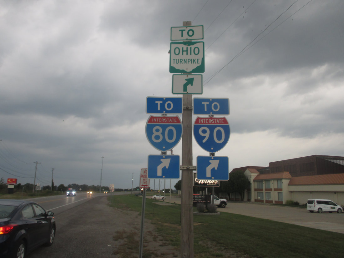
My photo of Interstate 90 signage in Ohio comes from a junction with Ohio Route 15 near Montpelier, in far northwestern Ohio. This guide marker assembly helps northbound travelers on Ohio Route 15 locate the ramp to the right onto the Ohio Turnpike, which carries Interstate 80 and Interstate 90. Note that Ohio Route 15 is also carrying US Route 20A north through this interchange so it can end at US Route 20 very soon. This photo was taken during a convoluted journey I took along an erratic route home from Columbus in September, 2017.
Back to the Ohio Interstates page.
Back to the Ohio main page.
Back to the home page.
Back to the Ohio Interstates page.
Back to the Ohio main page.
Back to the home page.

