Ohio State Route 15 is a highway in northwestern Ohio shaped like a rounded "L". The northwestern end is at the Michigan border near the town of Pioneer, Ohio. This is in the far northwestern corner of the state of Ohio. Ohio Route 15 serves as a continuation of Michigan Highway 99, and it runs due south from this point through all of Williams County. Near the town of Bryan, Ohio Route 15 begins its southeasterly tilt, heading for Defiance and Ottawa. At Ottawa, Ohio Route 15 joins US Route 224 east, so it can transit to its final expressway segment. You see, Ohio Route 15 is best known as the route designation for part of the expressway that connects Findlay, Ohio and Columbus, Ohio. That expressway starts off at Findlay as Ohio Route 15 and US Route 68; then it's just Ohio Route 15, and the final and longest phase is US Route 23. With this in mind, you can understand how Ohio Route 15 uses US Route 224 to go east until Findlay, where it joins Interstate 75 south for a spell. Ohio Route 15 then leaves Findlay and Interstate 75 to go east on the first part of the expressway. The end of Ohio Route 15 occurs as US Route 23 commandeers the expressway, having come from the north at an interchange in Carey, Ohio. This interchange also carries Ohio Route 103 across the area from west to east.
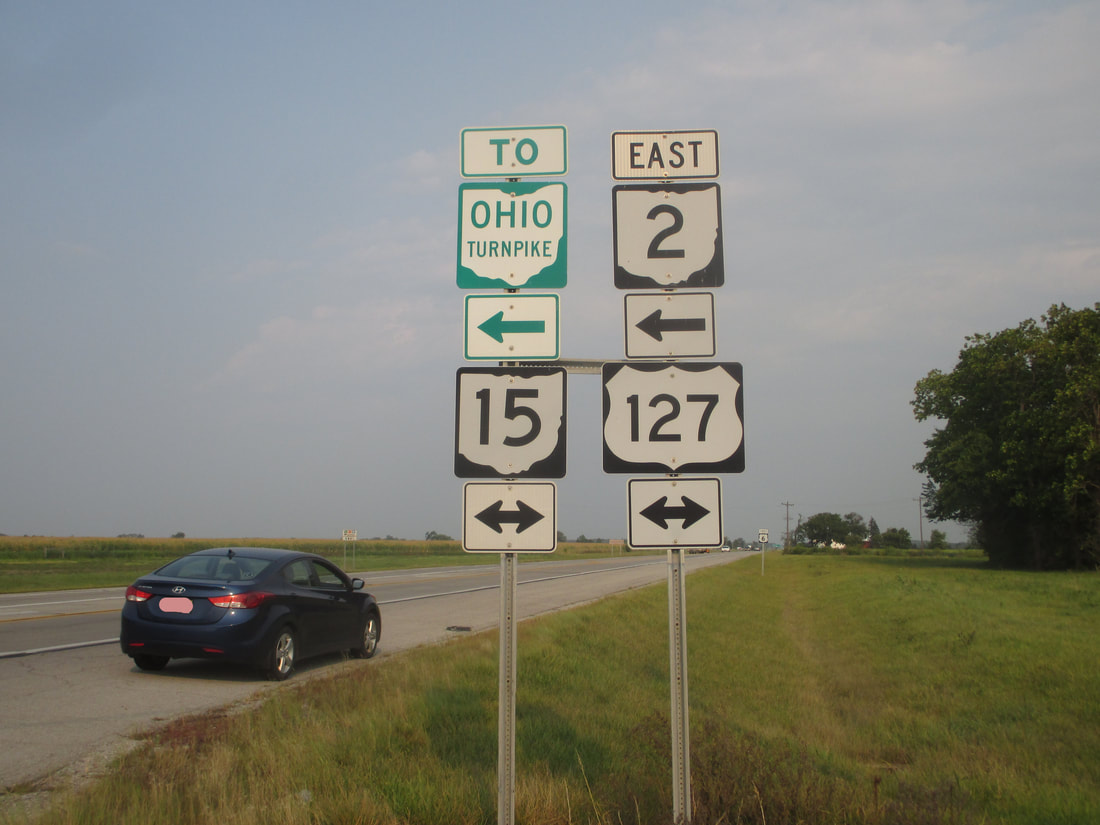
My photo of Ohio State Route 15 signage comes from an intersection just south of Bryan, Ohio, where US Route 6 meets US Route 127. At this junction, Ohio Route 2 comes from the east and turns north into Bryan; also, Ohio Route 15 is duplexed with US Route 127 throughout. That allows Ohio Route 15 to be mentioned on this signage, which faces west toward eastbound travelers on US Route 6 and Ohio Route 2. This photo was taken in September 2017, as part of a detour north on US Route 127 on the way home from Columbus.
Back to Ohio Routes 1 through 99.
Back to the Ohio main page.
Back to the home page.
Back to Ohio Routes 1 through 99.
Back to the Ohio main page.
Back to the home page.

