Michigan Highway 26 is the state highway in the Upper Peninsula with the smallest number, and it's the gateway to the Keweenaw Peninsula (Michigan's "horn"). As US Route 45 heads north into the western portion of the Upper Peninsula, it eventually reaches a fork in the road. To the northwest, US Route 45 continues to Ontonagon, but to the northeast is the birth of Michigan Highway 26. The remainder of US Route 45's journey to Ontonagon is not even fifteen miles, but Michigan Highway 26's path to the northeast goes on for much longer, extending all the way to Copper Harbor. The Portage River, a body of water separating the Keweenaw from the rest of Upper Michigan, has a single bridge across it, and that bridge between Houghton and Hancock, Michigan, is occupied by Michigan Highway 26 and US Route 41 (duplexed). This one and only bridge to the Keweenaw isn't the last time US Route 41 and Michigan Highway 26 will run concurrently; the two highways converge a total of three times, as Michigan Highway 26 forms a sort of alternate to US Route 41 on the Keweenaw. At Hancock, Michigan Highway 26 heads east as US Route 41 takes a more westerly route. The two highways join together again at Calumet, and stay concurrent until Phoenix. Michigan Highway 26 now jogs to the northwest, to follow the northwest shore of the "horn" of Michigan. After serving Eagle River and Eagle Harbor, Michigan Highway 26 ends in Copper Harbor at US Route 41. US Route 41 continues a bit farther east to its ultimate endpoint.
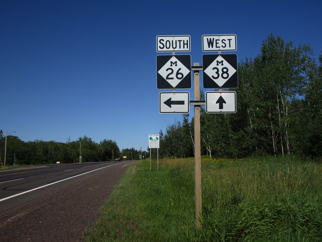
My photo for Michigan Highway 26 comes from the western end of its concurrency with Michigan Highway 38. This short concurrency takes place east of Ontonagon. The signage depicted faces east at westbound traffic on Michigan Highway 38, where Michigan Highway 26 turns to the south. This picture was taken on a trip to the Upper Peninsula in July 2015.
Here are some more photos along Michigan Highway 26:
Here are some more photos along Michigan Highway 26:

Michigan Highway 26's northern end marker in Copper Harbor.
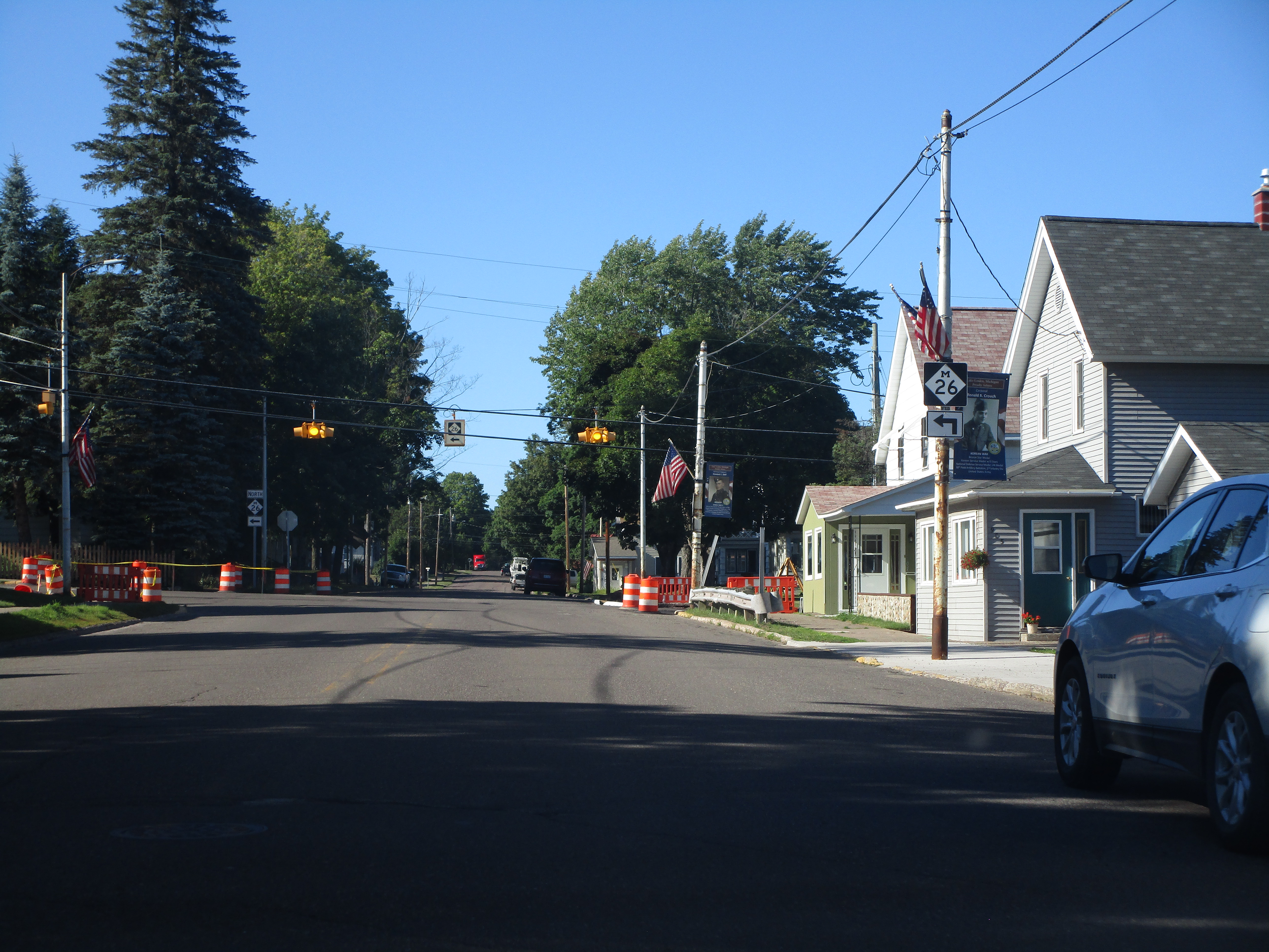
Michigan Highway 26 making a turn in Lake Linden, a town on the Keweenaw north of Houghton.
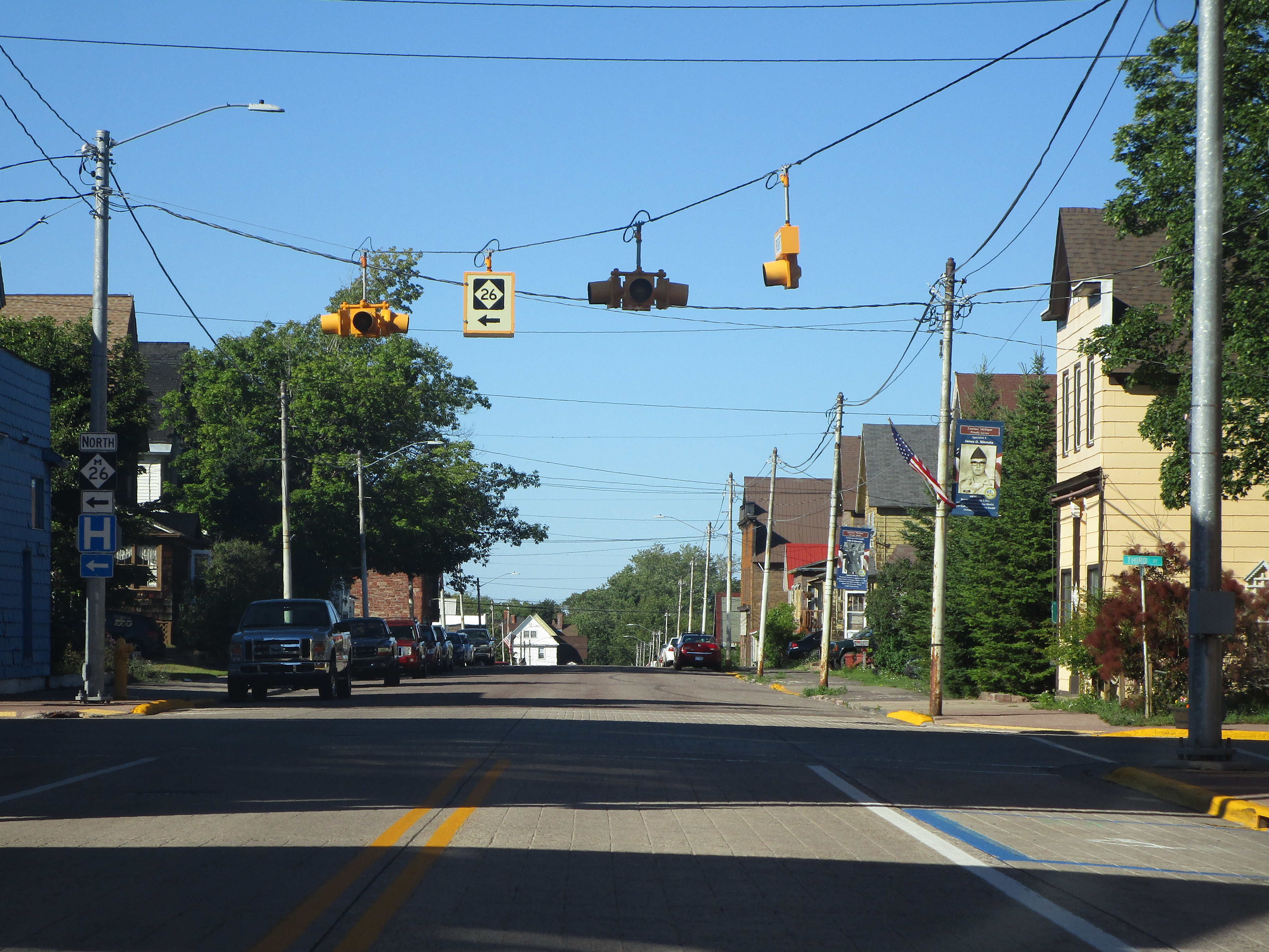
An interesting Michigan Highway 26 sign on a suspended backlit box in Laurium, Michigan.

Michigan Highway 26 and US Route 41 join together across the lift bridge connecting Hancock and Houghton, Michigan.

Michigan Highway 26 at the northern end of Michigan Highway 203, near Calumet.

Michigan Highway 26 at the west end of its concurrency with Michigan Highway 38, near Greenland.
