Michigan Highway 22 is the famed scenic route tracing the outline of the Leelanau Peninsula, running northwest out of Traverse City, then south along Lake Michigan. The route is somewhat shaped like the letter "J" rotated upside down. The tip of the hook, the eastern end, is a T-intersection in Traverse City at US Route 31, with a full view of the bay. At this intersection, US Route 31 comes from the south and turns east, and Michigan Highway 72 comes from the east and continues west. Highways 22 and 72 head west together from the intersection, but soon, the routes split. Michigan Highway 72 splits to head west across the base of the Leelanau, while Michigan 22 continues to hug the bayside, mainly heading northerly. At Northport, close to the tip of the peninsula, Michigan Highway 22 turns toward the southwest, to hug the western edge of the Leelanau. It passes by the road to Sleeping Bear Dunes National Lakeshore (that road is Michigan Highway 109), and at Empire, it exits the Leelanau Peninula. Michigan Highway 22 isn't done quite yet, though. It stays along the eastern shore of Lake Michigan through Elberta and Onekama, to end at US Route 31 just north of Manistee. Since Midwesterners love vacationing to the Traverse City area and the lakeshore locales along Michigan Highway 22, the Michigan Highway 22 route symbol has become a popular subject for bumper stickers and t-shirts. As such, the signs marking the route have become popular fodder for theft. In response, Michigan's DOT has started fabricating and posting Michigan Highway 22 signs without the distinctive "M" adorned with serifs. If you drive Michigan Highway 22, expect to see some of these less-desirable signs, posted to deter thieves.
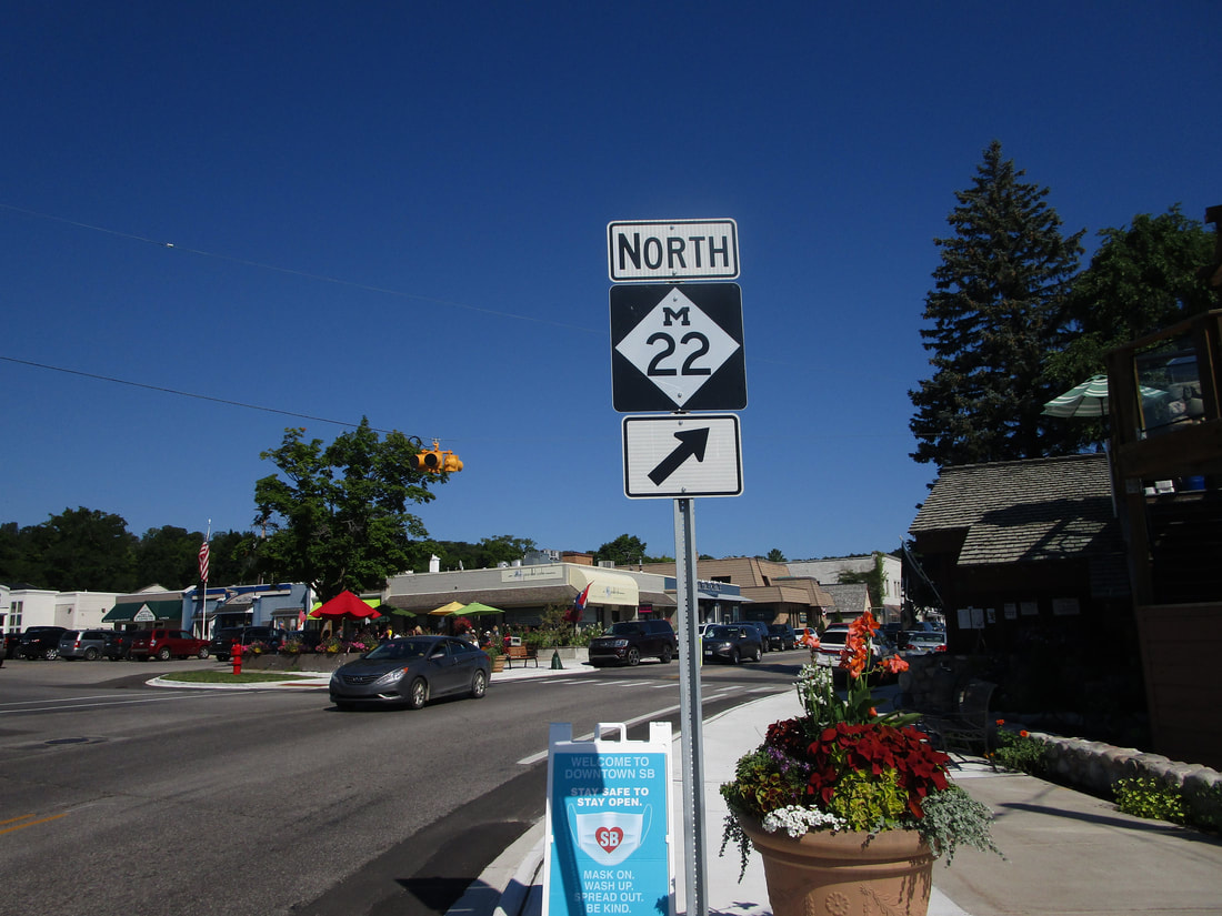
My photo of Michigan Highway 22 comes from Suttons Bay, the first community northwest of Traverse City on the eastern shores of the Leelanau Peninsula. At Broadway Street in Suttons Bay, Michigan Highway 22 has a sudden bend from northwest to north. Those on the overall northward journey along the eastern edge of the Leelanau will see the signage depicted in Suttons Bay. Don't go straight; you'll plow right into the outdoor seating of that restaurant! And I've eaten there twice, since I quite like it! I literally took this photo as I was waiting to be seated for breakfast at that restaurant in August 2020. That trip in August 2020 featured the central Upper Peninsula, Mackinac Island, and Traverse City.
Here are some more photos along Michigan Highway 22:
Here are some more photos along Michigan Highway 22:
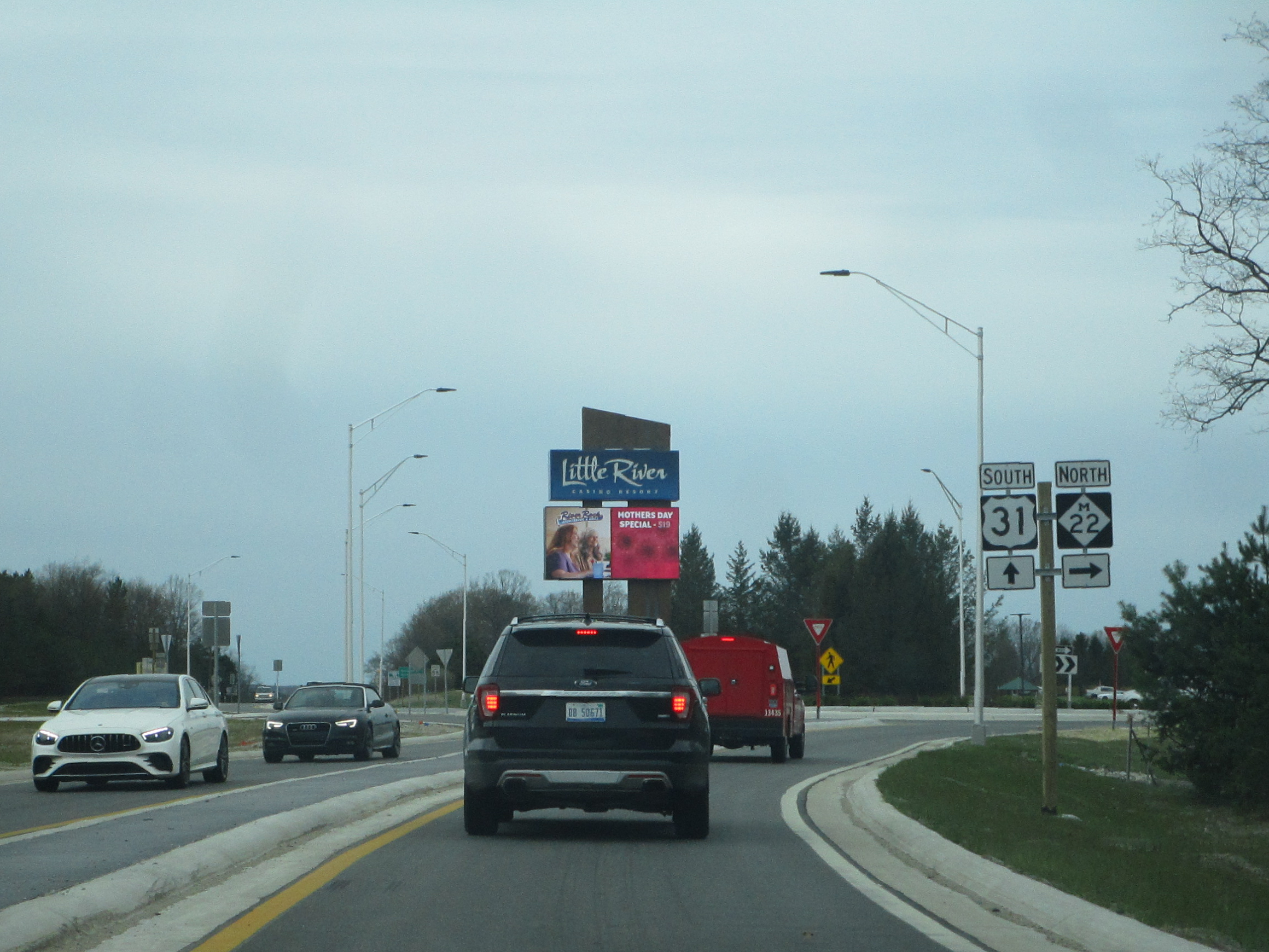
Michigan Highway 22 gets its southwestern start at a roundabout with US Route 31 near Manistee.
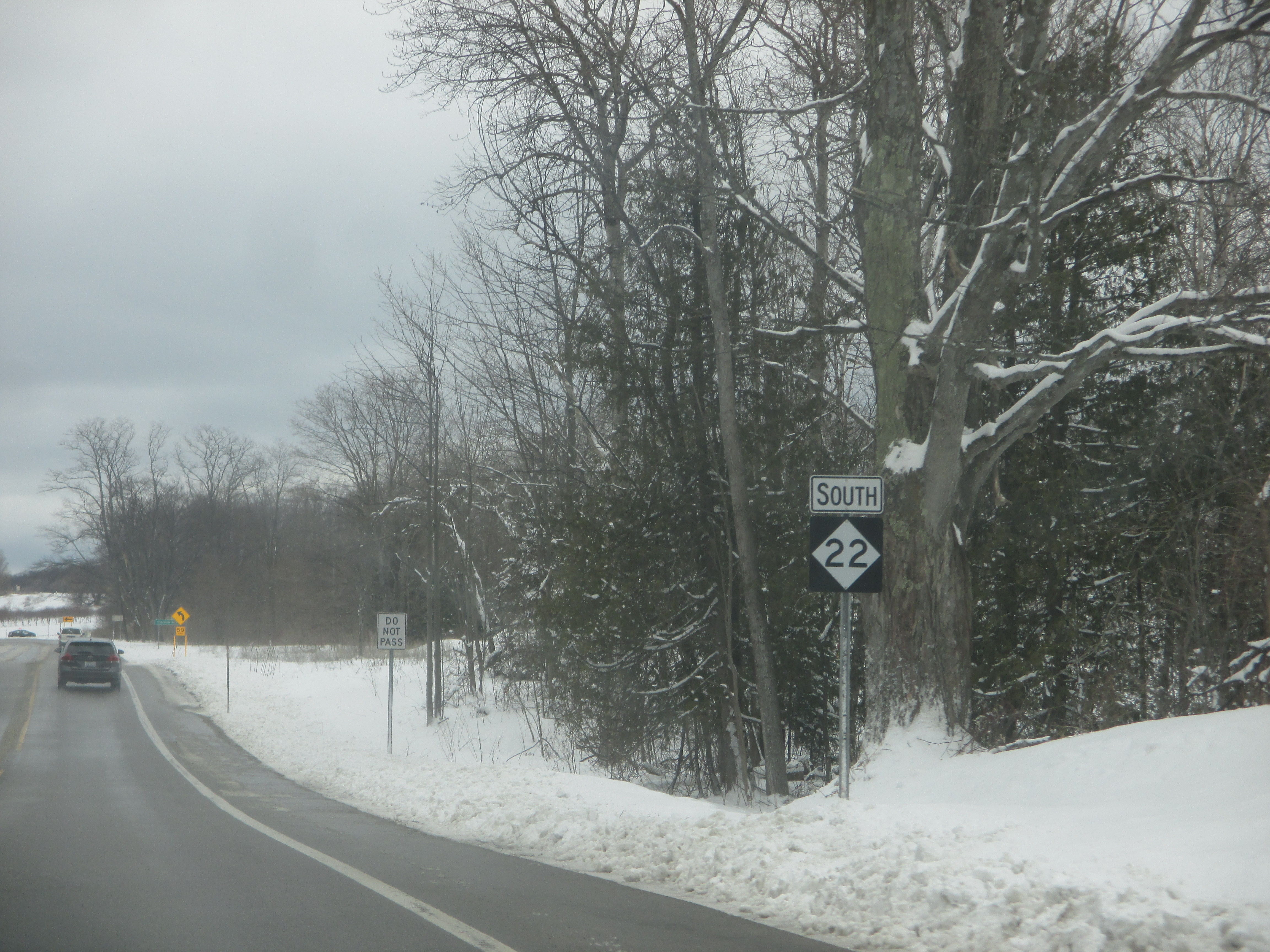
Because Michigan Highway 22 is such a popular scenic route and a noteworthy symbol of the Traverse City area, many vehicles owned by fans of the area are adorned with "M-22" stickers. People like posting the image of the M-22 shield on stuff so much, that other more audacious people have decided to steal the posted M-22 shields from the signposts. Michigan's DOT responded to this rash of thefts by cutting out the "M" on newer M-22 shields that have been posted. The sign here in this photo isn't proper, but
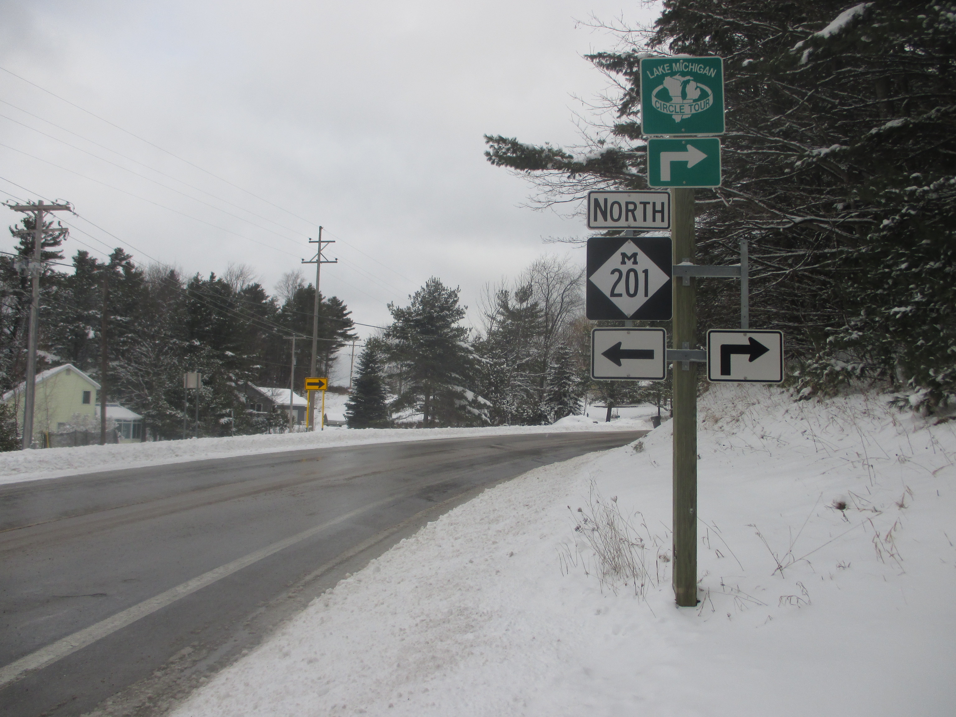
Here's Michigan Highway 22 reaching its northernmost point, at the junction with Michigan Highway 201 in Northport. Note that the M-22 route marker has been stolen, explaining the alternate version of the sign you saw in the previous photo! This assembly faces west at eastbound travelers on Michigan Highway 22.

A marker on Michigan Highway 22's eastern leg, directing northbound travelers to the location of Michigan Highway 204. This is in the village of Sutton's Bay.
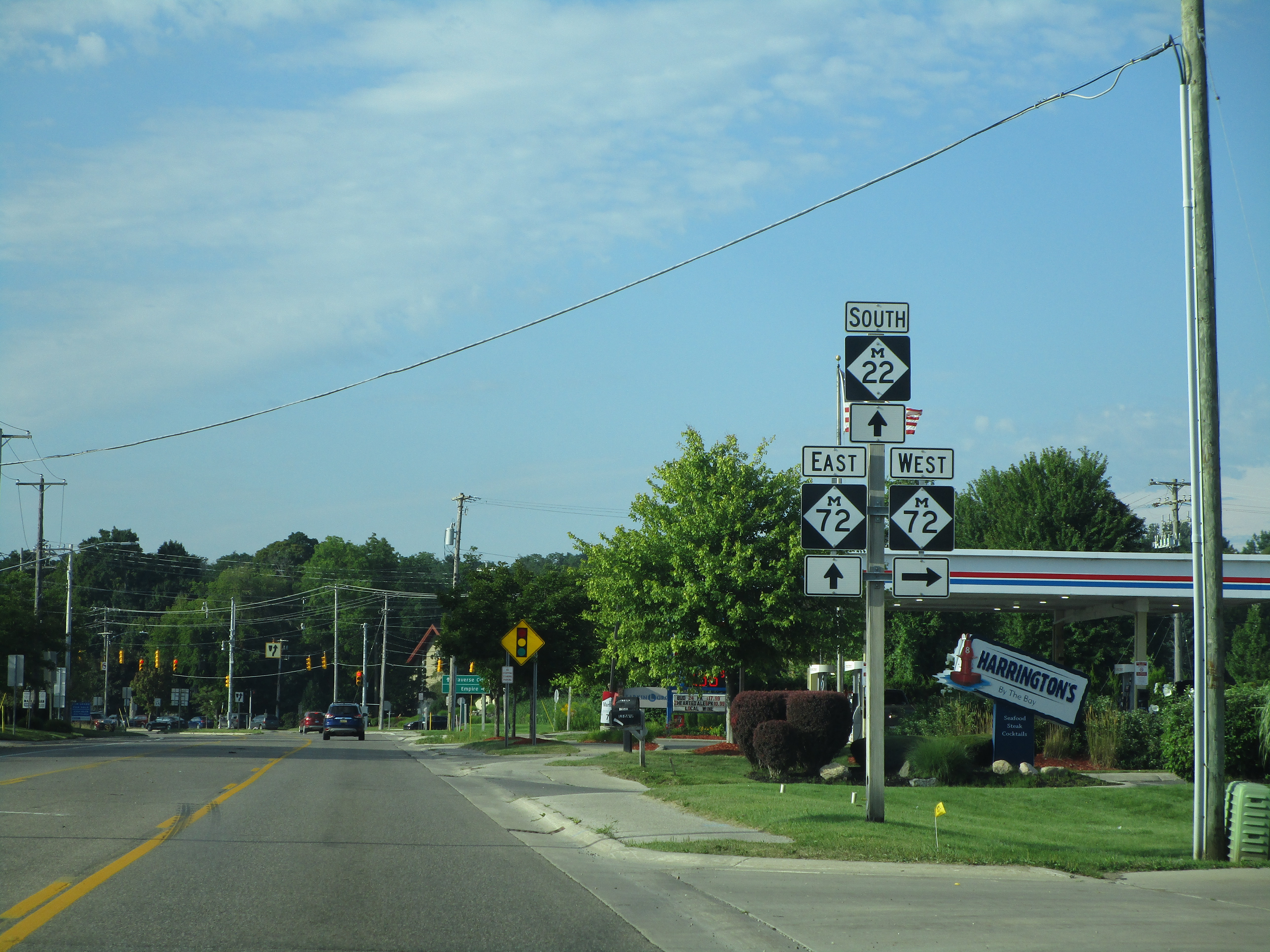
Michigan Highway 72 comes from the west and joins the final segment of Michigan Highway 22 as the two routes enter Traverse City.
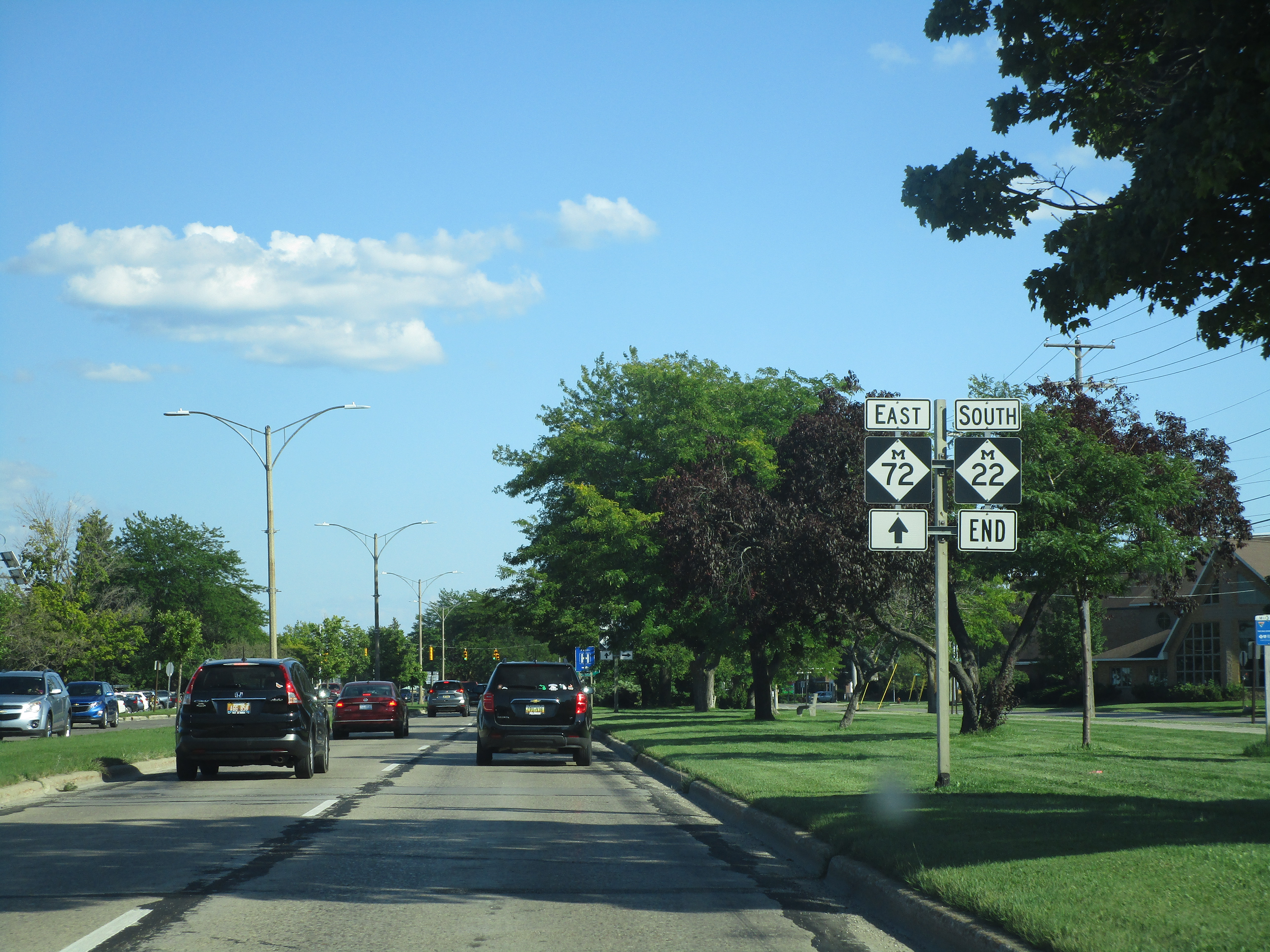
Michigan Highway 22 meets its southeastern endpoint in Traverse City. It's concurrent with Michigan Highway 72, which continues, and US Route 31's concurrency with Michigan Highway 37 serves to terminate M-22 right here.

Eastbound Michigan Highway 14 at exit 10, which leads to the western start of Michigan Highway 153.
